


Before the coldest air of the season arrives next week, the remainder of this week will bring above average temperatures. For most of October, the east coast has been under a strong ridge, allowing for warmer than average temperatures.
Below is the GEFS model valid for Friday of this week.
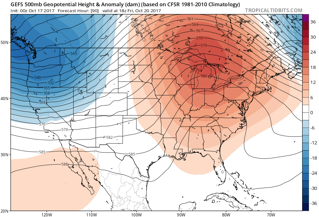
High temperatures will be in the 60s and perhaps 70s the remainder of this week, leading to yet another fantastic weather weekend. The current pattern will begin to breakdown by the 25th of October when a powerful early season trough sets up shop over the eastern half of the US.
Between model consensus, the expectation the MJO will be between phase 5 and 6 (cool phases for the end of October), and other favorable teleconnections, we are confident in predicting that from the 25th through at least the 31st will feature below average temperatures state-wide.
Below is the GEFS for October 25th, indicating strong ridging over the west coast, leading to a significant trough over the east coast.

EXPECTED HIGH TEMPERATURES OCTOBER 25th – 31st
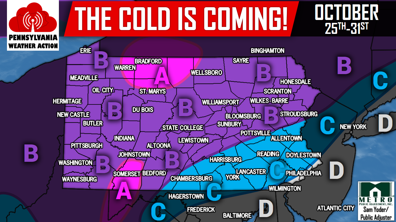
Area A – High temperatures are expected to be in the mid to upper 40s during this time period. Although it is currently unexpected, first flakes for these areas are certainly possible if precipitation is timed right.
Area B – High temperatures are anticipated to be in the low to mid 50s during this time period. Although it is not expected, and less of a likelihood of occurring than area A, if precipitation is timed right with the colder temperatures, first flakes for some locations in this area are possible.
Area C – High temperatures are expected to be in the mid to upper 50s during this time period.
Area D – High temperatures are anticipated to range from the upper 50s to low 60s during this time period.
This is the first true shot of colder than average weather that will give us a friendly reminder winter is right around the corner!
Be sure to have our Facebook page liked to receive the latest updates as we head into Fall and Winter. Click here >>>Pennsylvania Weather Action’s Facebook Page
Don’t forget to share the chilly forecast with your friends by using the social buttons below! Stay warm!
You must be logged in to post a comment.