The cold has finally arrived and winter-like weather is here to stay. January will be a much different month weather-wise than December and honestly a complete flip. Temperatures near average now (highs in 20s and 30s, lows in teens and 20s), until January 9th will lead to well below normal temperatures by Mid-January. Models have been consistently indicating this truly icy cold for mid-month for nearly three weeks.

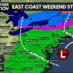
Along with this cold, the potential for winter storms has developed, especially between January 9th-12th and that’s just the beginning. All three major models being the GFS (American), ECMWF (Euro) and GEM (Canadian), have all indicated the potential for a winter storm or even two in Pennsylvania between January 9th-12th. Will conditions be favorable? Yes, extremely favorable. A negative AO and MJO phase 8 will be in place both supplying the necessary cold air, as well as a neutral to negative NAO which supports the possibility of a coastal low pressure.
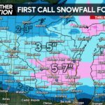
If cold air is as overwhelming as it is on the image above, the southern half of Pennsylvania would have the best shot at snow produced by a low pressure to the south. However, several cold shots will fly in beginning Sunday, bringing the lake effect snow potential sky-high.
That’s all for now, we will continue to monitor the threat(s) of a winter storm between the 9th and 12th.
We will be posting much more on our app regarding the expected weather such as exclusive videos and weather models. The app also offers a current conditions, interactive radar, local forecasts and much more so be sure to download it!
Thank you for reading and have a Happy New Year.
Share this weather update with family and friends!


You must be logged in to post a comment.