


The end of the workweek wraps up with a gorgeous day. Temperatures will climb into the mid to upper 40s for South-Central and Southeastern Pennsylvania, while the rest of us are still stuck in the 30s for high temperatures. Mostly sunny skies can be expected. Temperatures will continue to climb as we head into the weekend, with more of us reaching the 40s!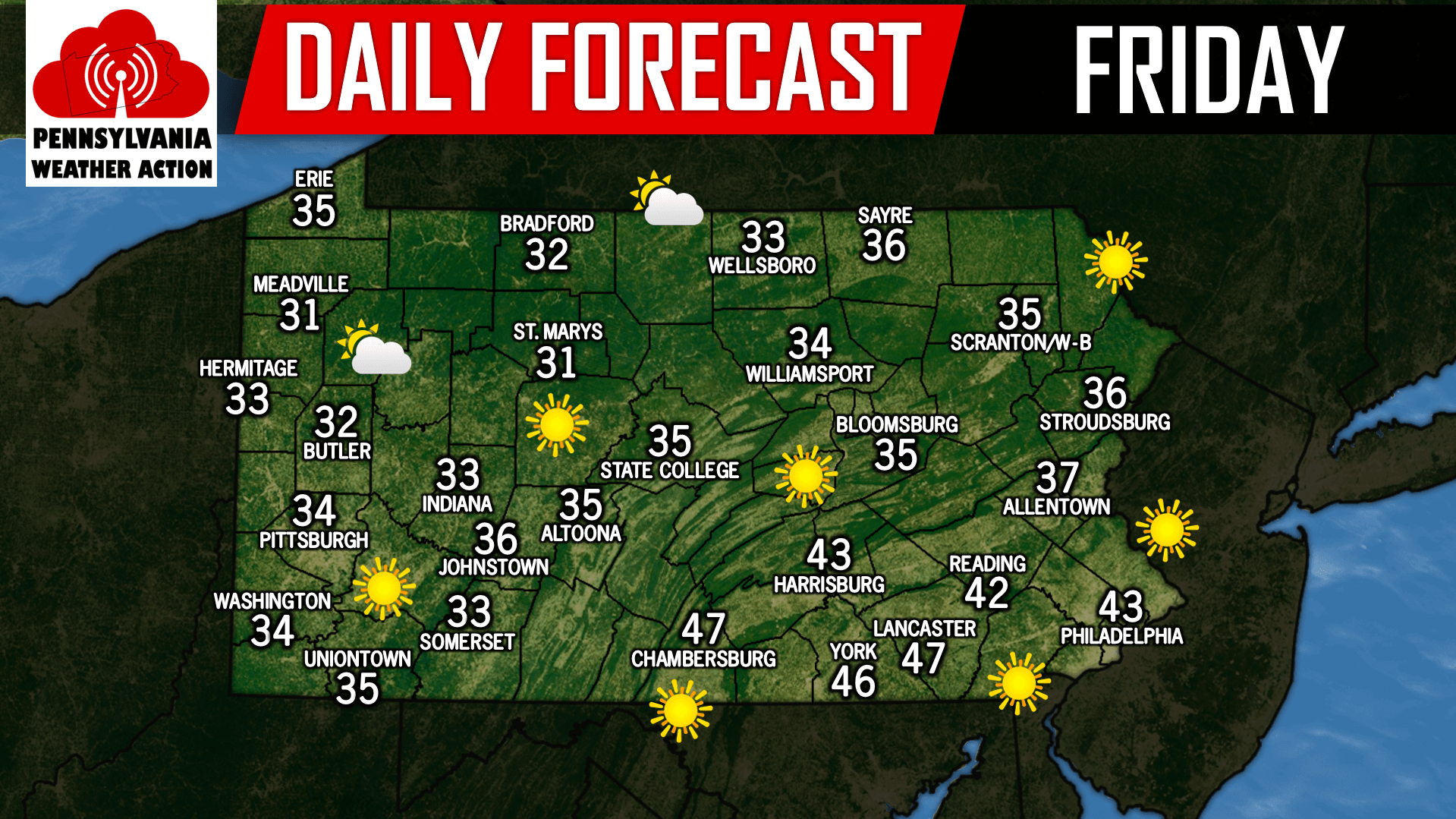
The next chance of precipitation does not arrive until Monday afternoon as a storm system known as a Great Lakes Cutter cuts to our northwest Monday, allowing for a trailing cold front to push through the area. A steady to heavy rainfall will accompany this cold front as it passes through the area Monday afternoon through Tuesday morning. 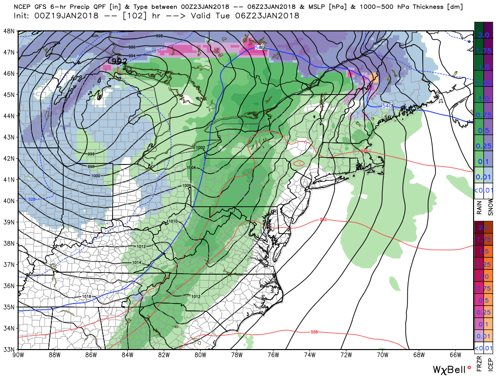
Preliminary projections suggests a widespread 1/2 inch to an inch of rainfall Monday afternoon through Tuesday morning for all areas.

You must be logged in to post a comment.