
Another warm January day is expected across the state with some late afternoon showers likely across Western Pennsylvania. For Eastern Pennsylvania, the showers will hold off until the nighttime hours. The rain will be on the light side.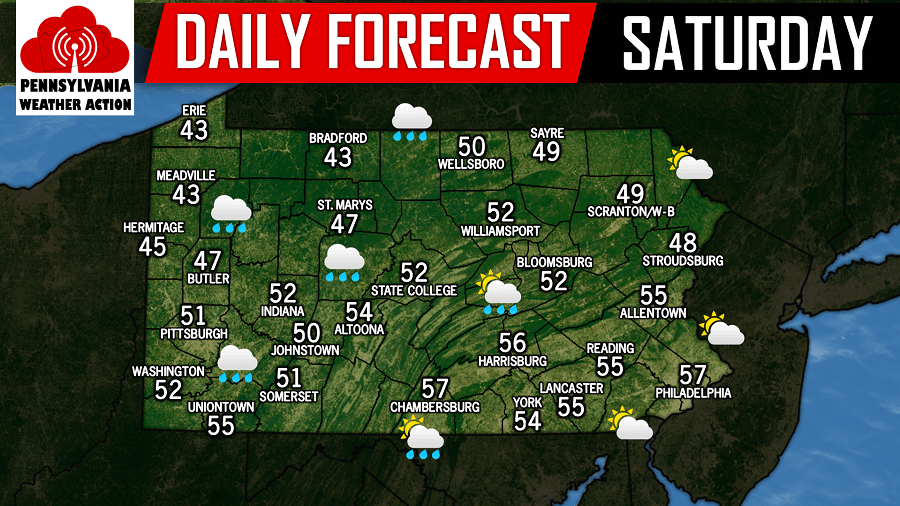
The coastal storm for Monday is still expected to remain out to sea, however an inverted trough is beginning to show up on model guidance that could produce light snow for some areas Monday evening into Tuesday morning. Inverted troughs are very hard to predict. They usually produce a narrow swath of accumulating snowfall. In this swath, it is possible for a few inches of snowfall. With that being said, we will likely not know where this inverted trough will setup until Monday morning.
We are going to watch this afternoon’s guidance come in. If they continue to show a grow in confidence of an inverted trough setting up somewhere over the area Monday evening into Tuesday morning, we will have a full update on this system later this evening. For now, below is the latest NAM model for 4:00 AM Tuesday morning: 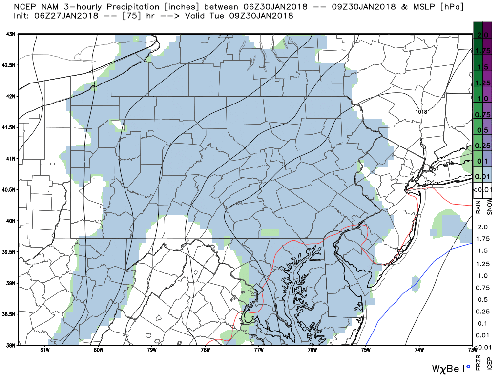
Our attention then turns to another storm that could produce a wider swath of snow late next week. Too early for details, but we will have updates throughout the week as we track that system.

You must be logged in to post a comment.