


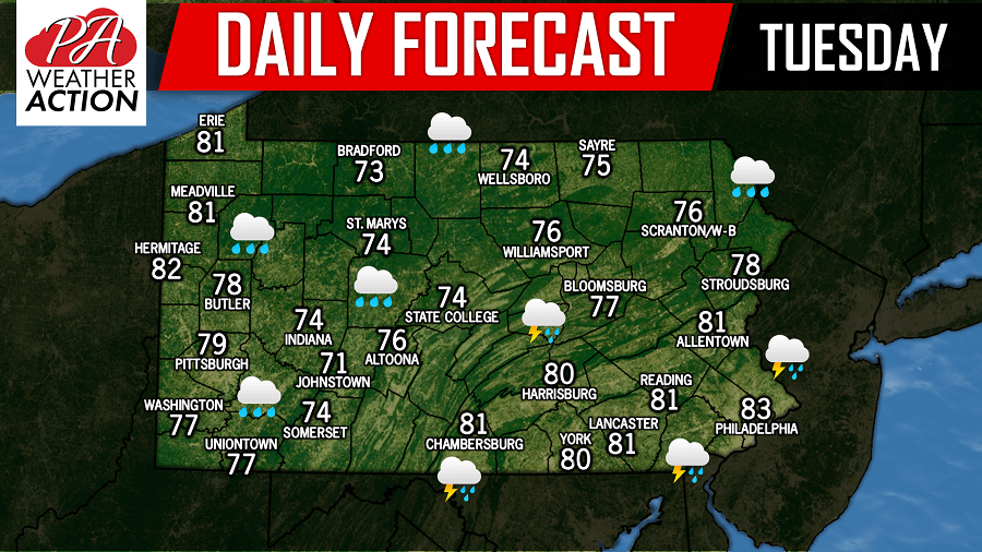
Another day with another chance of scattered showers and thunderstorms with high temperatures in the 70s and 80s. Areas that were hit hard in Northeast Pennsylvania yesterday could once again experience major flash flooding if these storm cells develop over the same areas that just experienced flooding.
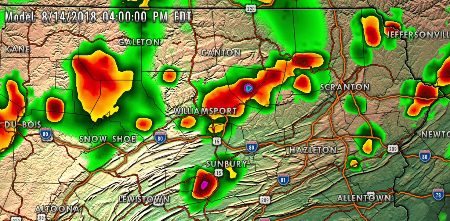
 Below is a look at the future radar valid for 4:00 PM:
 Stay tuned to our Facebook page for the latest, have a great Tuesday and stay safe!
You must be logged in to post a comment.