


The NWS Storm Prediction Center has already highlighted much of Eastern PA in an Enhanced Risk for severe storms Monday. Widespread severe thunderstorms are expected across the area.
A line of strong storms will form in Central PA in the late morning and early afternoon hours of Monday. The line is then likely to turn severe as tears east into Eastern PA late afternoon into early Monday Evening.
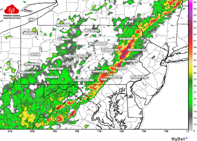
The model above is forecasting the radar for 5:00 PM Monday. As you can see, potent storms will be moving into Allentown, Reading, Lancaster, and York. These storms are expected to produce frequent cloud-to-ground lightning, as well as scattered damaging winds, hail, and possibly a few tornadoes.
SPC MAP FOR MONDAY’S SEVERE STORMS
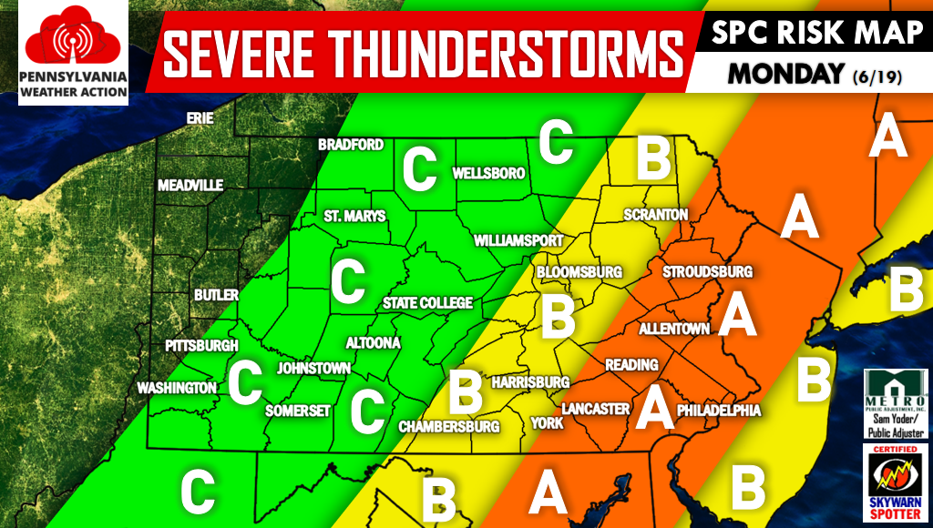
Area A – Locations included in this region are under an Enhanced Risk. Numerous severe thunderstorms are expected in this area, likely in the form of a line.
Area B – Locations included in this region are under a Slight Risk. Damaging winds will be possible, caused by a line organizing in the western section of this area and dissipating in the eastern section of this area.
Area C – Locations included in this region are under a Marginal Risk. Damaging winds will be possible as the line of storms begins to develop in this area.
Below is our thunderstorm risk graphic.
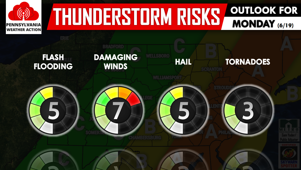
Damaging winds and hail will be the main risks. Flash flooding will be possible especially across Central PA, and tornadoes are most probable in Eastern PA.
We will be posting watches, warnings, and live radar on our facebook page >> Click Here to Like PA Weather Action on facebook! Warn your friends and family of this uncommon risk by sharing this article using the icons below.


You must be logged in to post a comment.