


To begin with, this article will be more technical than normal. This winter started off with temperatures near average in December. Though, you were probably wondering why it never snowed when it was cold and why it always rained when it was warm. We often turn to the NAO and AO when we think of winter. However, neither of those factors really played a big role in December. The teleconnection that dominated the pattern was the PNA.
If you don’t know what the PNA is, it’s no big deal. All you need to know is when the PNA is negative, cold air often sinks down into the Western US while a ridge keeps the Eastern US warm. With the jet-stream sitting in the Central US, storms cut west of us producing rain for our area. A positive PNA often results in a cold, snowier pattern for our region. In December, we had storm after storm cutting through the Midwest, bringing us rain followed by a short period of near to slightly below average temperatures. Another factor that could have had implications on December was the La Nina, which has now warmed to neutral.
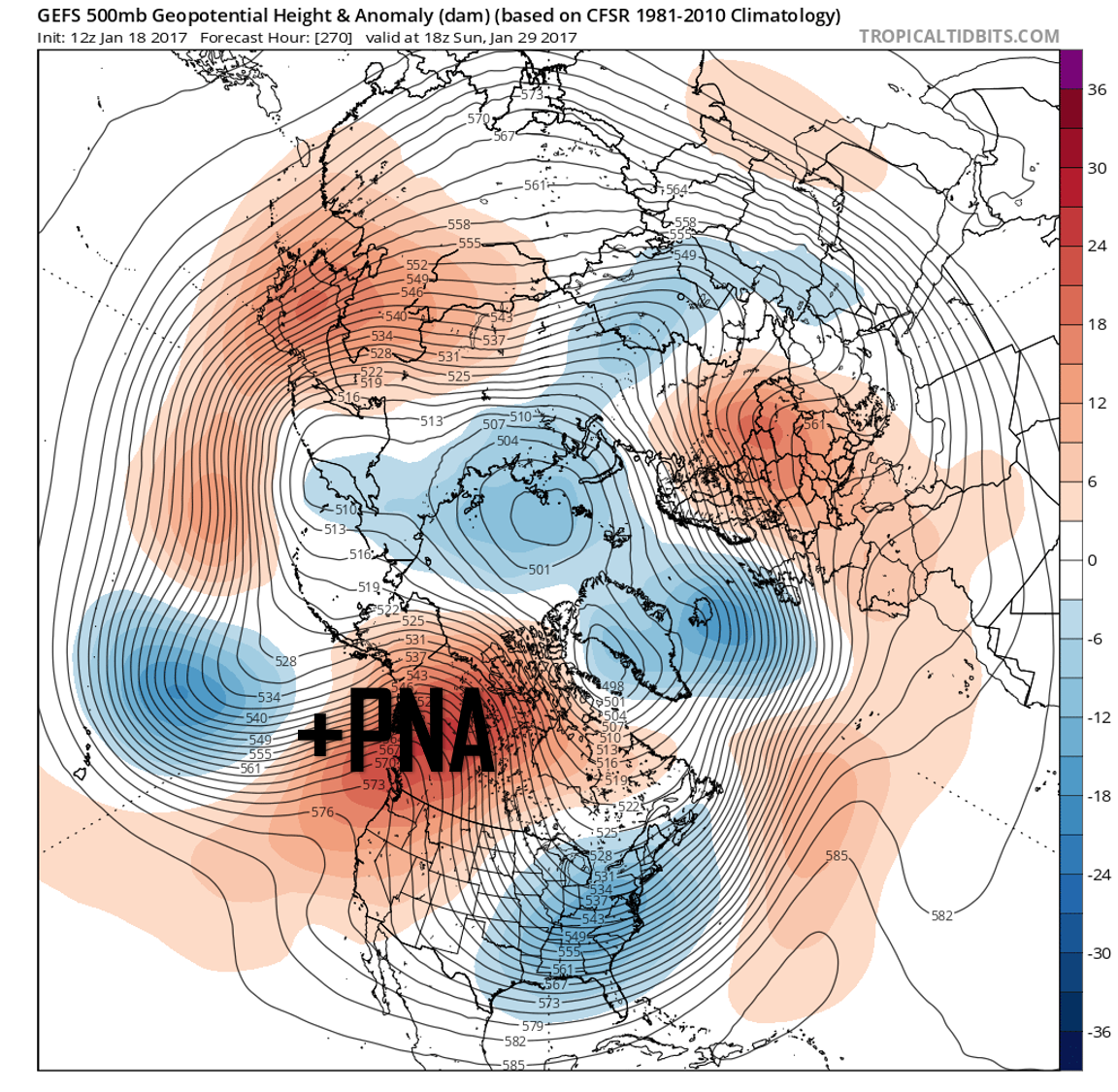
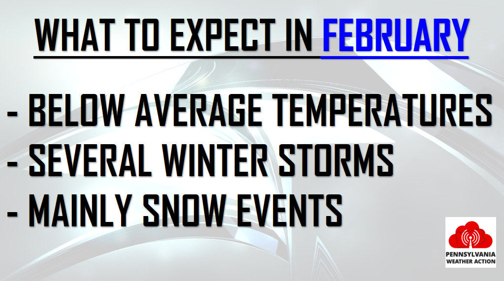
Why will February be different? There are several contributing reasons. Starting off with the PNA, a positive PNA is FINALLY expected as we head into February.
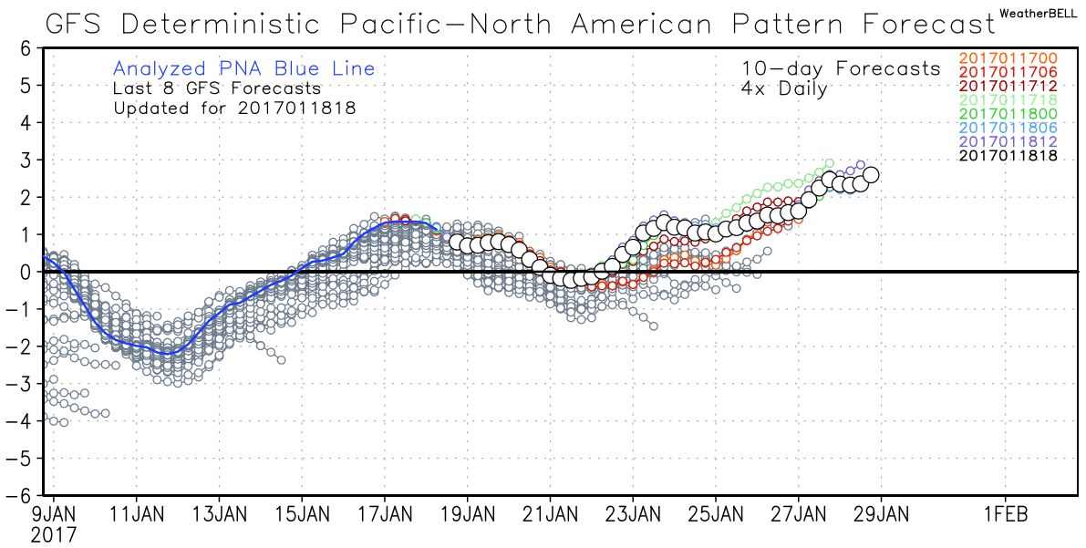
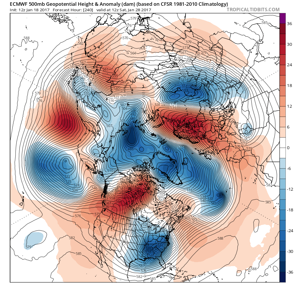
Are models indicating a positive PNA-like pattern? The answer is an overwhelming yes. There is a general consensus throughout the models of a very chilly pattern in the Eastern US through atleast the first half of February, and long range models are indicating the pattern could last into March.
Furthermore, another indicator we look at is the stratosphere. We need a stratospheric warming event to help break down this current pattern. Once again, models are in general agreement that this will occur. 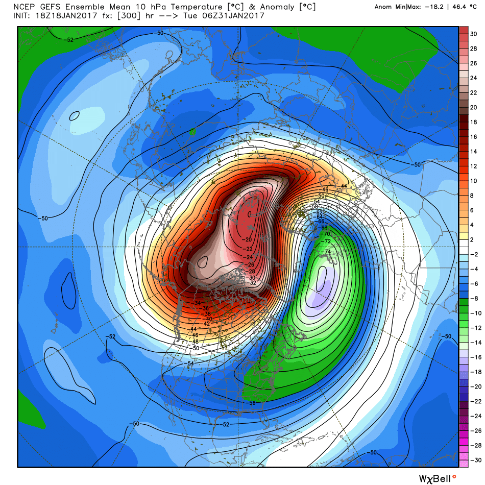
The setup displayed is an ideal setup for cold temperatures here in our region. The Arctic Circle is getting just about torched, while the polar vortex is displaced into Eastern Asia. As you can see, colder air spills right down into the Northeast US. While the stratosphere doesn’t always translate to the troposphere, the significance of this event makes the probability of it having implications on our temperatures somewhat higher than usual. Also keep in mind there is typically a delay between a stratospheric warming event and the actual results at the surface.
Finally we move to the MJO. If you haven’t figured out by now our weather for the most part is controlled by global ocean temperatures. The MJO has to do with sea surface temperatures to the west and east of the Pacific Islands. Again, all you need to know is phases 1, 2, 3 and 8 are “cold phases,” meaning there is a correlation between those phases and below average temperatures in our area. Here is the GEFS Forecast for the MJO moving forward.
Up to this point we have been in the “circle of death,” meaning no impact warm or cold. You may be wondering where the cold air is based on that image. We are in phase 8 right now, but there is a lag time of about 10-15 days. This would mean the cold air should begin to show itself around January 28th, which is exactly when we expect the pattern change to begin. We are expected to move into phases 1 and 2 before returning to the circle of death. If you look longer range, the MJO could possibly move into phase 7 and then back into cold phases.
If you have read up to this point, congratulations! You probably now know a few new things you didn’t before you opened this article.
All of these factors will likely result in a colder than normal month of February, with several winter storms. The storms will likely be snow events rather than rain events.
Make sure to click here to follow us on Facebook for more updates>>>>PA Weather Action on Facebook!
Also don’t forget to share the forecast below!
You must be logged in to post a comment.