


The storm system that has delivered snowfall to Florida will be the same system that will turn into a coastal blizzard beginning late tonight and into Thursday. While the worst of the storm is still expected to be East of Pennsylvania, a trend west has taken place over the last 24 hours, leading to increased totals over Eastern Pennsylvania.
Almost all of Eastern Pennsylvania is under some kind of weather alert. Most counties are under a Winter Weather Advisory with the exception being far Southeast Pennsylvania around Philadelphia where Winter Storm Warnings have been issued by the National Weather Service. Although not pictured, as you approach coastal New Jersey, blizzard warnings have been issued. Below is the latest alerts map issued by the National Weather Service: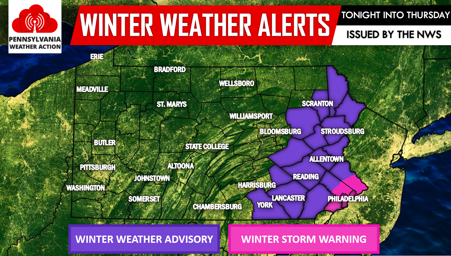
Taking a look at our future radar using the GFS, the snow will begin to over spread Southeast Pennsylvania after midnight. Below is valid for 1:00 AM: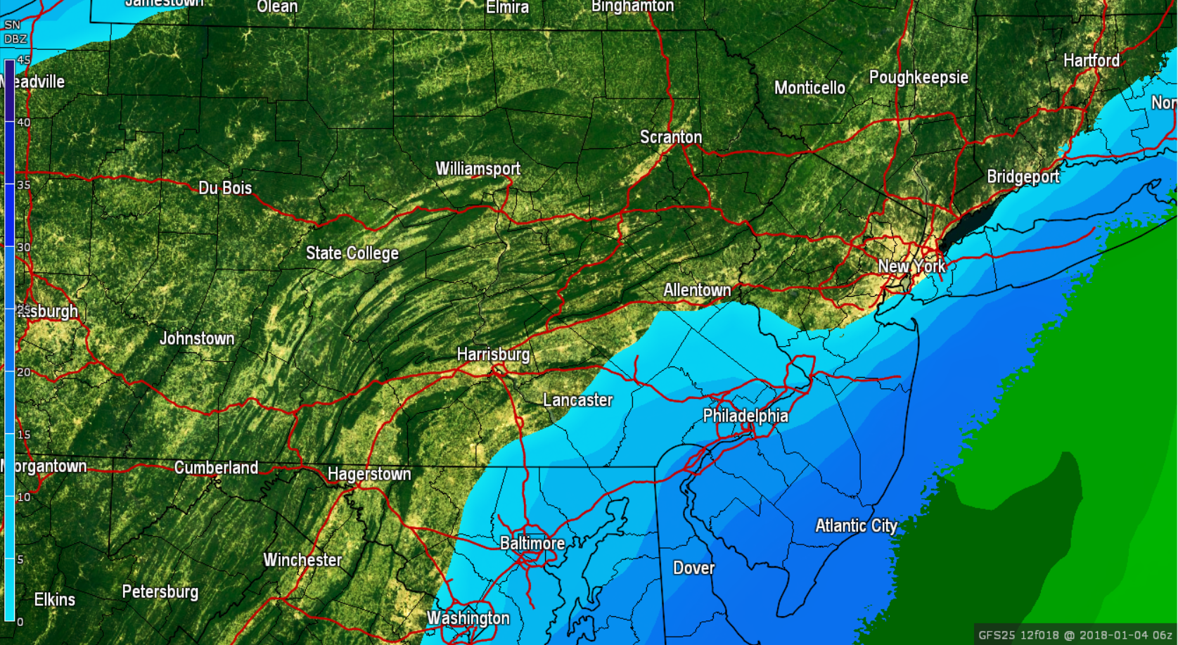
The snow will begin to push northwest and will gradually pick up in intensity. By 4:00 AM much of Eastern Pennsylvania is receiving moderate to heavy snow: 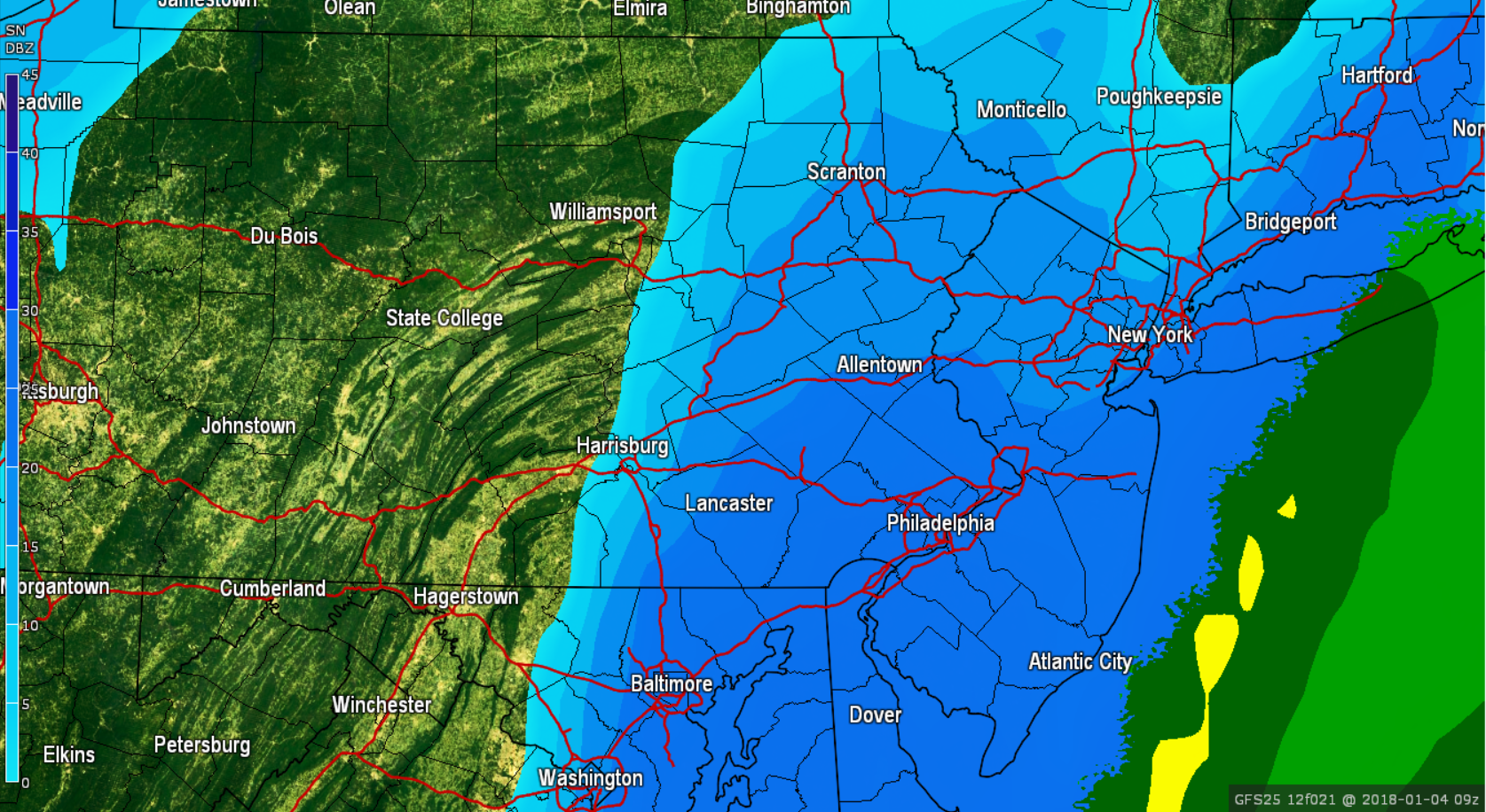
The peak of this storm will be right around rush hour Thursday morning. If you have to go to work in the morning, please be prepared. School cancellations are likely. Below is valid for 7:00 AM with heavy snow and windy conditions across Eastern Pennsylvania: 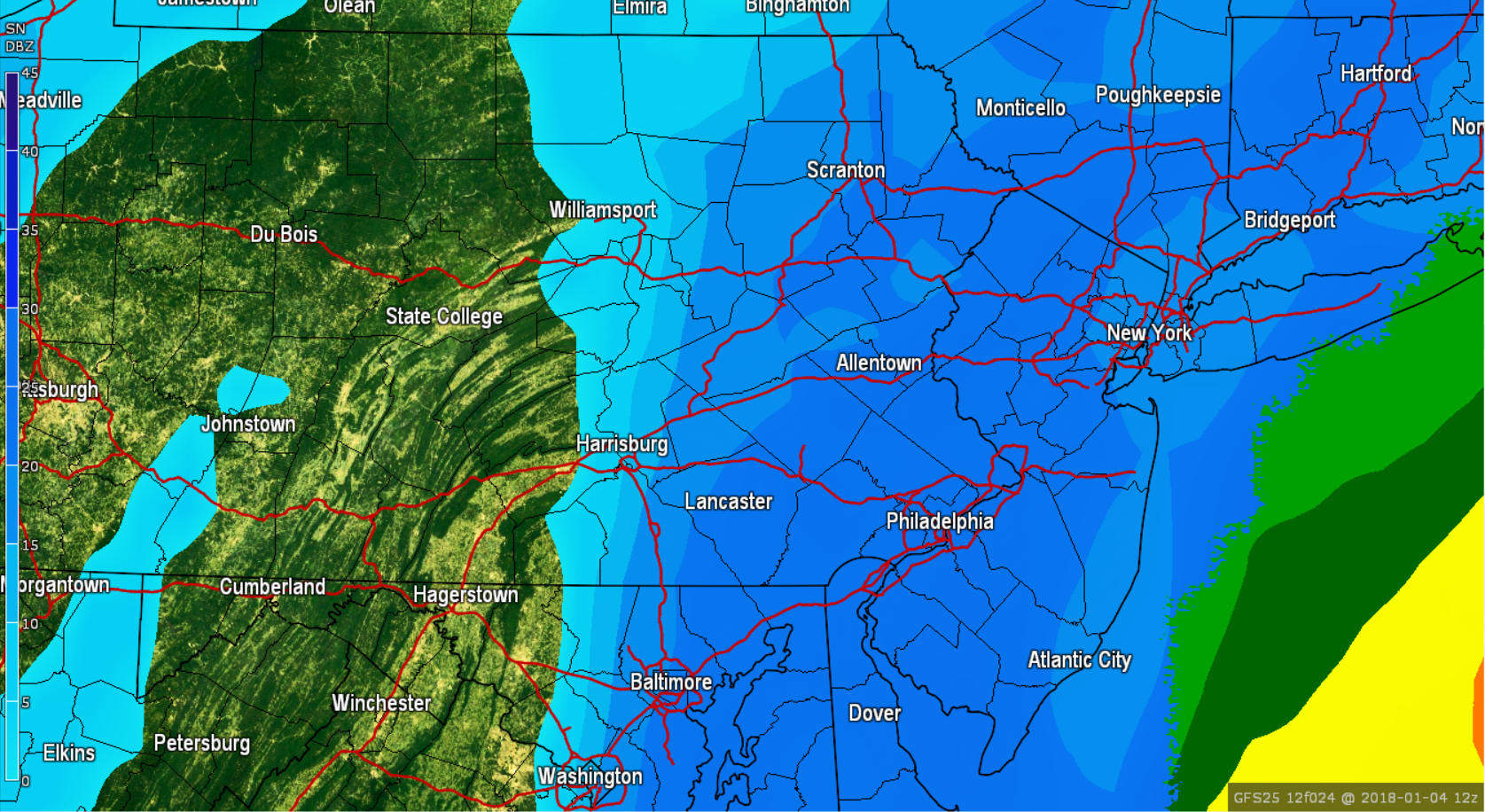
The snow will continue through the morning hours Thursday and will begin to taper off after lunchtime. Below is valid for 1:00 PM Thursday afternoon: 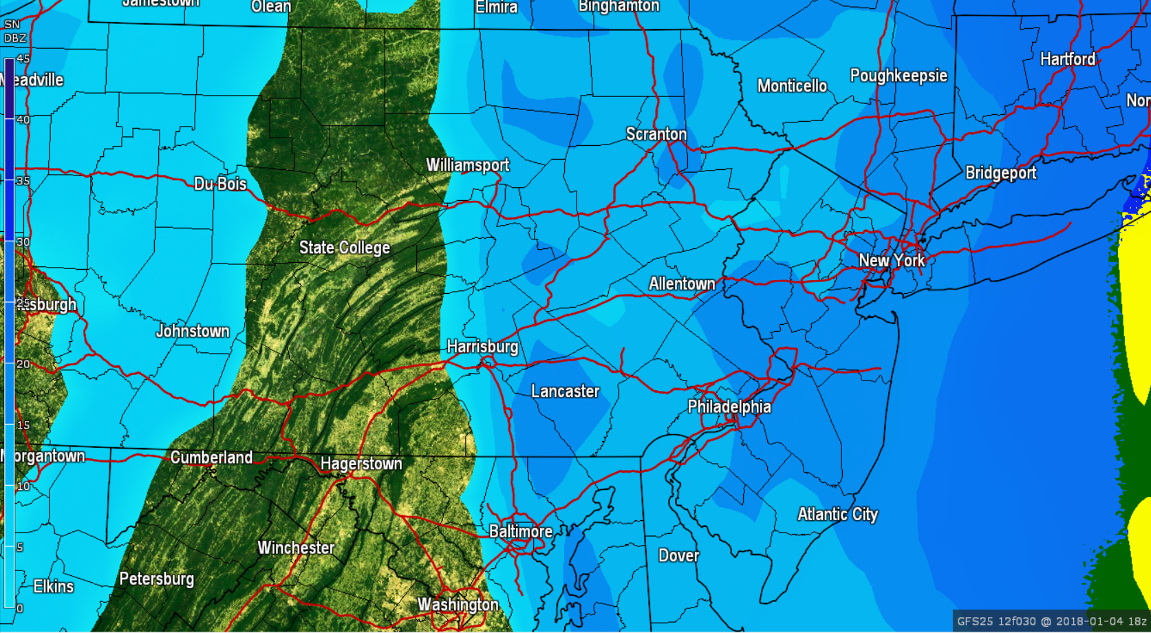
While the snow totals may not be that impressive compared to previous big storms, the wind combining with the snow will significantly impact travel. Winds will gust over 30 MPH for Eastern Pennsylvania and up to 50 MPH for coastal areas.
BELOW IS OUR FINAL CALL SNOW TOTALS THROUGH THURSDAY:
Timing: Snow will begin around midnight for Southeastern Pennsylvania and will overspread to the northwest shortly after. The worst of the storm will be between 4:00 AM and 10:00 AM. The snow will begin to taper off after lunchtime Thursday.
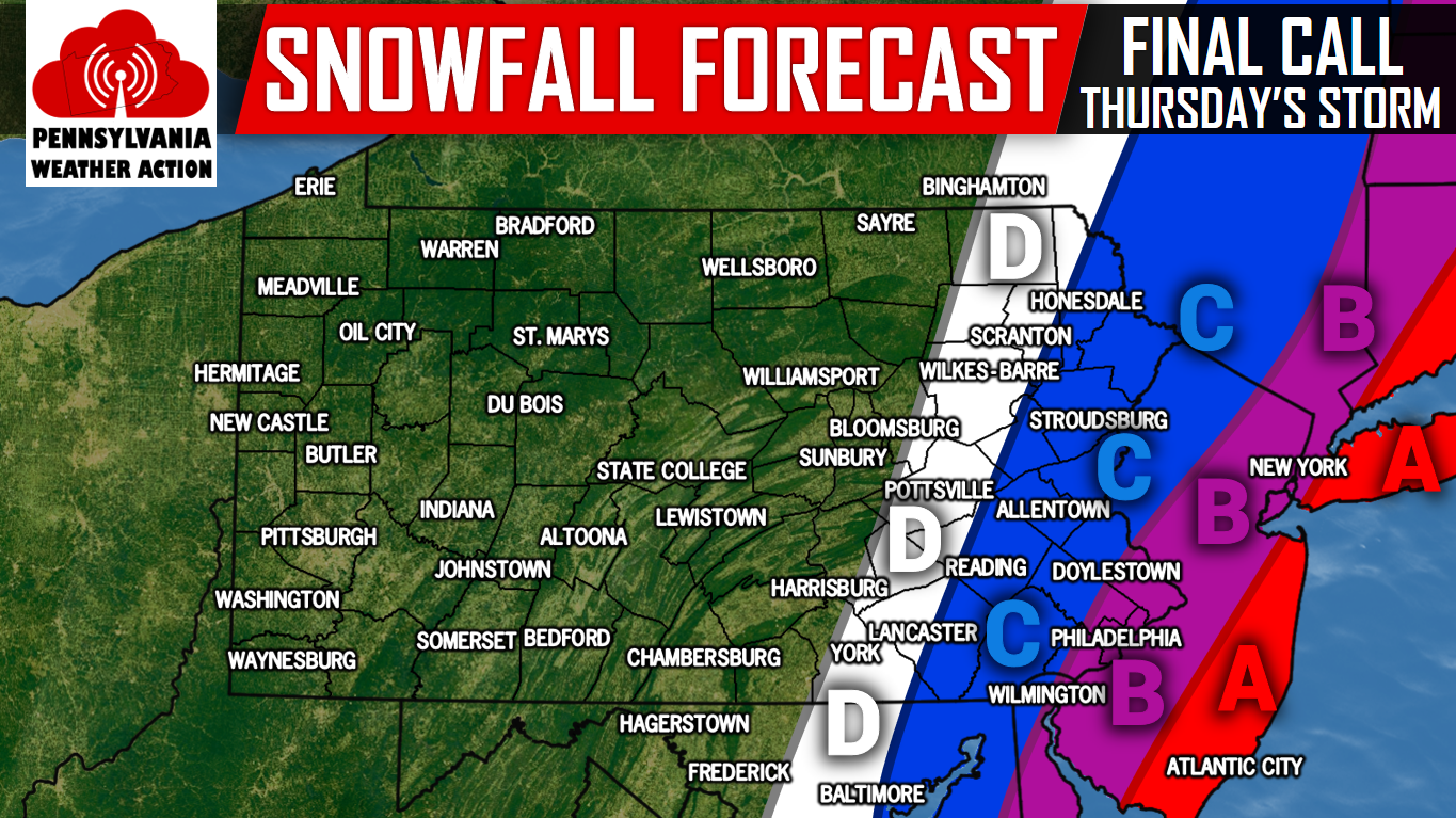
Area A: 6 to 10 inches of heavy, wind-driven snow. Blizzard conditions are expected with winds gusting up to 50 MPH. Widespread power outages are likely. Travel will be impossible at times.
Area B: 4 to 6 inches of heavy, wind-driven snow. Blizzard-like conditions at times are possible. Winds will gust up to 40 MPH. Scattered power outages are likely. Travel is not recommended.
Area C: 2 to 4 inches of wind driven-snow. Winds will gust up to 30 MPH. Isolated power outages are possible, but not likely. Treacherous travel is expected.
Area D: Coating to 2 inches of wind driven-snow. Winds will gust up to 30 MPH. Isolated power outages are possible, but not likely. Travel will be impacted by snow covered roads, plan accordingly.
For more updates regarding this powerful coastal blizzard and more, like our page on Facebook by clicking here>>>Pennsylvania Weather Action’s Facebook Page
Download our app to stay ahead of the storm>>>Click here to download our app!
Do not forget to share the news with your family and friends using our icon below, stay safe!
You must be logged in to post a comment.