


Since we have released our first call yesterday evening, guidance has suggested upper air temperatures to be a tad bit warmer than previously expected. What this means is, for areas in Southern PA, a mix with rain showers will more of a common theme than we originally thought. However, our first call for this area was only for a coating to an inch, so regardless, not much was to be expected.
Timing has been pushed up a bit: Precipitation will overspread Western PA between 2 and 4 AM, Central PA between 4 and 6 AM, and Eastern PA after 6 AM. The duration of the snow and rain showers will last no longer than 6 hours. We expect all precipitation to be out of the state shortly after lunchtime Thursday.
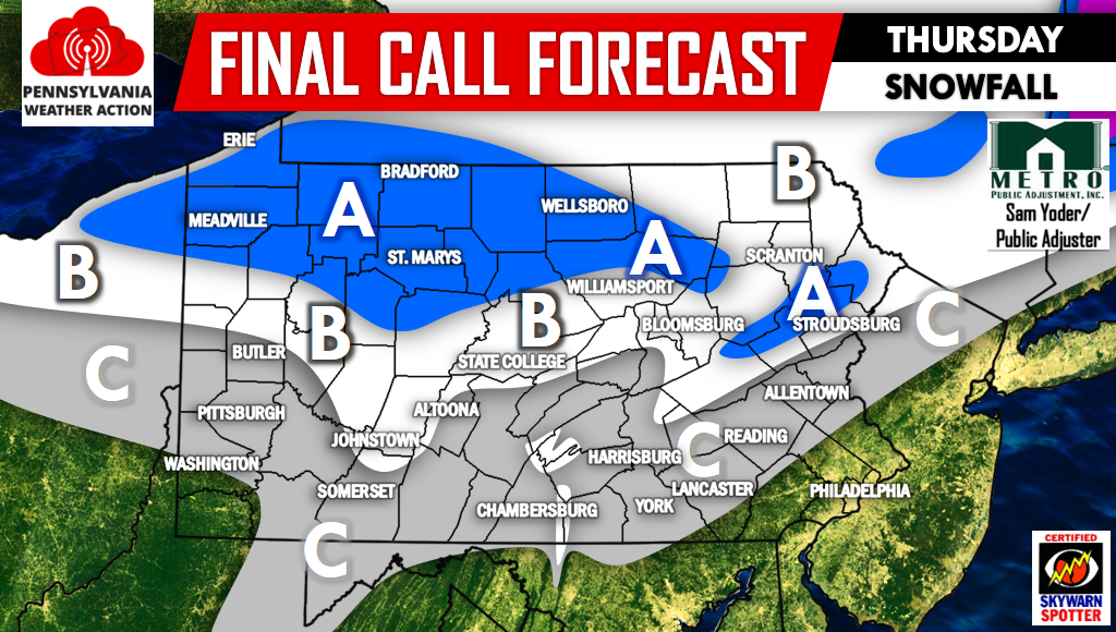
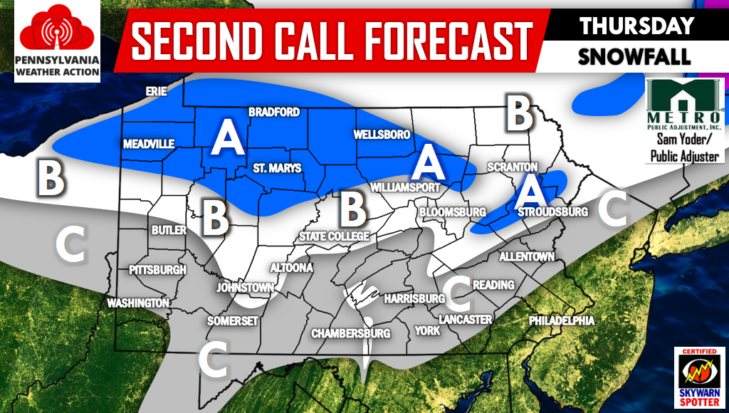
FINAL CALL MAP FORECAST
Area A – Snowfall accumulation of 2-4″.
Area B – Snowfall accumulation of 1-2″.
Area C – Snow and rain mix limiting snow accumulation to under 1″.
More snow is expected Friday across Western PA, with over a half foot possible near Meadville and Erie, see our First Call Forecast for that event here >>> CLICK HERE FOR FORECAST
Don’t forget to like Pennsylvania Weather Action on facebook and share this forecast below!
You must be logged in to post a comment.