


Rain has already changed to snow for far Northwest Pennsylvania as our storm system is really beginning to get its act together. While many of us are enjoying temperatures in the 50s and 60s, expect these temperatures to rapidly drop once the arctic front pushes through your area.
If you have been following our previous forecasts, there are no major differences in our final call.
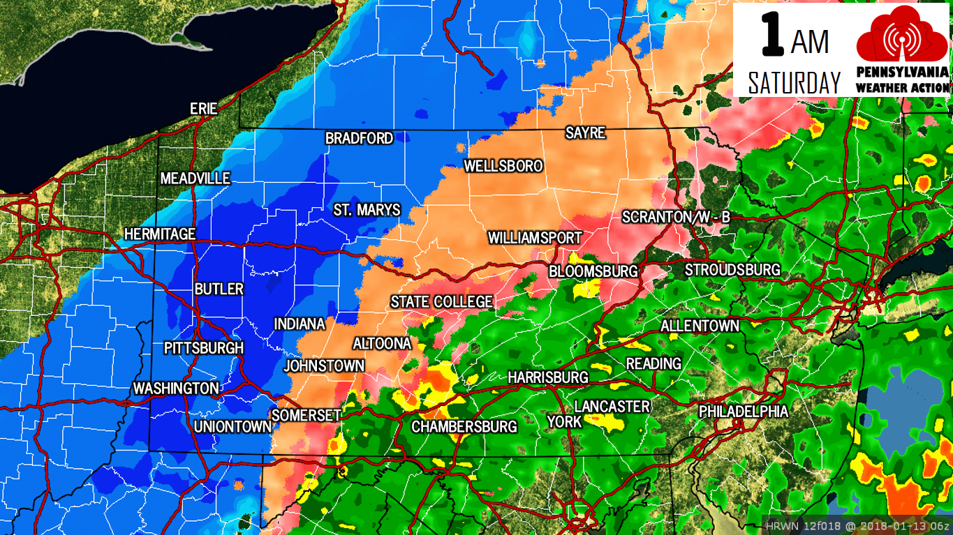
The rain/ice and the ice/snow line will continue to crash southeast allowing all areas of Central and Western Pennsylvania to change over to some sort of frozen precipitation. Below is a look at our future radar for 1:00 AM Saturday.
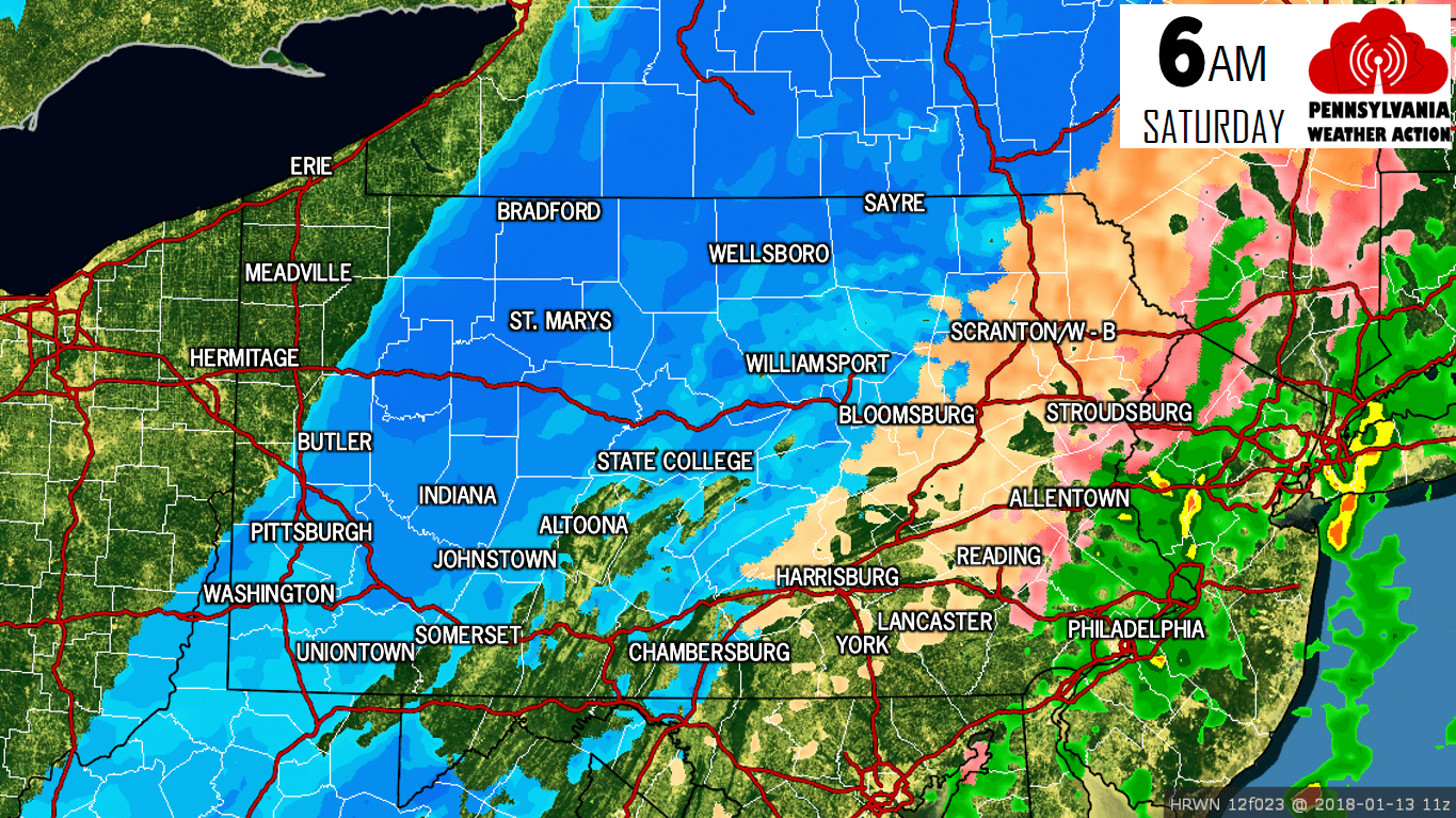
By 6:00 AM, will begin to shut off in Central and Eastern Pennsylvania. However, for Western Pennsylvania snow will still be falling.
 We expect all precipitation will end by 8:00 AM Saturday morning. While not all of us will experience the frozen precipitation, all of us will experience the flash freeze! Temperatures tonight into early tomorrow morning will drop over 30 degrees in a matter of a couple hours. Black ice will be a huge concern Saturday for all locations throughout our state. Please take extra caution while driving Saturday.
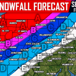
FINAL CALL SNOWFALL FORECAST
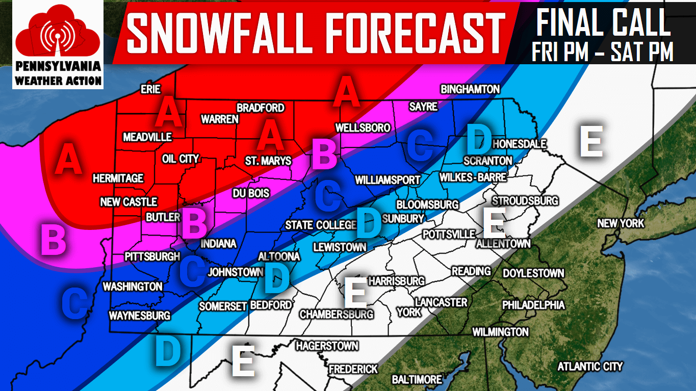 Area A: 6 to 10 inches of snow is expected after the changeover from freezing rain/sleet to snow Friday Night from west to east. Travel will be very hazardous due to a layer of ice under the snow.
Area B: 4 to 6 inches of snow is expected after the changeover from freezing rain/sleet to snow Friday Night from west to east. Travel will be hazardous due to a layer of ice under the snow.
Area C: 2 to 4 inches of snow is expected after the changeover from freezing rain/sleet to snow Friday Night into Saturday Morning from west to east. Travel will be difficult due to a layer of ice under the snow.
Area D: 1 to 2 inches of snow is expected after the changeover from freezing rain/sleet to snow Friday Night into Saturday Morning from west to east. Travel will be difficult due to a layer of ice under the snow.
Area E: A coating to 1 inch of snow is expected after the changeover from freezing rain/sleet to snow Friday Night into Saturday Morning from west to east.
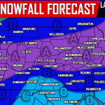
FINAL CALL FREEZING RAIN/ICE FORECAST
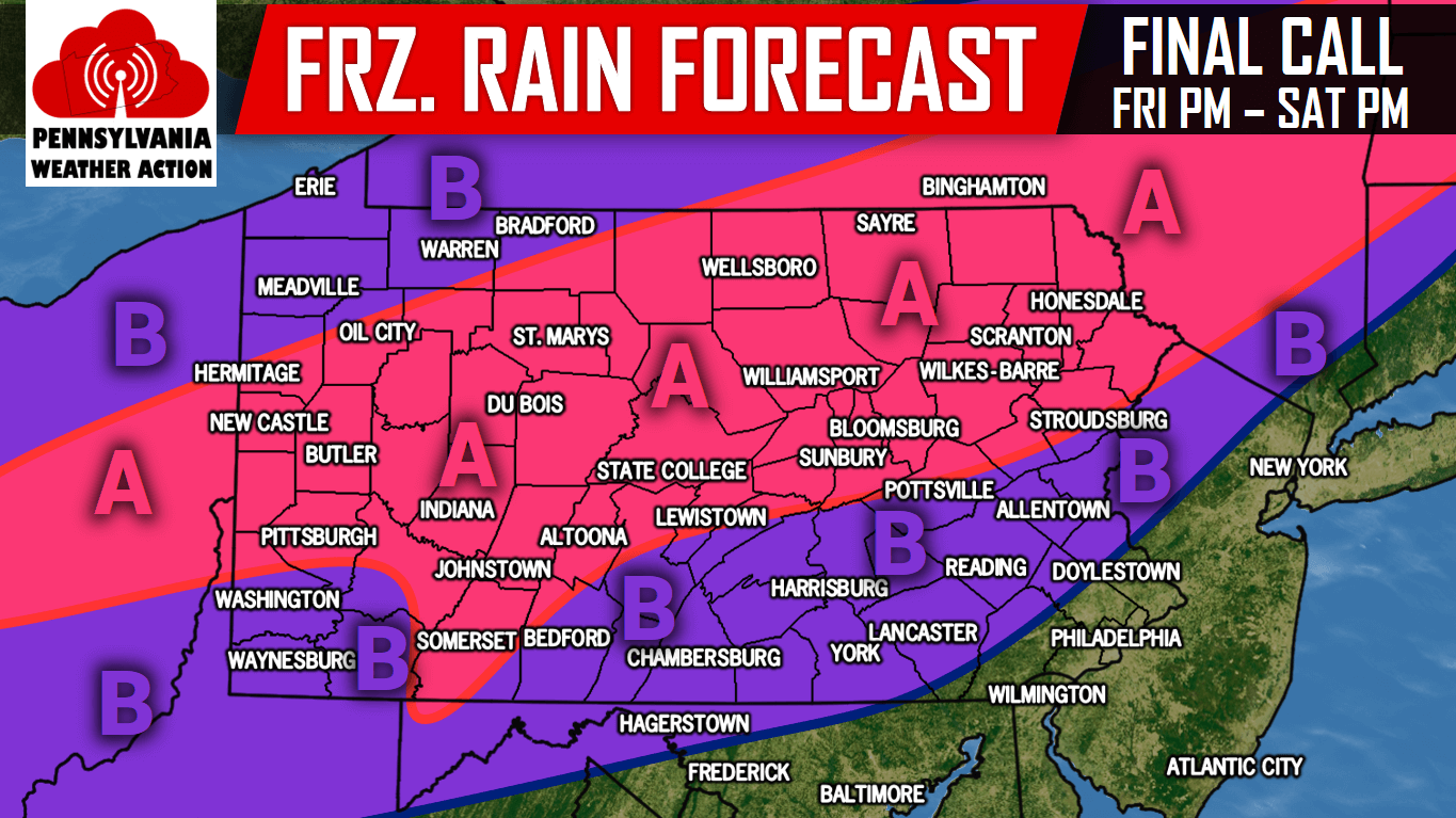 Area A: .10 to .20″ of freezing rain/ice accumulation expected after the changeover from rain to freezing rain Friday Evening from west to east. Travel will be very hazardous.
Area B: .01″ to .10″ of freezing rain/ice accumulation expected after the changeover from rain to freezing rain Friday Night from west to east. Travel will be very hazardous.
For more updates regarding this significant winter storm, like our page on Facebook by clicking here>>>Pennsylvania Weather Action’s Facebook Page
Get our app for interactive radar, NWS alerts, and more >>>Click here to download our app!
Share the important forecast with your family and friends using the button below!
You must be logged in to post a comment.