


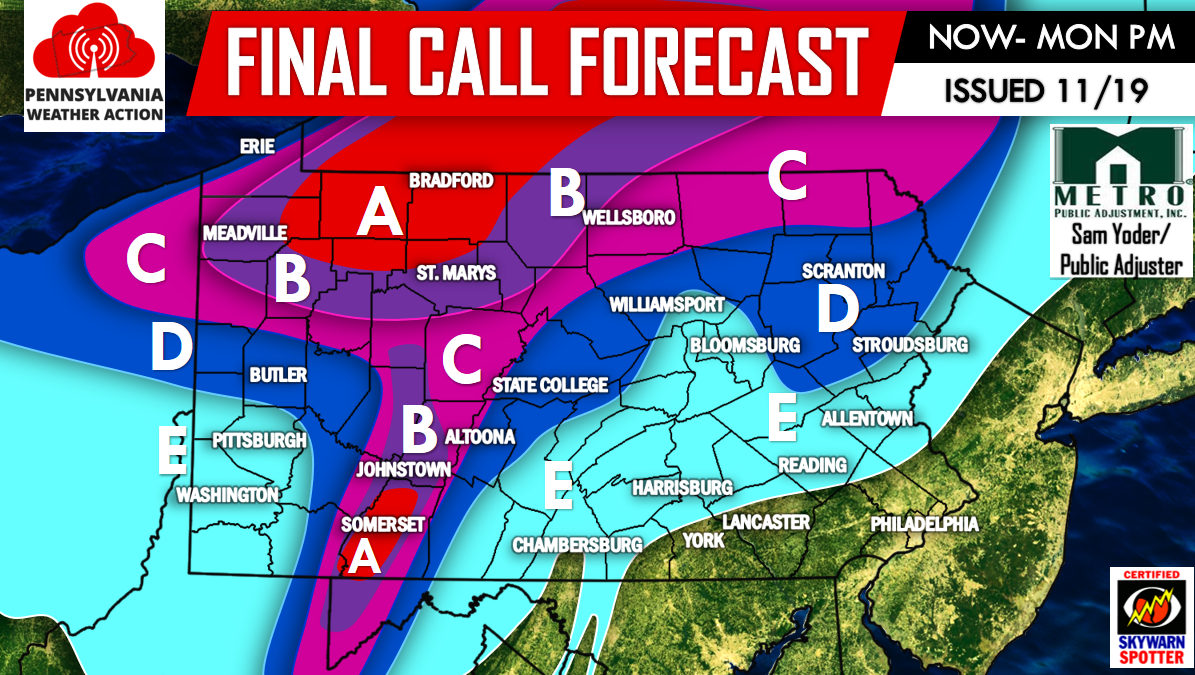
Our final snow forecast needed some slight adjustments, mainly to upgrade snow totals over the Laurel Highlands.
Currently as of 3 PM the cold front is centered right over Central PA splitting PA in half of two different seasons. Spring in the East and Winter in the West! The cold front will continue to push East, packing a very cold punch along with rain showers changing to snow showers the further West you go.
Area A – 6 to 10 inches of snowfall, with isolated amounts up to a foot possible. Blizzard like conditions will be felt at times with winds gusting over 40 mph.
Area B – 4 to 6 inches of snowfall is expected. Blizzard like conditions are possible due to winds gusting over 40 mph.
Area C – 2 to 4 inches of snowfall is expected. Whiteout conditions are possible at times due to winds gusting over 40 mph.
Area D – 1 to 2 inches of snowfall is expected. Brief whiteout conditions are possible under locally heavier snow squalls. Winds will gust over 40 mph.
Area E – Snow showers are possible. Little to no accumulation is expected. Winds will gust over 40 mph.
**Isolated power outages are possible across the state due to very gusty winds.**
If you haven’t already, follow us for the latest updates by liking our Facebook page, click here>>>>PA Weather Action on Facebook!

You must be logged in to post a comment.