
We hope everyone is enjoying this beautiful Thursday afternoon because the weather is about to change…fast. From temperatures in the 50s and 60s, to accumulating snow within a 12 hour period is pretty impressive and that is exactly what we are anticipating going into the overnight hours.
Because surface temperatures are so warm, especially for our southern counties, precipitation may start off as some rain showers, before transitioning to snow. Below is the GFS showing a push of rain and snow into the area by 10 PM tonight: 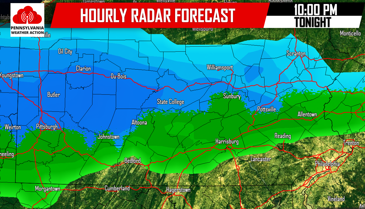
After midnight, most areas will be experiencing some steady wet snow, with some areas still hanging onto the rain showers along the mason/dixon line. When we take the same model out to 4 AM Tomorrow Morning, we have a state-wide light to moderate snowfall:
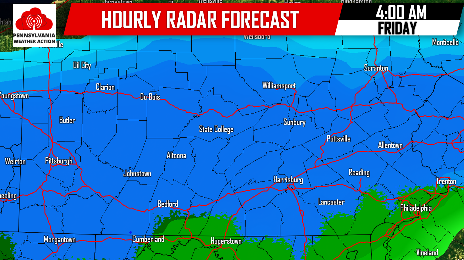
This particular model is likely a bit too warm at 4 AM. We expect all areas to be snowing at this point. The snow will continue through 7 AM before tapering off by 10 AM for all locations.
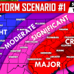
FINAL CALL SNOW FORECAST FOR TOMORROW MORNING
Our most notable change in our final forecast is the extension of zone B farther south, other than that only minor adjustments were made.
Timing: Precip will arrive between 9 PM and Midnight. Steady snow for most after midnight and will begin to taper off by 10 AM. Friday Morning commute will be treacherous especially for areas in A and B.
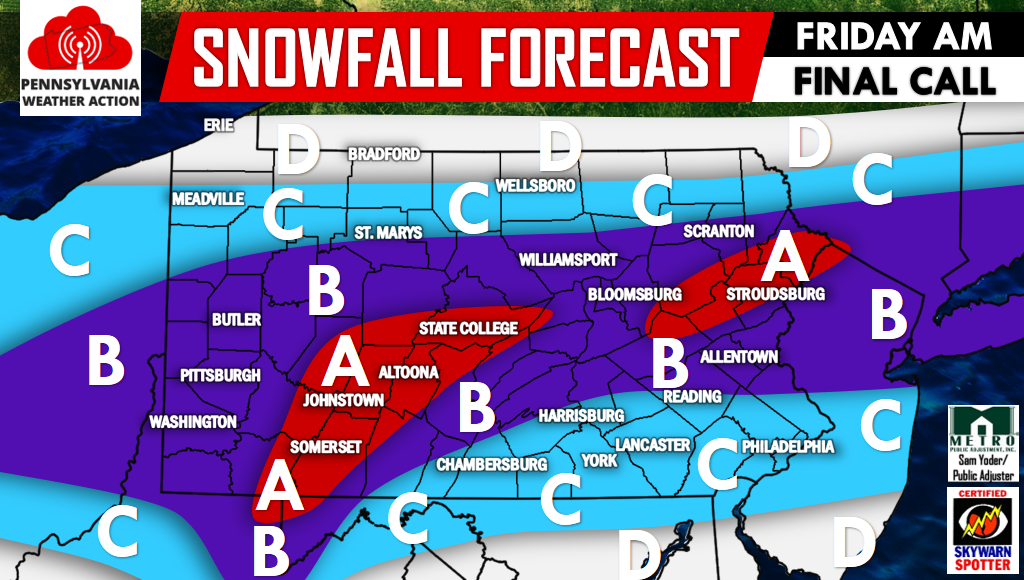
Area A: 4 to 6 inches of snowfall is expected. Hazardous travel conditions are expected Friday Morning.
Area B: 2 to 4 inches of snowfall is expected. Travel delays are expected for the Friday Morning commute.
Area C: 1 to 2 inches of snowfall is expected. Travel delays are possible depending how hard the snow is falling. This region will have a tough time accumulating snow on paved surfaces if the snow remains light. Most accumulations will be on grassy surfaces.
Area D: A coating to 1 inch of snowfall is expected.
For more please follow us on Facebook as we are not only tracking this system, but another (potentially larger) system early next week, details arrive Tomorrow>>>PA Weather Action on Facebook!
Don’t forget to share our final call with your family and friends using the icons below, stay safe!
You must be logged in to post a comment.