
Another round of snow from a clipper is expected to begin Wednesday evening in Western PA and will continue to overspread the rest of the state as the night goes on. Latest trends over the last 24 hours have been for a track a bit farther north. However, it is still expected Western PA and the Laurel Highlands receive the greatest amounts.
Snow will move into Western PA as early as 3:00 PM tomorrow: 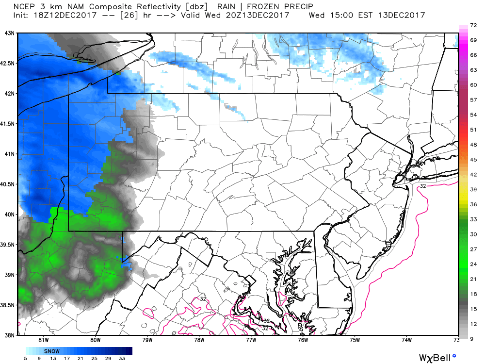
Any green you see on this future radar is not actually rain, instead it is a model error. Temperatures will be far too cold to be raining anywhere in the state.
As we take the same future radar out to to 10:00 PM Wednesday night, the snow has overspread much of the state: 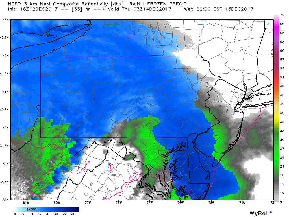
The snow is expected to fall throughout the nighttime hours and into early parts of Thursday morning. The snow will not taper off until after 5:00 AM Thursday morning. The Thursday morning commute to work will be impacted in many areas with snow covered roads. Plan accordingly.
While this clipper system does not have a lot of precipitation to go along with it, temperatures will help produce higher snow totals. Instead of a typical 10:1 snow ratio, this will more in the 15-20:1 ratio range. This will be a light, fluffy snow, whatever snow falls, will pile up quick. Take a look at the expected temperatures as the snow falls: 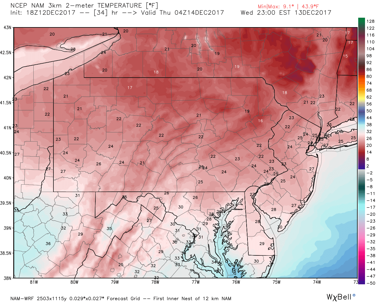
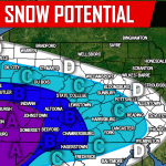
FIRST CALL SNOW TOTALS MAP
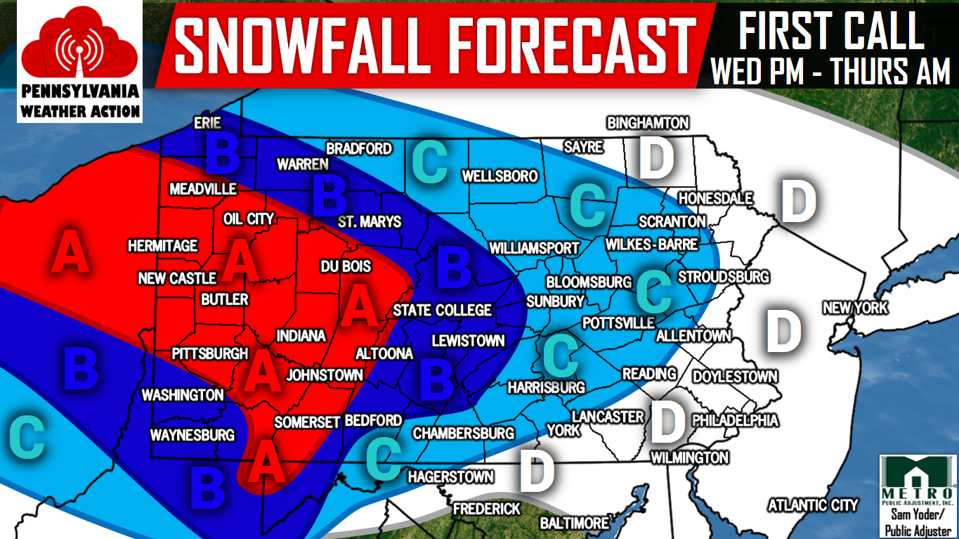
Area A: 4-6″ of snow accumulation is expected. Travel on untreated roadways will be hazardous late Wednesday Night into Thursday Morning.
Area B: 2-4″ of snow accumulation is expected. Travel on untreated roadways will be hazardous late Wednesday Night into Thursday Morning.
Area C: 1-2″ of snow accumulation is expected. Travel on untreated roadways will be difficult late Wednesday Night into Thursday Morning.
Area D: A coating to an inch of snow accumulation is expected. Watch for slick spots late Wednesday Night into Thursday Morning.
Make sure you have us liked on Facebook for the latest regarding this clipper and much more, click here>>>Pennsylvania Weather Action’s Facebook Page. Also, download our app for the latest alerts and interactive radar. Click here to download our app!
Share this snowy news with your family and friends using the button below, stay tuned for our Final Call Forecast Wednesday Evening!
You must be logged in to post a comment.