


We are tracking a system that will produce a light wintry mix for our state on Tuesday. Precipitation will likely start off as snow for the northern two-thirds of the state Tuesday morning, before transitioning to a period of sleet and freezing rain by the afternoon hours. All areas will end in the form of rain by Wednesday morning.
Below is the GFS valid Tuesday 7 PM: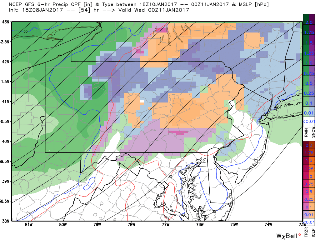
You can see areas in Western PA have already changed to rain, while Central and Eastern areas are dealing with Snow (blue), Sleet (orange), and Freezing rain (Pink). It is important to know this will not be a big event by any means. We stress the word LIGHT wintry mix for the state Tuesday. However, even just a glaze of ice can cause travel headaches.
The precipitation, like we stated, wraps up in the form of rain Wednesday Morning: 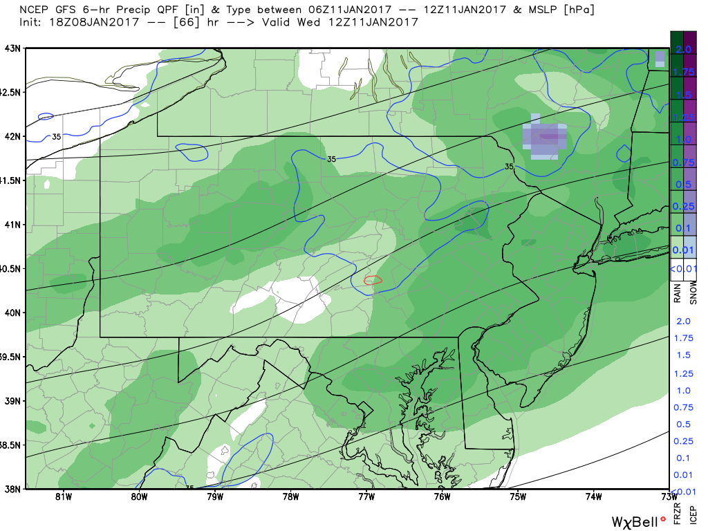
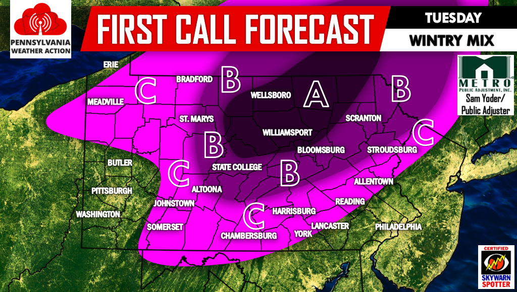
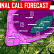
First Call for Tuesday’s Wintry Mix
Timing: Precipitation will overspread Western PA Tuesday Morning and overspread Central and Eastern PA by lunchtime. We expect everyone to turnover to a plain rainfall by midnight Wednesday.
Area A – Around an inch of snow is possible before changing over to freezing rain for an extended period. Ice accretion of .10-.20″ is possible.
Area B – Up to an inch of snow is possible before changing over to freezing rain for several hours. Ice accretion of .05-.15″ is possible.
Area C – A coating to a half inch of snow is possible in the northern section of this area. Up to .10″ of ice accretion is possible for the entire area.
Click here to like us on Facebook for more updates regarding this system and much more>>>>PA Weather Action on Facebook! Don’t forget to share the forecast below, stay safe!
You must be logged in to post a comment.