


We are tracking a weak area of low pressure that will develop to our west and take a path just south of our state, putting most, if not all areas, on the cold side of the storm. This will lead to a light to moderate snowfall for many during the Thursday Night and Friday Morning time period.
Snow will develop across much of PA by Midnight Friday Morning. We will have to keep a close eye on southern pa’s temperatures, as warmer temperatures may allow for rain to mix in with the snowfall, or may prohibit snow from accumulating. Below is the latest NAM valid at 4 AM, showing our concern: 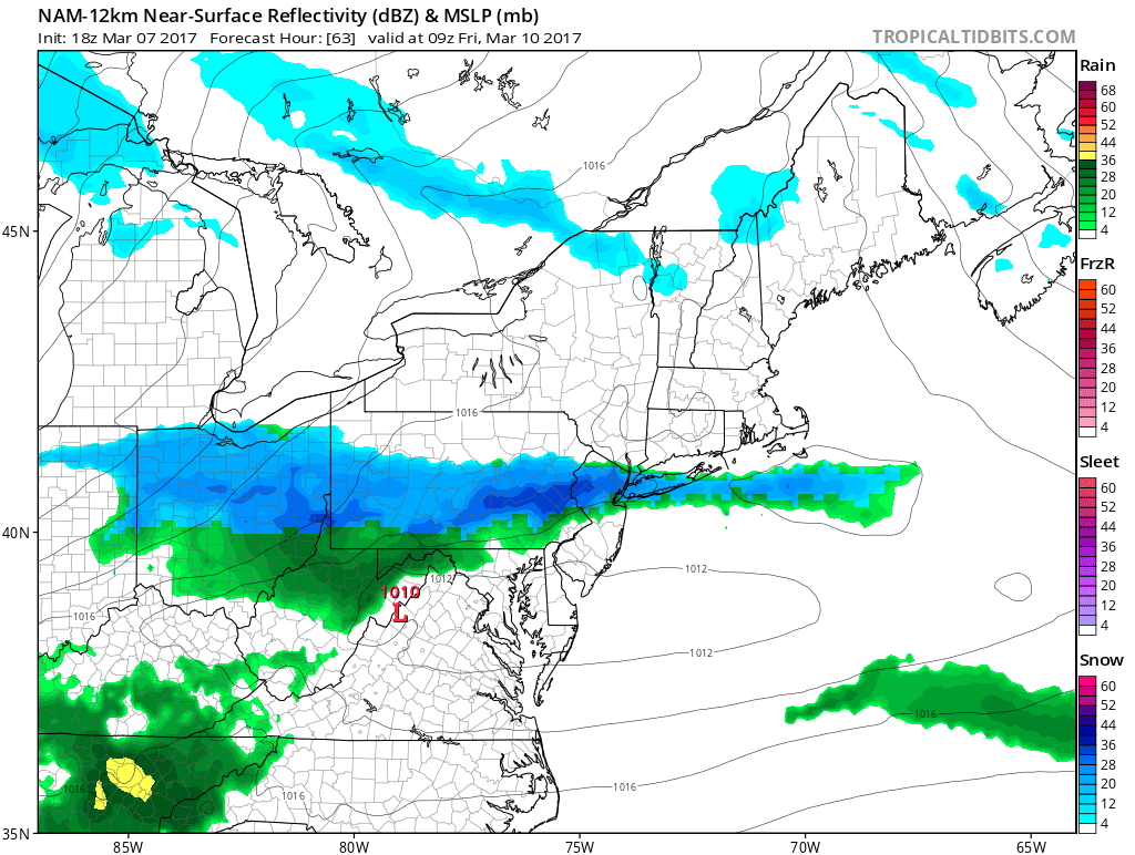
We will keep this as a mostly snow event for everyone, however if trends over the next 24-48 hours bump this north, southern pa might be dealing with more of a rain maker than snow. When we take this same model out to 7 AM, most of PA is snowing: 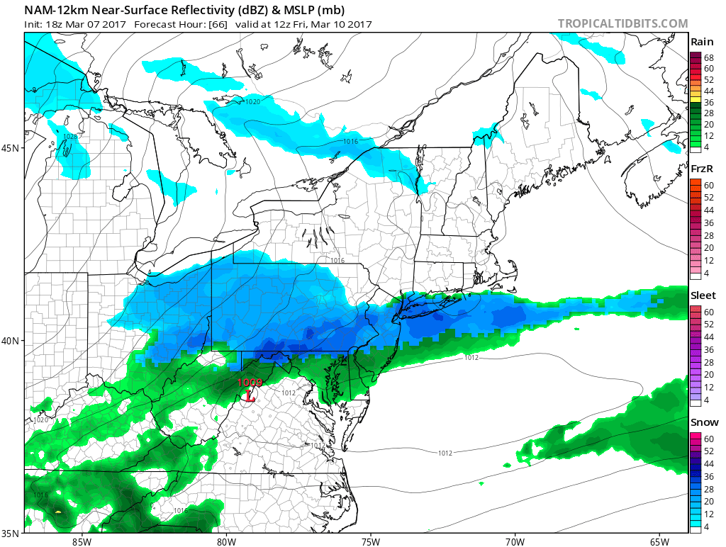
Most of the activity should taper off between 10 AM and noontime Friday.
FIRST CALL SNOW FORECAST THURSDAY NIGHT INTO FRIDAY MORNING
Timing: Snow will overspread the region between 9 PM and Midnight west to east and will taper off between 10 am and noontime Friday.
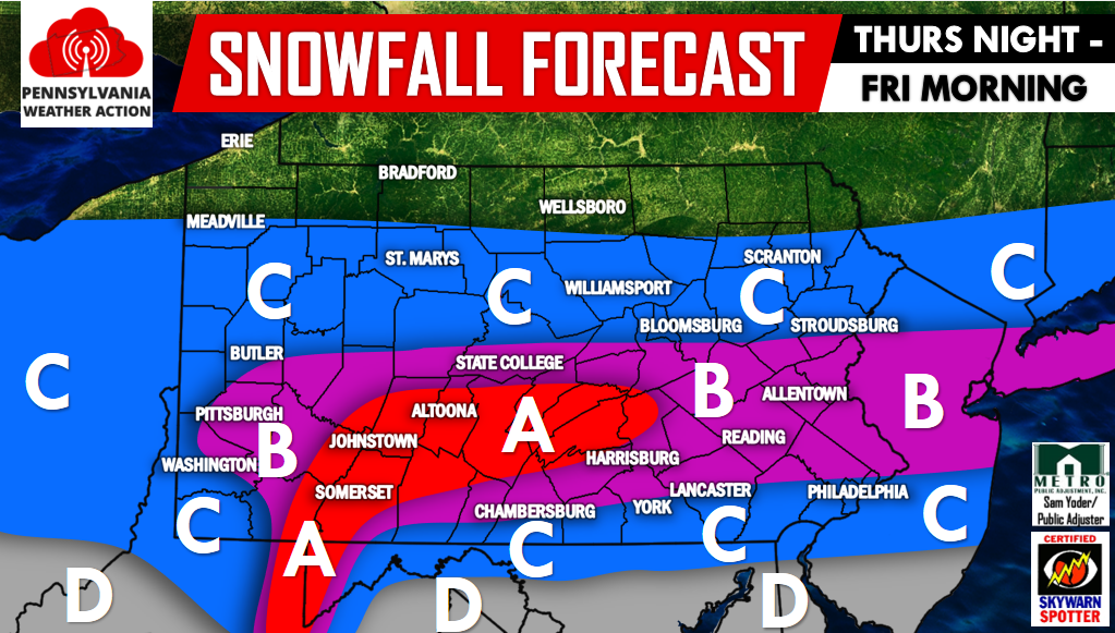
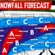
Area A: Areas in the highest of elevations over the Laurel Highlands will receive the most accumulations. 4 to 6 inches of snowfall is expected. Significant Travel delays are likely during the Friday Morning rush.
Area B: 2 to 4 inches of snowfall is expected. Travel delays can be expected for the Friday Morning rush.
Area C: 1 to 2 inches of snowfall is expected. Warmer surface will prevent from higher totals. Use caution traveling Friday Morning.
Area D: Coating to 1 inch is expected. A mix of rain will prevent from higher totals.
Follow us on our Facebook page for more updates by clicking here>>>PA Weather Action on Facebook!
Don’t forget to share our snowy forecast with your family and friends by using the icons below!
You must be logged in to post a comment.