
A clipper system will be moving into the area as early as Monday night bringing with it a pretty large swath of light fluffy snow. Just like many clipper systems, there is not much moisture to work with. However, temperatures will be in the upper teens and low 20s during the duration of the snowfall, allowing for higher than 10:1 ratios. Anywhere from 15:1 to 20:1 is looking likely.
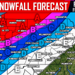
Taking a look at our future radar for 7:00 PM, snow has already pushed into Western Pennsylvania: 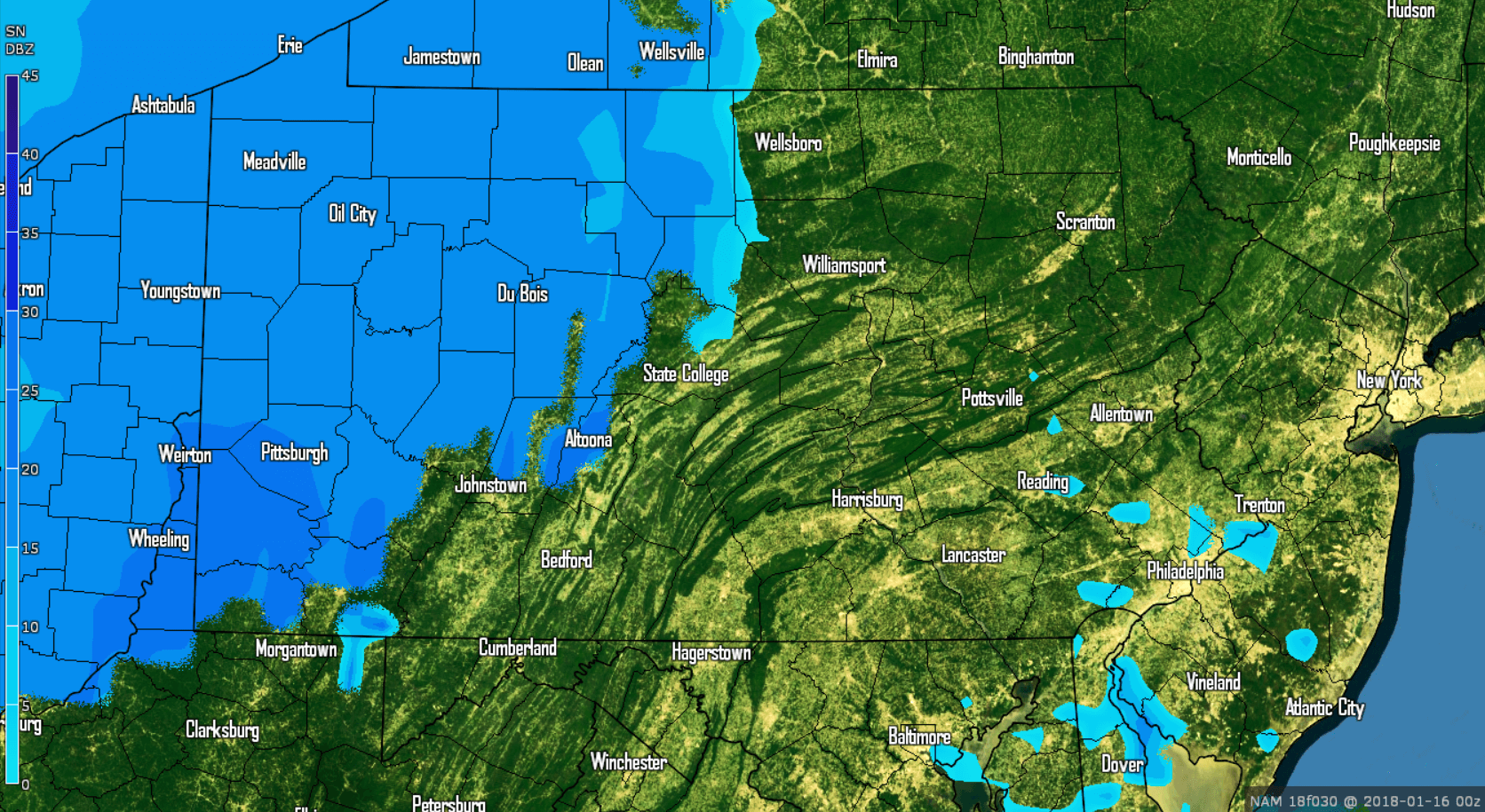
As the snow begins to push into Central and Eastern Pennsylvania, the mountains will begin to eat up some of the precipitation. We do anticipate there to be patches in the precipitation.
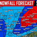
By 1:00 AM Tuesday morning, much of Central Pennsylvania is now receiving snow: 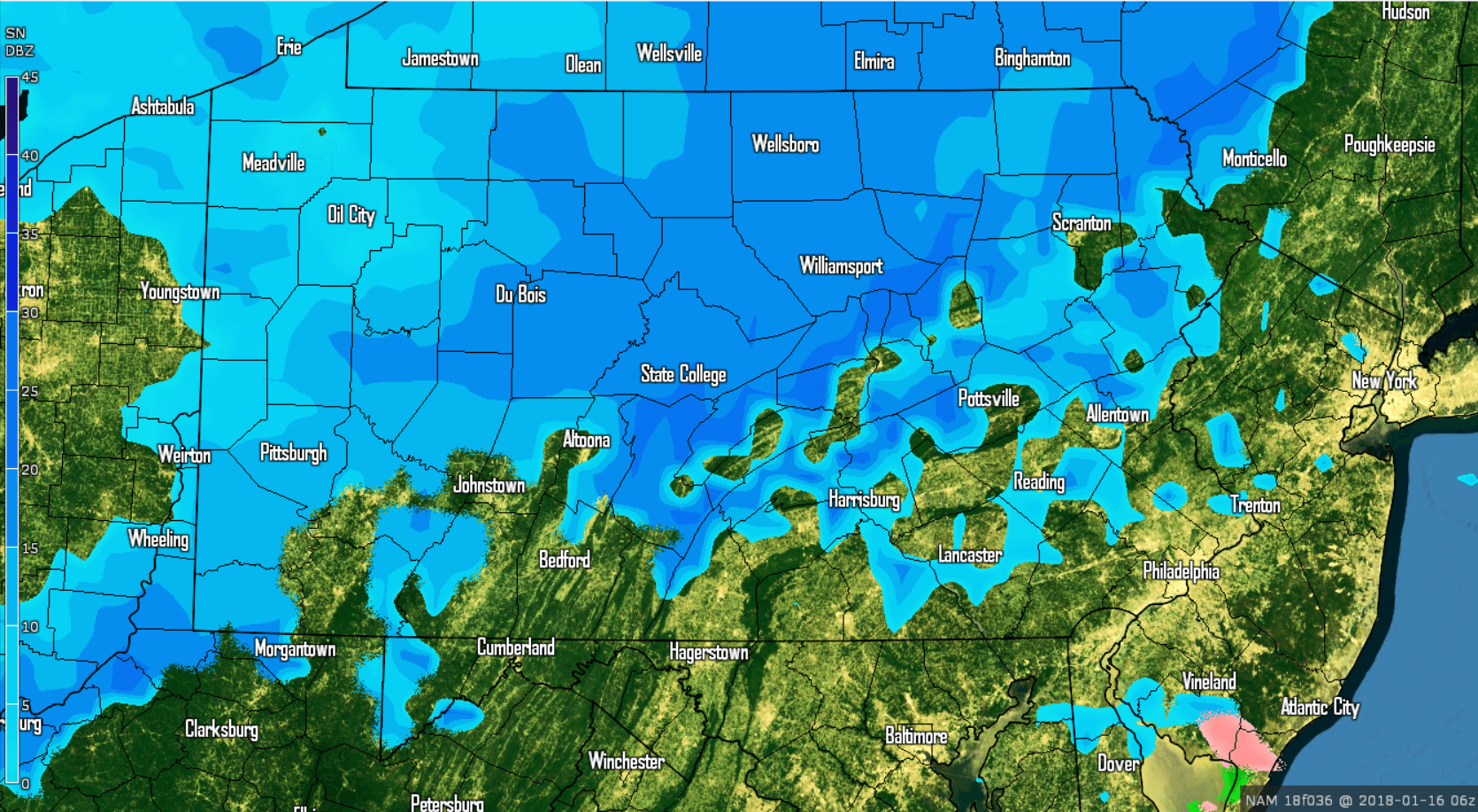
We do anticipate that the northern two-thirds of Pennsylvania will see more snow than the southern third, although we do expect more snow to be falling across Southern Pennsylvania than this particular model is showing.
Heading into the morning rush hour Tuesday, much of the snow has now pushed into Eastern Pennsylvania: 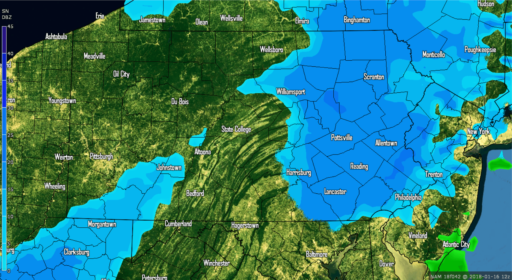
The greatest impact from this event will be over Eastern Pennsylvania because of the timing. Snow covered roads are likely for the Tuesday morning rush hour.
Snow will linger into the afternoon hours Tuesday before completely exiting by the evening hours. Below is valid for 1:00 PM Tuesday: 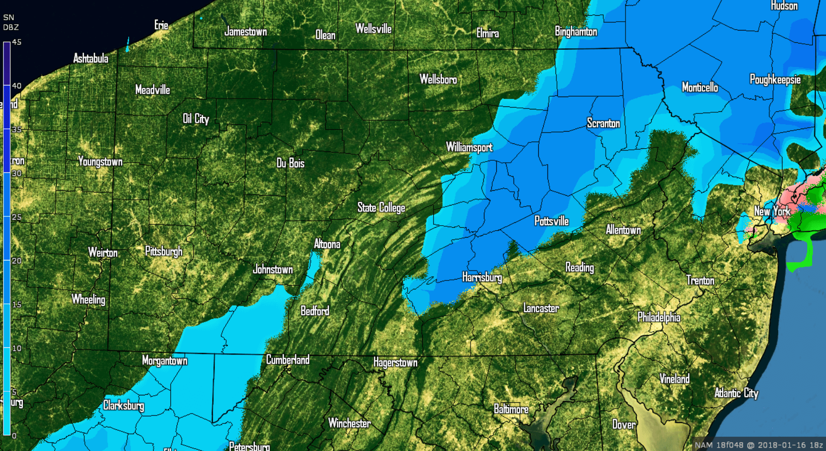
After this light snowfall, we are keeping our eyes on a potential coastal low Wednesday night into Thursday. Currently we expect this to miss the area. However, any shift northwest would bring more accumulating snowfall to Eastern Pennsylvania. Again, we are just keeping an eye on it at this point.
FIRST CALL SNOW FORECAST MONDAY NIGHT INTO TUESDAY:
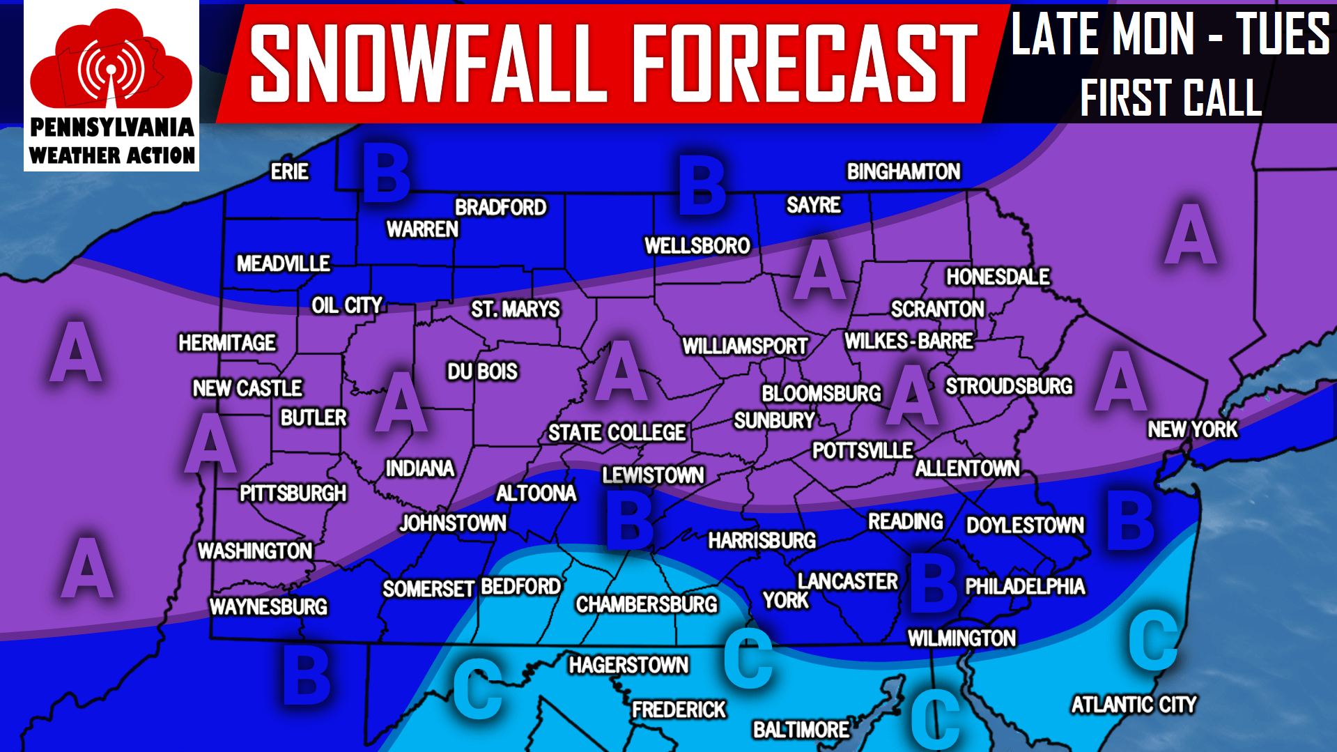
Area A: 2 to 3 inches of snowfall is expected. Snow covered roads and travel delays are likely.
Area B: 1 to 2 inches of snowfall is expected. Snow covered roads and travel delays are likely.
Area C: A coating to 1 inch of snow is expected. Snow covered roads and travel delays are possible.
For more updates on this snow event and more, be sure to have us liked on Facebook by clicking here>>>Pennsylvania Weather Action’s Facebook Page
Do not forget to share this with your family and friends about the expected snowfall by using our icon below!
You must be logged in to post a comment.