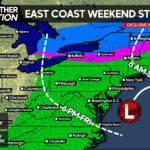
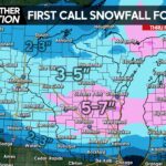
A weak low pressure will be swinging through the area Saturday into Sunday bringing with it, rain showers at first, that will transition to a period of snowfall for many of us, Saturday Night into Sunday Morning.
The key factors to receive accumulating snowfall this time of year is…1.) If it occurs overnight, the odds for it to accumulate increase drastically. 2.) Must need heavy snowfall rates this time of year to get the snow to stick. 3.) Lastly, what are the surface temperatures?
Take a look at the GFS future radar valid early Sunday Morning: 
Notice where the darker blues are, that is where your accumulating snow is. Also, the snowfall arrives during the overnight on the GFS, the other guidance agrees with this, which is factor number 1 to receive accumulating snowfall this time of year. This map is a little deceiving too, as we do not expect a solid shield of precip, but instead lines of intense snow squalls and showers overnight Saturday into Sunday Morning. These snow squalls have the potential to produce very heavy snowfall rates. The snow will have a hard time sticking to paved surfaces, however expect the snow to stick to grass and tree limbs.
GFS temperatures projections for early Sunday Morning: 
If you are below 32 degrees on this map, the better odds you are to receive accumulating snow. Notice South Central and Southeast PA areas..temperatures are well into the 30s, these areas should not expect any accumulations.
Timing: Saturday Night through Sunday Morning. Should be all cleared at by lunchtime Sunday.
How at risk is your area to receive accumulating snow? Here is a first look>>>>
For more updates “like” us on Facebook by following this link>>>>Pennsylvania Weather Action Facebook Page!
Area A – Great Risk for accumulating snow
Area B – Moderate Risk for accumulating snow
Area C – Low Risk For accumulating snow


You must be logged in to post a comment.