


After a cool May, many people have been questioning when will sustained summer-like weather officially begin? We are happy to say a sustained period of warmer than normal temperatures will begin Sunday and last through at least next Thursday. Beyond that is too far out to say with much confidence that we see above/below normal temps.
Below is a look at our current pattern:
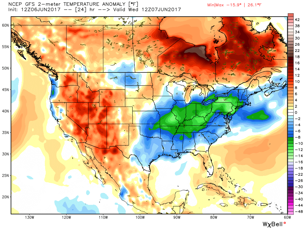
A persistent ridge out west has led to a trough in the east, resulting in a lot of cool and damp days across our state. As we head into the weekend, a rather quick pattern change will take place, virtually swapping the ridge and trough placement.
Next week’s pattern: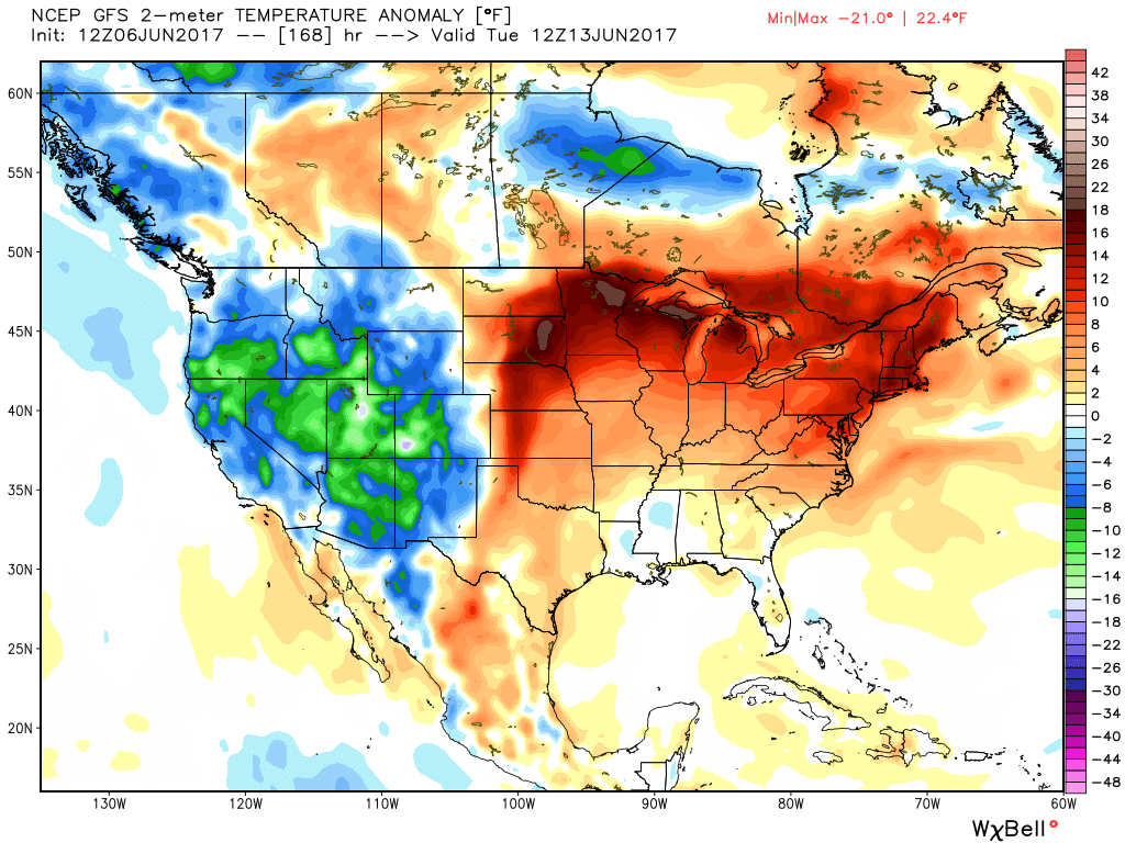
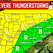
BELOW IS OUR PROJECTED TEMPERATURES DURING THE SUNDAY THROUGH THURSDAY TIME PERIOD:
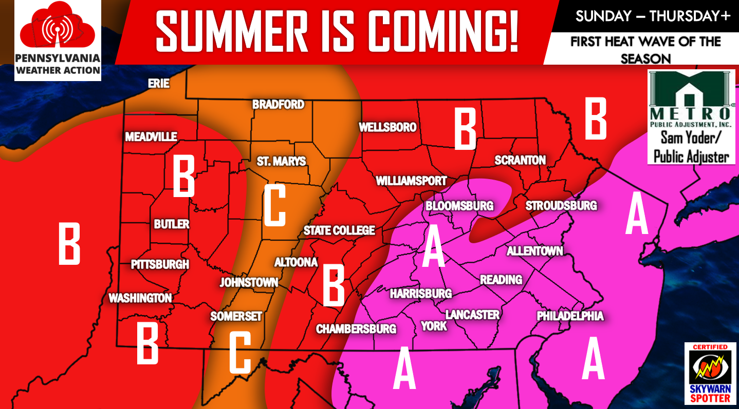
AREA A – Sustained high temperatures in the upper 80s to middle 90s. All locations in this area will experience a true heat wave (3 consecutive days of 90+ degree weather).
AREA B – Sustained high temperatures in the middle 80s to 90 degrees. Some locations will experience a true heat wave (3 consecutive days of 90+ degree weather).
AREA C – Sustained high temperatures in the low to middle 80s. A far cry from Tomorrow’s forecast where many areas will struggle to reach 60 degrees!
If you have not already, please give our Facebook page a like as we track our first heat wave of the season, click here>>>PA Weather Action on Facebook!
Don’t forget to share this article with family and friends below!
You must be logged in to post a comment.