


Over the past several weeks, many areas of the state have dealt with their fair share of flash flooding. Unfortunately more heavy downpours are expected this weekend across the region. Flash flooding has already begun in Southwest PA (Friday Evening), where multiple flash flood warnings have been issued and nearly a dozen flash flooding incidents have been reported to the NWS.
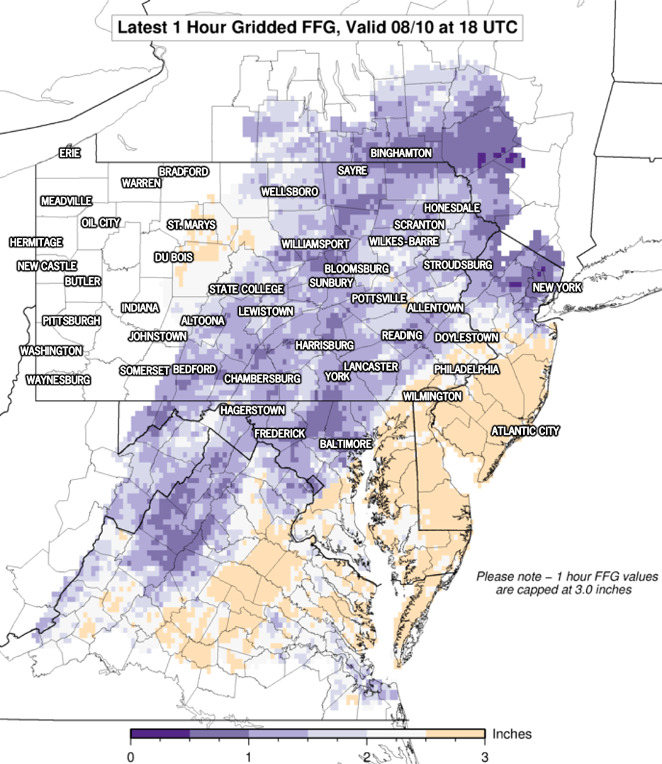
Why will only an inch or two of rain cause flash flooding? The ground is still very waterlogged and latest flash flood guidance suggests only an inch of rain an hour may cause flash flooding in much of the state. Here is a graphic from the NWS:
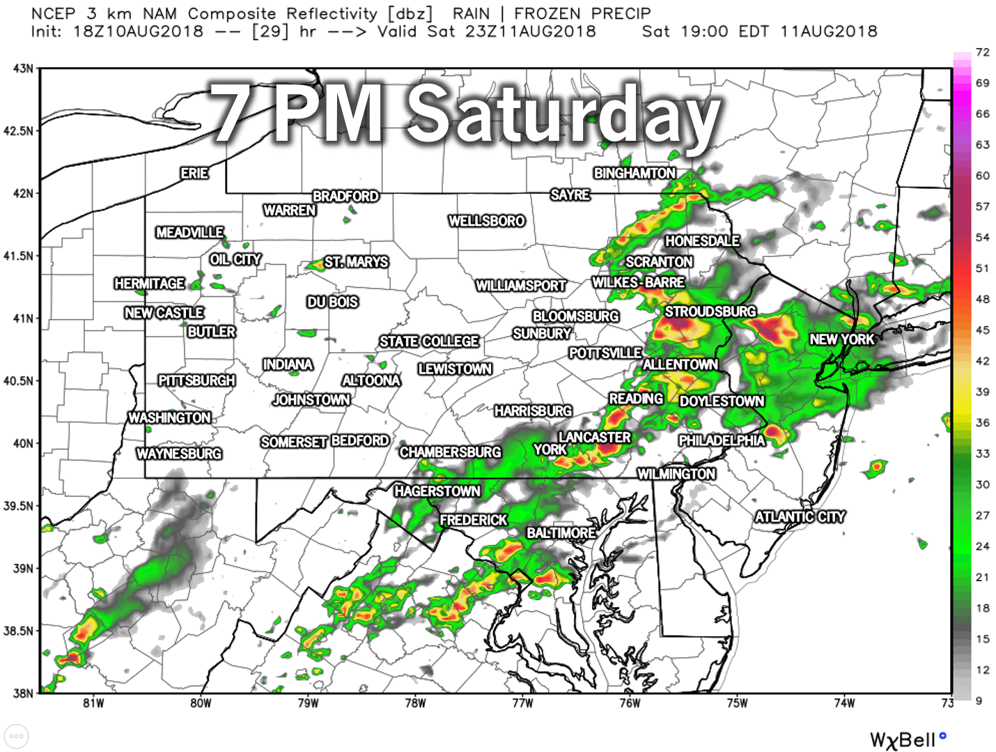
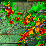
Widespread heavy showers and storms will roam Central and Eastern PA Saturday afternoon and evening, before exiting to the northeast. Here is the Hi-Res NAM model for 7 PM Saturday:
Rain will not be as abundant Sunday, but scattered showers and storms will still be possible state-wide. While more rain is likely to begin next week, below is our rainfall forecast ending Sunday Night.
WEEKEND RAINFALL FORECAST TOTALS
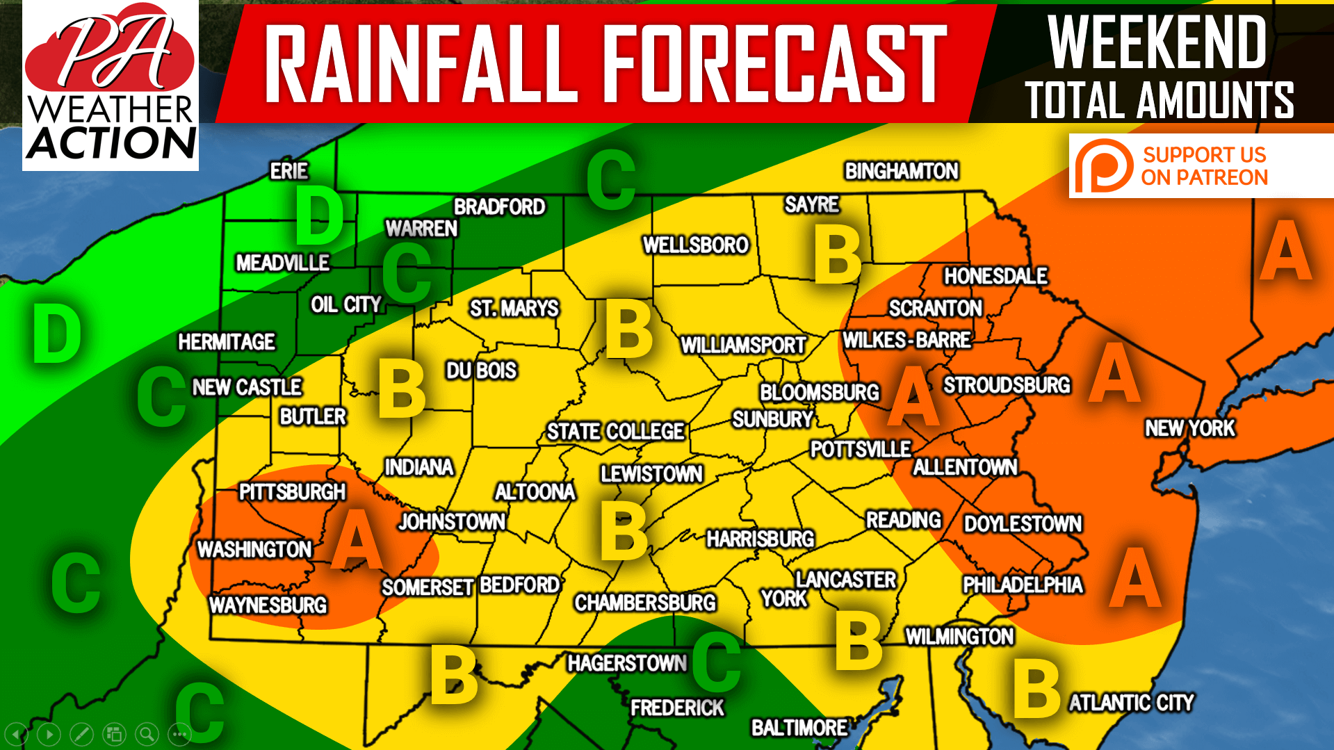
Area A: Rainfall totals of 2-3″ are expected. Flash flooding is very possible in heavy, persistent areas of rain. Avoid flooded roadways.
Area B: Rainfall totals of 1-2″ are expected. Flash flooding is very possible in heavy, persistent areas of rain. Avoid flooded roadways.
Area C: Rainfall totals of .50-1″ are expected. isolated flash flooding is still possible.
Area D: Rainfall totals of .25-.50″ are expected.
If you appreciate our efforts and would like to make a small donation along with some extra perks, click here>>>Support PA Weather Action on Patreon!
Also, be sure to download our free app for your latest forecast, interactive radar, alerts, and more >>> Download Our App Here!
Share this important update with your family and friends using the button below, stay safe!
You must be logged in to post a comment.