


Although Pennsylvania and surrounding states will escape Hurricane Matthew’s brutal impact, the same cannot be said for the Southeast Coast. As many of you know by now, a serious situation is about to unfold for the residents that live along the Florida, Georgia, and South Carolina Coast-line. Devastating impacts will be felt. Many of these areas are under a state of emergency and immediate evacuation is a must.
Luckily for areas that live North of the VA/NC border, Hurricane Matthew will take a turn out to sea and lead to minimal impacts for the Northern Mid-Atlantic and Northeast. However, if you recall us talking about a potential trough interacting with Hurricane Matthew leading to enhanced rainfall over our region, that looks to be back in the forecast. Only, the interaction isn’t nearly as strong as guidance was suggesting a few days ago. Nevertheless, periods of rain can be expected Saturday Afternoon and potentially into Sunday. But, this is NOT directly from Hurricane Matthew, instead this rainfall is more associated with the trough that will be passing through.
Here’s our look at the Mid-Atlantic regional view of Hurricane Matthew Impacts: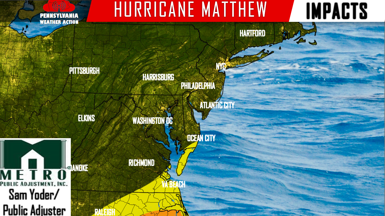
Orange – Moderate impacts. Winds will be sustained between 25 and 40 mph Saturday Afternoon into Sunday. Gusts of 50 mph is possible.
Yellow – Low impacts. Sustain winds of 15-25 mph Saturday Afternoon into Sunday with gusts reaching 40 mph.
Again, Hurricane Matthew’s impacts will not be much of an issue for anywhere in the Mid-Atlantic, however, rainfall will be expected from a passing passage/trough Saturday into Sunday, and for that here is our rainfall forecast: 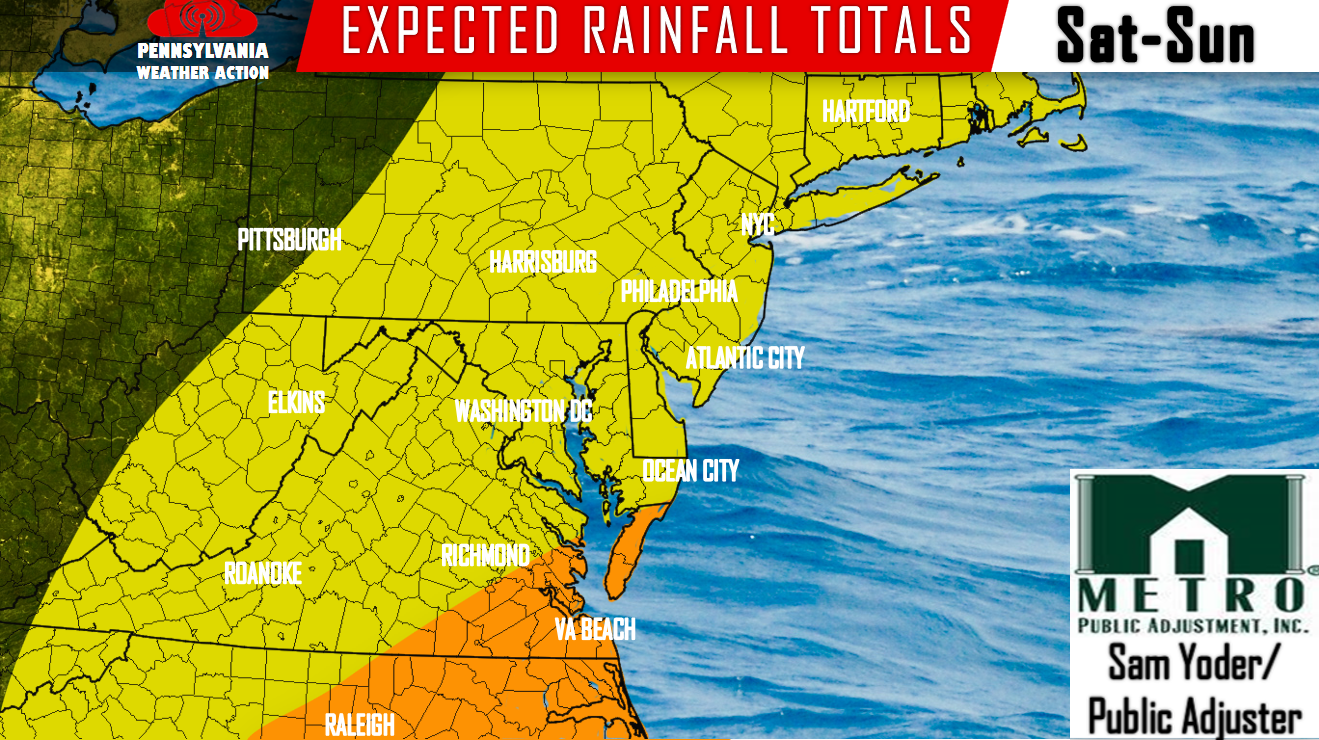
Orange – Up to 2 inches of rainfall is expected. This is associated with Hurricane Matthew. These locations will receive Matthew’s outer bands.
Yellow – Up to 2 inches of rainfall is expected, but this is NOT associated with Hurricane Matthew. This comes from the passage/trough passing through the area.
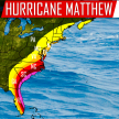
Here’s where things get serious. Next up is our forecast for the Southeast Coast. Please if you have any family or friends, let them know a major Hurricane is practically on their doorstep.
Southeast Coast impact map with storm track: 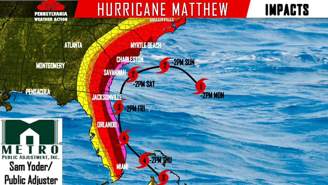
Pink – Devastating impacts. Potential sustained winds of over 100 mph with gusts approaching 120 mph. Storm surge of over 10 feet is possible. This area needs to evacuate immediately. You will be risking your life if you do not evacuate. Widespread power outages likely.
Dark Red – Major impacts. Sustained winds between 60 and 80 mph are possible with gusts nearing 100 mph at times. This area too needs to evacuate. Coastal areas in this region can expect a storm surge over 7 feet potentially. Widespread power outages likely.
Red – Significant Impacts. Sustained winds between 40 and 60 mph is possible with gusts up to 75 mph at times. Scattered Power outages likely.
Orange – Moderate impacts. Sustained Winds between 25 and 40 mph are possible with gusts up to 50 mph at times. Isolated power outages possible.
Yellow – Low impacts. Sustained winds between 15 and 25 mph and gusts reaching 40 mph at times is possible.
Rainfall map: 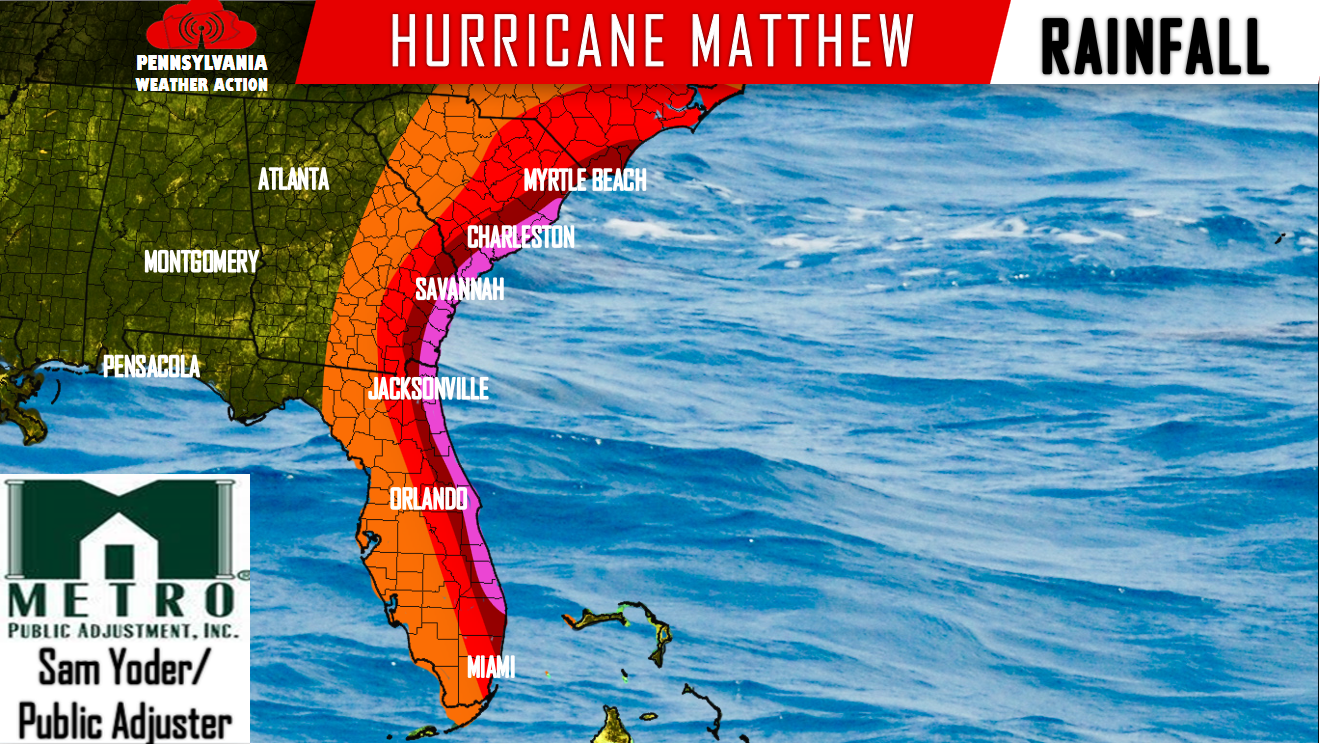
Pink – 8 to 14 inches of rainfall is expected.
Dark Red – 4 to 8 inches of rainfall is expected.
Red – 2 to 4 inches of rainfall is expected.
Orange – Up to 2 inches of rainfall is expected.
This is a serious situation for the Southeast areas, while our area dodges a devastating impact. It simply time to prepare for Florida, Georgia, and the Carolina Coast. If you are reading this from these areas, evacuate now. Don’t risk your life.
Follow Hurricane Matthew on our Facebook page: PA Weather Action on Facebook!
Also, subscribe to our new Youtube Channel:PA Weather Action’s Youtube Channel

You must be logged in to post a comment.