


We are watching two areas of low pressure systems this week that will lead to our potential snow event on Thursday. One will be dropping out of Canada in the form of a weak clipper system, while another area of low pressure develops in the south and eventually heads northeast. Where these two systems merge off the coast on Thursday, is what makes the major differences between model guidance and also our snowfall amounts.
The quicker and further south these two systems merge, the more likely it is our state gets into a more note-worthy snowfall, especially Northeastern PA. The European model is the closest to this solution, therefore it is the snowiest of our current guidance, but even then we are only talking about a couple inches of snow at most verbatim. The GFS, merges the two systems a bit further north, leading to less of an impact for us.
Below is a graphic representing the differences between the GFS and Euro: 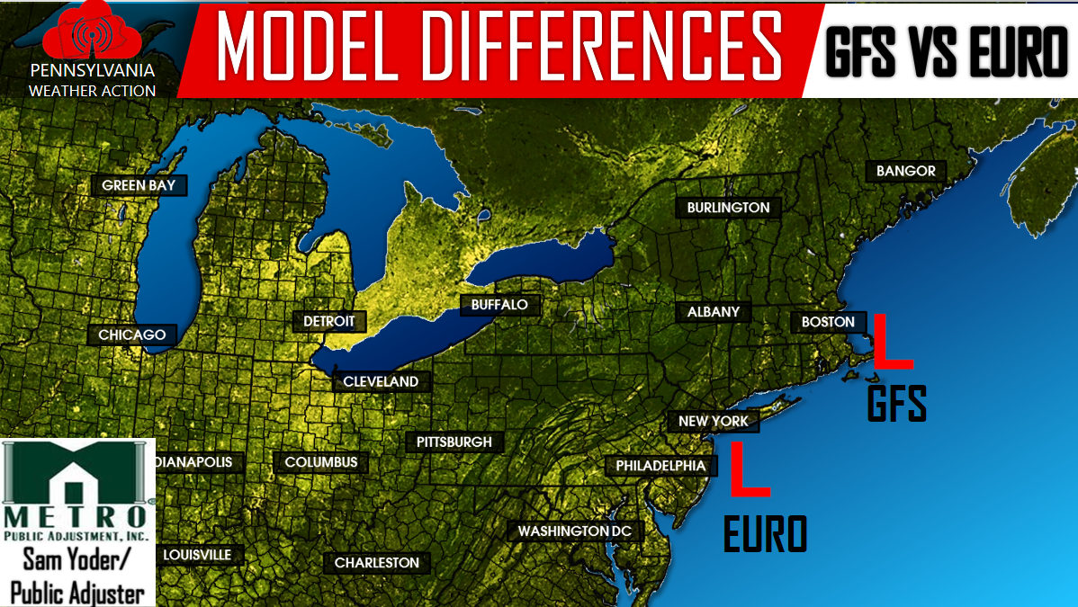
Again, the European model merges these two systems off the coast of NJ, leading to a more snowier solution, specifically for Eastern PA and points Northeast, while the GFS does not merge these two systems until it reaches near Cape Cod.
Regardless of the outcome, this does not look like it will be a big snow maker for PA. There is the potential for a 1-3/2-4 inch type snowfall mainly for Northeastern PA. However, we will have to keep a close eye on this storm, because if the two systems merge even quicker than the Euro is suggesting, then we would be talking about slightly higher totals.
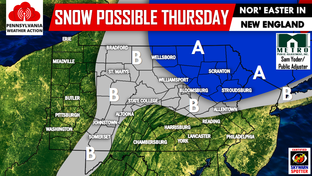
For now, here is a map highlighting the areas under the “snow threat” for Thursday:
If you have not already, now would be a great time to have us liked on Facebook by clicking here>>>PA Weather Action on Facebook!
Area A: Potential for light to moderate snow accumulation.
Area B: Potential for light snowfall accumulation.
The Lower Susquehanna Valley into the Delaware Valley will likely be too warm and only see rain out of this system.
We will have more updates on this storm in the upcoming days, with more specific amounts released Tomorrow Evening. Don’t forget to share the forecast below!
You must be logged in to post a comment.