


Are you dreaming of a white Christmas? For some, those dreams will be a reality this year! A very weak area of low pressure will approach Western Pennsylvania Sunday night from the Ohio Valley and eventually merge with a coastal system off the coast early Christmas morning.
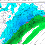
Taking a look at the mid-day run of the GFS, you can see the area of snow developing for western areas by 7:00 PM Sunday night: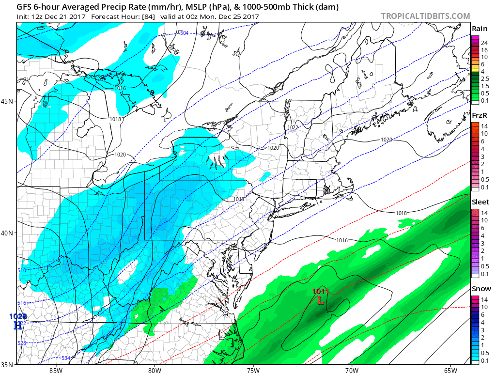
Notice the low pressure off the coast of Virginia. In the next frame, these two systems merge, allowing for snow to spread over Central and Eastern Pennsylvania by 1:00 AM Christmas morning: 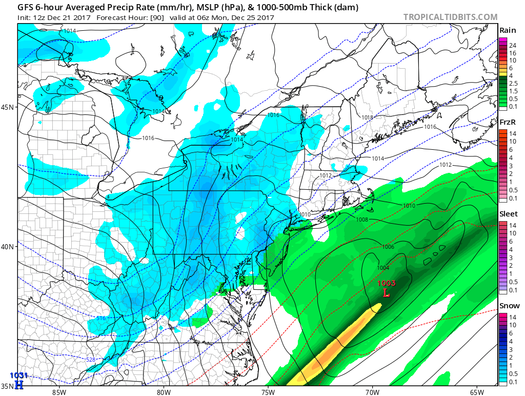
This will not be a high impact event. The snow will remain light for everyone and it is a quick hitter. By 7:00 AM Christmas morning the snow is exiting the area: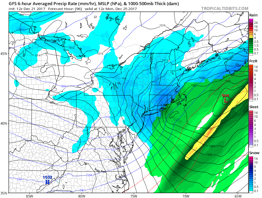
If you have plans traveling to Southern New England on Christmas, prepare for more of an impact from this event. Those areas could see several inches of snowfall.
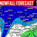
CHRISTMAS EVE INTO CHRISTMAS DAY SNOWFALL FORECAST:
Timing: Snow will overspread west to east between 6:00 PM and 10:00 PM Sunday night and exit the area from west to east between 4:00 AM and 8:00 AM Christmas morning.
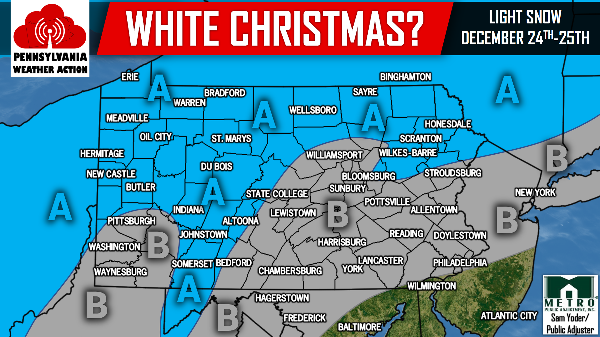
Area A: Best chance for accumulating snow. Totals will be light, likely in the 1 to 2 inch category, but enough for a white Christmas!
Area B: Snow is possible. Accumulations look minimal, but cannot rule out a coating of snow!
All in all, this is not a big system by any means. Instead, just enough snow to make things look festive for the holiday!
For more on this system and much more, like our page on Facebook, click here>>>Pennsylvania Weather Action’s Facebook Page
Share the news of a possible white Christmas with your family and friends using our icon below!
You must be logged in to post a comment.