
What we thought originally was going to be a sheared out system for Monday, now looks like it will be a snow maker for some, and a rain/snow mix for others beginning late Sunday Night into Monday. Then behind that system, we are tracking a larger storm as we mentioned yesterday, that could produce a more significant amount of rain and/or snow for many areas.
First off below is the latest GFS valid 1 AM Monday Morning: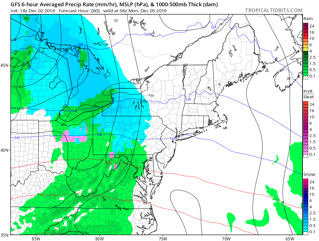
Temperatures will be very marginal, so for lower elevations, this might just be a cold rain for you. But areas that do receive snow, could see up to a couple inches mainly in grassy surfaces.
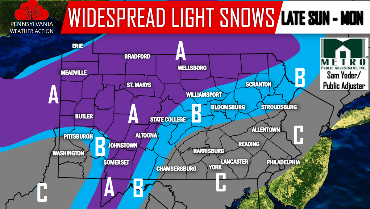
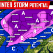
Here is our First Call for Sunday Night into Monday:
Area A: 1-2 inches of snowfall is expected.
Area B: A coating to 1 inch of snowfall is expected, possibly mixing with some rain showers.
Area C: A snow/rain mix is expected. A slushy coating is possible.
Then our eyes rapidly turn to the Tuesday-Wednesday time-frame. A low pressure system will likely cut to our West, through the Ohio Valley, then will transfer its energy into a coastal low. How quickly it transfers its energy into the coastal low will determine how much wintry precipitation our state receives. The earlier the better for those rooting for snow.
Here’s a look at the latest GFS valid 7 PM Tuesday Night: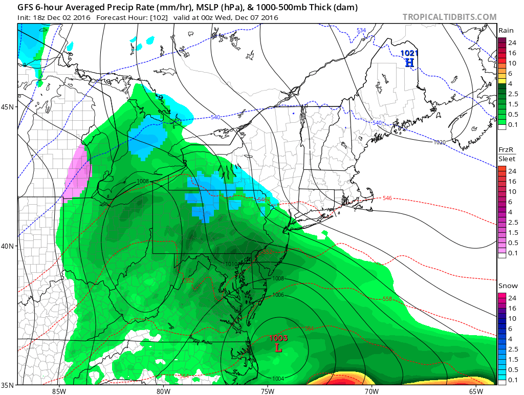
This is a much warmer solution than other guidance as the primary low cuts over the PA/OH border. If this were the case we would see a mainly rain event. But, the European and Canadian guidance is much colder with the system and actually brings several inches of snowfall across much of Central PA. Lower amounts further East and West.
Based on latest trends, we will likely have to have a first call map for the Tuesday/Wednesday system posted by Tomorrow Evening, as well as a second call for Sunday Night/Monday. For the latest, follow our Facebook page by clicking here>>>>PA Weather Action on Facebook!
Don’t forget to share the news with your family and friends below!
You must be logged in to post a comment.