
We are tracking a strong nor’easter that will impact our area tomorrow into Friday. Heavy rain, heavy snow, and strong winds are all on the playing field with this storm system. All areas will begin as rain Thursday. As temperatures cool off, areas in Northern and Western Pennsylvania will begin to change over to snow first. Once the storm system transfers to the coast and rapidly strengthens, areas in Eastern Pennsylvania will also change over to a period of snow Friday, before ending.
Rain will begin from southwest to northeast, starting as early as 10:00 AM Thursday morning for Southwest Pennsylvania. By 5:00 PM Thursday afternoon, the whole state will have rain falling from the sky: 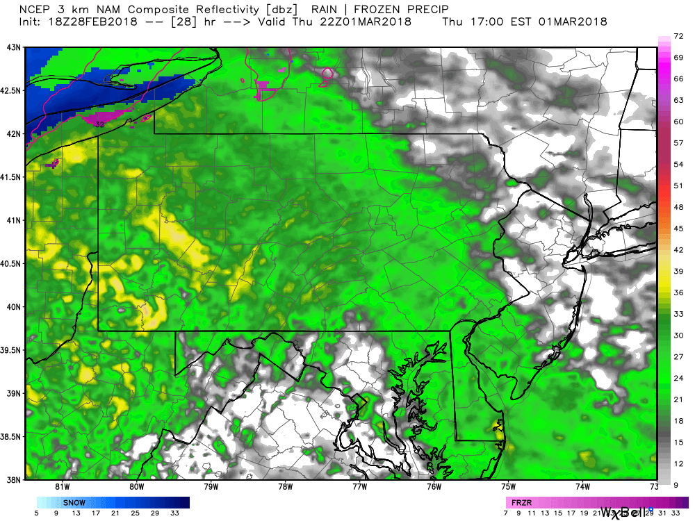
Temperatures will begin to crash Thursday night, leading to a change over to heavy snow for Northwest Pennsylvania by 11:00 PM Thursday night: 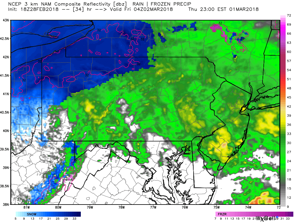
While the precipitation looks to be nearing the end, that will not be the case. As the low pressure rapidly strengthens off the coast of Long Island, the low pressure will stall and throw back precipitation over our region. Depending how heavy the precipitation is, will determine what will be falling. Areas under heavy precipitation may be snowing, while the next town over under lighter precipitation might be raining.
By 5:00 AM Friday, rain will continue to change over for much of Central and Northern Pennsylvania: 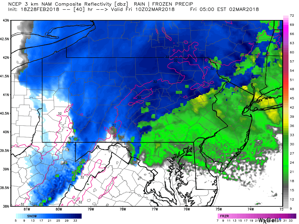
As we head into the later hours of Friday morning, many areas of Eastern Pennsylvania have changed over to heavy snow. On top of rain and snow, wind will be a significant factor across Eastern Pennsylvania especially, where wind speeds of 40 to 50 mph are certainly possible. Below is a look at 11:00 AM Friday morning: 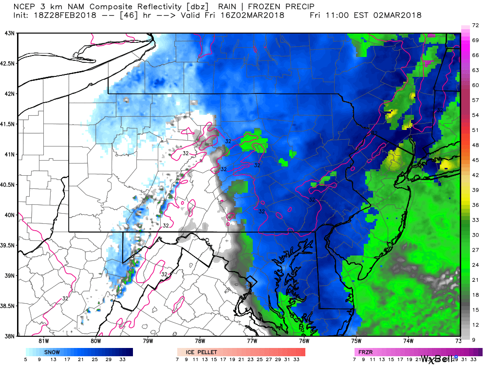
Snow will continue to fall over Eastern Pennsylvania Friday afternoon. The snow will begin to taper off later in the evening hours likely after 7:00 PM Friday evening: 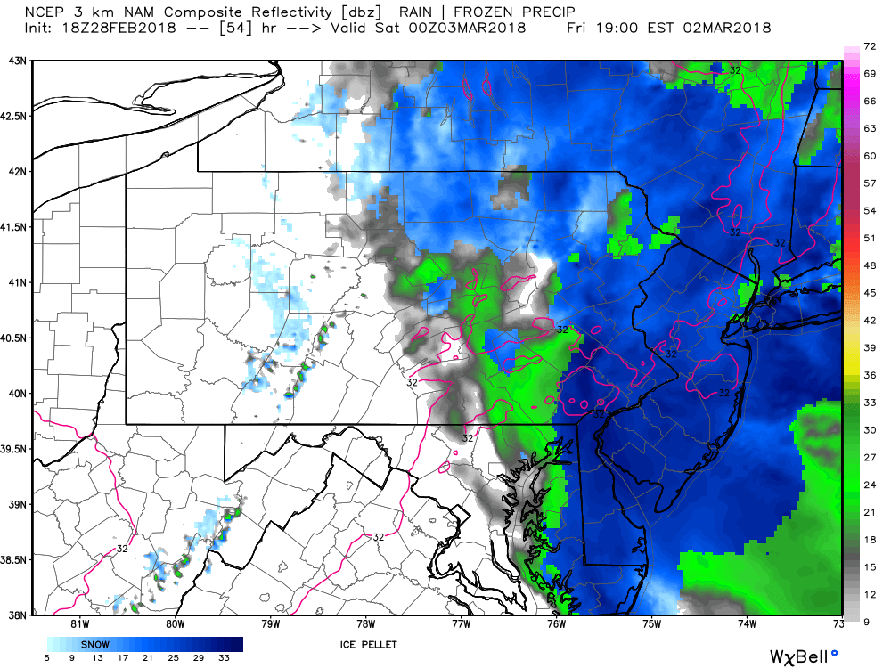
The future radar images we are showing are only one model output. This particular model is one of the more aggressive solutions in terms of how much snow actually falls. It is also more aggressive than our current thoughts, but it does show our general thinking of how areas will transition from rain to snow.
FIRST CALL MAP FOR THURSDAY INTO FRIDAY’S NOR’EASTER: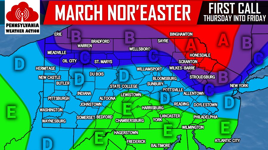
Area A: Rain to start will change over to a heavy, wind-driven snowstorm. This area will receive the longest duration of snow after the change over from rain. 8 to 12 inches of snowfall is possible, with isolated higher elevations receiving more. On top of the snow, winds will be gusting between 40 and 50 MPH at times. Widespread power outages are likely.
Area B: Rain to start will change over to heavy snow. 5 to 8 inches of snowfall is expected, with winds gusting between 40 and 50 mph at times across Eastern Pennsylvania. Widespread power outages are likely across Eastern Pennsylvania.
Area C: This area will experience a longer duration of rain before changing over to snow. 2 to 5 inches of snowfall is expected. Widespread power outages remain likely over Eastern Pennsylvania in this zone as winds will still gust between 40 and 50 MPH.
Area D: After a long period of rain, a transition to snow is expected before the storm wraps up. A coating to 2 inches of snowfall is expected. Scattered power outages are possible across Eastern Pennsylvania in this zone where winds will gust between 40 and 55 MPH.
Area E: This area will remain all rain, with rainfall amounts over 1 inch likely. Winds will gust across Southeastern Pennsylvania between 50 and 60 MPH with scattered power outages likely.
Please stay tuned to our final forecast, as Nor’easters are very difficult to predict. Like our page on Facebook to stay ahead of the action click here>>>Pennsylvania Weather Action’s Facebook Page
Share the news about the Nor’easter to your family and friends using our icon below!
You must be logged in to post a comment.