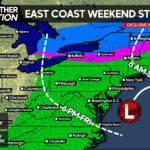
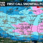
All the way back on the 8th of this month, we typed up a post suggesting the teleconnections favored a storm on Christmas week, specifically the 21st-28th. Now that we are much closer to that time period, all three major models now indicate a significant storm to impact the region between the 27th and 29th.
There are many variables on the field for this particular storm. Not only do we have to worry about where the low pressure system tracks, we also have to track a high pressure system up in Canada, that will dictate just how much cold air makes it into the region.
As of now, all three models favor a rainy solution over all of Pennsylvania, with some ensemble support suggesting snowfall.
This particular run takes the low pressure from the southwest, heads east to about Arkansas, before cutting up into the Great Lakes, putting Pennsylvania on the warm side of the storm. The high pressure in Canada supplying the cold air moves away too quickly to tap into any wintry precip. If it were to remain in place for another 12 hours or so, we would be talking about a much more wintry solution.
This afternoon’s European run:

The Euro has an absolutely wild solution. It takes the low pressure and “cuts” it off from the Jet Stream known as a cut-off low, over the deep south, before heading northward. Once again, our area is on the warm side of the storm, however snow breaks out all the way to the Gulf of Mexico in Southern Alabama & Mississippi. Simply impressive. This is certainly not the likely solution, although it does indicate what kind of system we are dealing with…a powerful one. Again, this scenario would be a rainy one in PA, however a storm track a couple hundred miles east, delivers a snowstorm to the region.
And then the Afternoon Canadian run:

Similar to the GFS, the Canadian takes the storm up through the Great Lakes, leaving us with a big rain event. The high pressure moves out even quicker than the GFS however. Only northern portions of Maine would see any wintry precip out of this scenario.
Summary:
So we know there will be a storm between the 27th and 29th of this month. Right now it looks like it will be a big rain maker for PA. However, many variables could change that leading to a wintry event. And let me tell you, this will be a substantial storm, so if we happen to see all snow from this, we would be talking about big accumulations..but lets not get ahead of ourselves, as the odds right now favor a RAINY solution. At this point, I would favor far northern locations in PA to have the better chance to see any wintry precip out of this, with the best chance for wintry precip in Upstate New York & points North.
Good news is, the pattern is beginning to change as we head into the New Year..meaning more snow chances will come in January.
-Chris


You must be logged in to post a comment.