


Strong to severe thunderstorms are possible for much of the area tomorrow as a front passes through the region.
Morning rain and thunderstorms is likely for Northwest Pennsylvania in the mid-morning hours. Below is a look at 7:00 AM tomorrow morning: 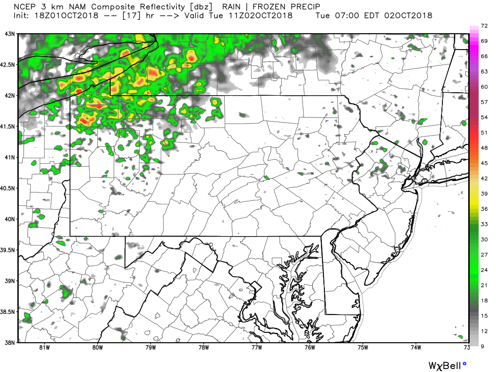
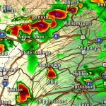
As the day progresses, the chances for severe weather increases. By the afternoon and evening hours, a line of storms will form in Northwest PA and will gradually push southeastward. This will be a broken line of severe thunderstorms. So one town might get hit hard, while the next town over remains dry. Below is a look at 5:00 PM Tuesday: 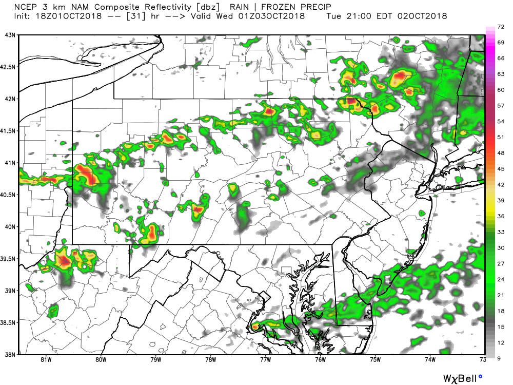
LATEST STORM PREDICTION CENTER OUTLOOK FOR TUESDAY:
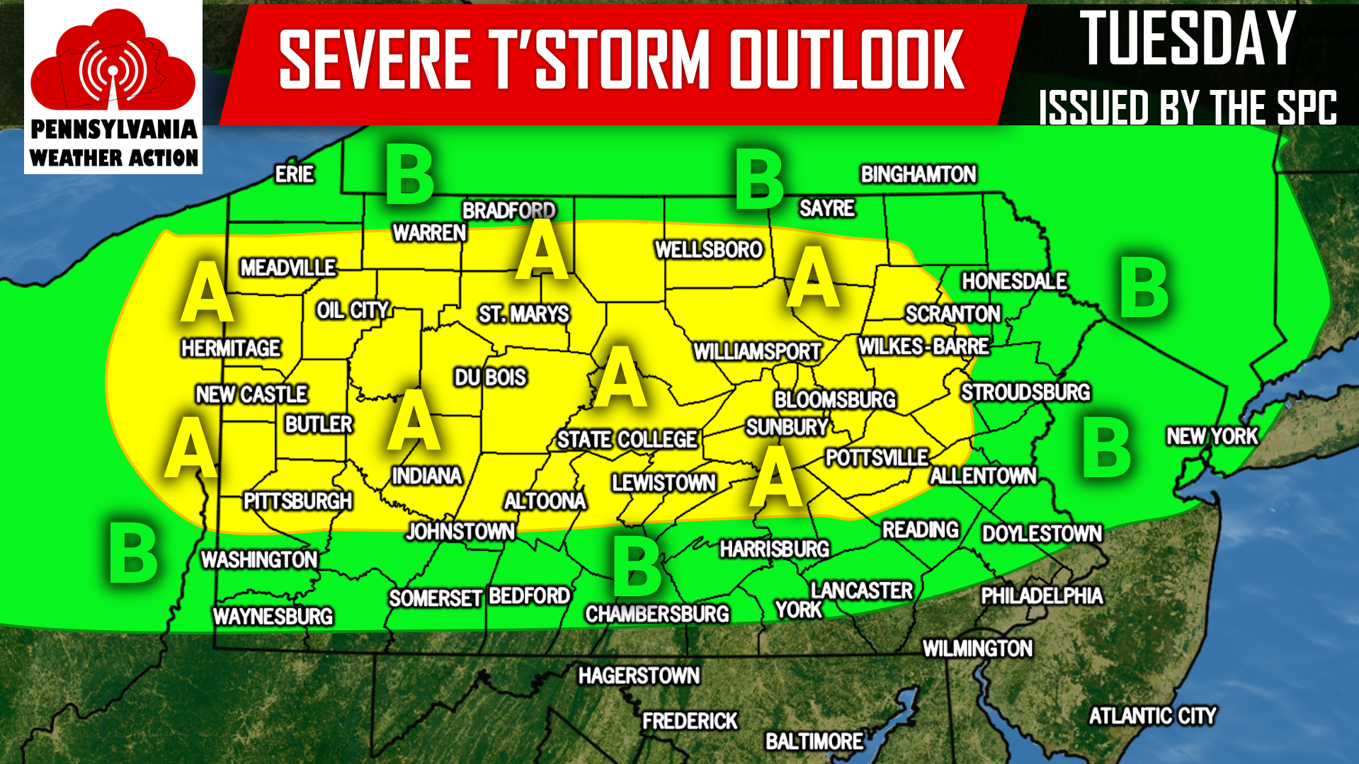
Area A: The Storm Prediction Center has placed this area under a SLIGHT RISK for severe weather. The main threat from these storms will be for damaging winds in excess of 60 MPH and hail.
Area B: The Storm Prediction Center has placed this area under a MARGINAL RISK for severe weather. The main threat from these storms will be for damaging winds in excess of 60 MPH and hail.
For the latest follow our Facebook page by clicking here: Pennsylvania Weather Action’s Facebook page
Download our app to keep you ahead of the severe weather with the latest weather alerts and traffic conditions! Click here: Pennsylvania Weather Action’s App
Share this article with your family and friends using our icon below! Stay safe!
You must be logged in to post a comment.