


If you read last night’s forecast, you will not be surprised by the severe weather forecast for tomorrow. With that being said, over the last 24 hours, data and observations have increased the risk for an isolated tornado or two tomorrow. Initially, damaging winds was expected to be the main threat, which it still is. But now, a tornado risk exists out ahead of the cold front passing through the region tomorrow. The Storm Prediction Center stated, “Supercellular structures may also develop and result in a few tornadoes – especially if isolated cells can materialize ahead of any lines (as hinted in a few of the convection-allowing models).”
The expected arrival for these storms will be between 12:00 PM and 2:00 PM for Western Pennsylvania, 2:00 PM to 5:00 PM for Central Pennsylvania, and 5:00 PM to 8:00 PM for Eastern Pennsylvania. Below is a look at the future radar for 2:00 PM Wednesday: 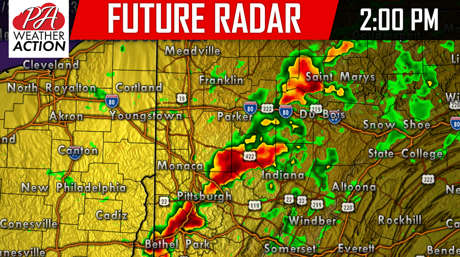
The cold front will advance eastward throughout the afternoon and evening hours. Yesterday it was unclear how well the line would maintain itself as it advanced eastward, but the latest trends suggest the line will hold strong into Central and Eastern Pennsylvania. Below is a look at 4:00 PM Wednesday: 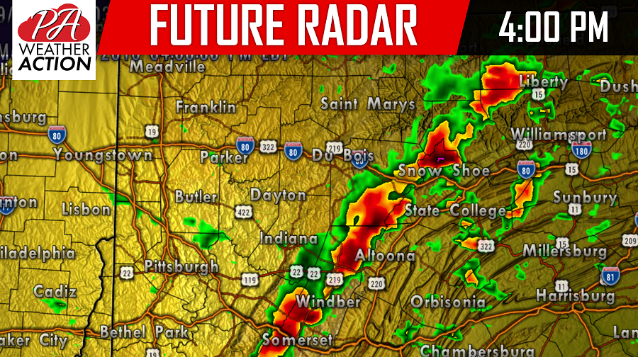
Again, the damaging wind threat remains the greatest concern with winds speeds in excess of 60+ MPH possible along this line of storms. However, an isolated tornado threat is possible, especially with super cells that develop out ahead of the main line, which are future radar is indicating in that 4:00 PM radar shot.
Below is a look at 6:00 PM Wednesday: 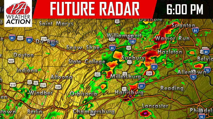
And then 8:00 PM: 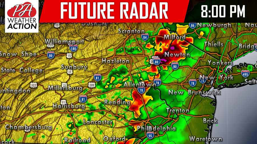
LATEST STORM PREDICTION CENTER OUTLOOK FOR WEDNESDAY:
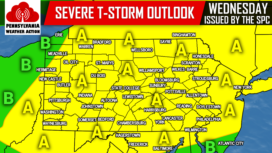
Area A: This covers most of Pennsylvania. A SLIGHT RISK for severe weather has been issued by the Storm Prediction Center for these locations. Damaging winds in excess of 60+ MPH and isolated tornadoes are possible.
Area B: A MARGINAL RISK for severe weather has been issued by the Storm Prediction Center for these locations. Damaging winds in excess of 60+ MPH is possible, the tornado threat is much more limited in these locations.
For the latest, be sure to follow us on Facebook, click here>>>Pennsylvania Weather Action’s Facebook page
To stay ahead of the severe weather, download our free app today for the latest weather alerts and traffic conditions, click here>>>Pennsylvania Weather Action’s App
Share this article with your family and friends using our icon below, stay safe!
You must be logged in to post a comment.