


Lately all of our severe weather has come in the form of flash flooding, as it seems like we are stuck in a never-ending rainy pattern. While flash flooding will be a threat tomorrow, damaging winds, hail, and an isolated tornadoes are possible especially in Central and Eastern PA. As of now, the SPC has much of the state in a Marginal Risk, with parts of Northeast PA included in the Slight Risk contour Friday. We would not be surprised if in tonight’s update, more of Eastern PA is included in the Slight Risk category.
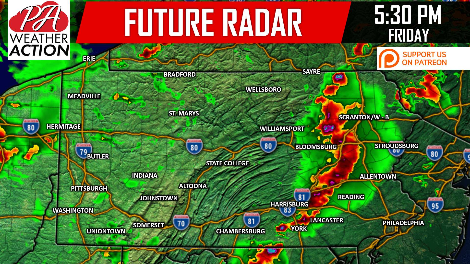
A line of strong to severe storms will likely develop in the mid-Susquehanna Valley Friday Afternoon, before moving east into Eastern PA in the late afternoon and early evening hours. Damaging winds will be the primary threat as usual, along with isolated hail and possibly a tornado.
Here is the NAM Hi-Res Model for this line, swipe to see the following frames.
Western PA and parts of the Appalachians that see an impact from the main line will still see pop-up strong to severe storms Friday Evening.
SPC RISK MAP
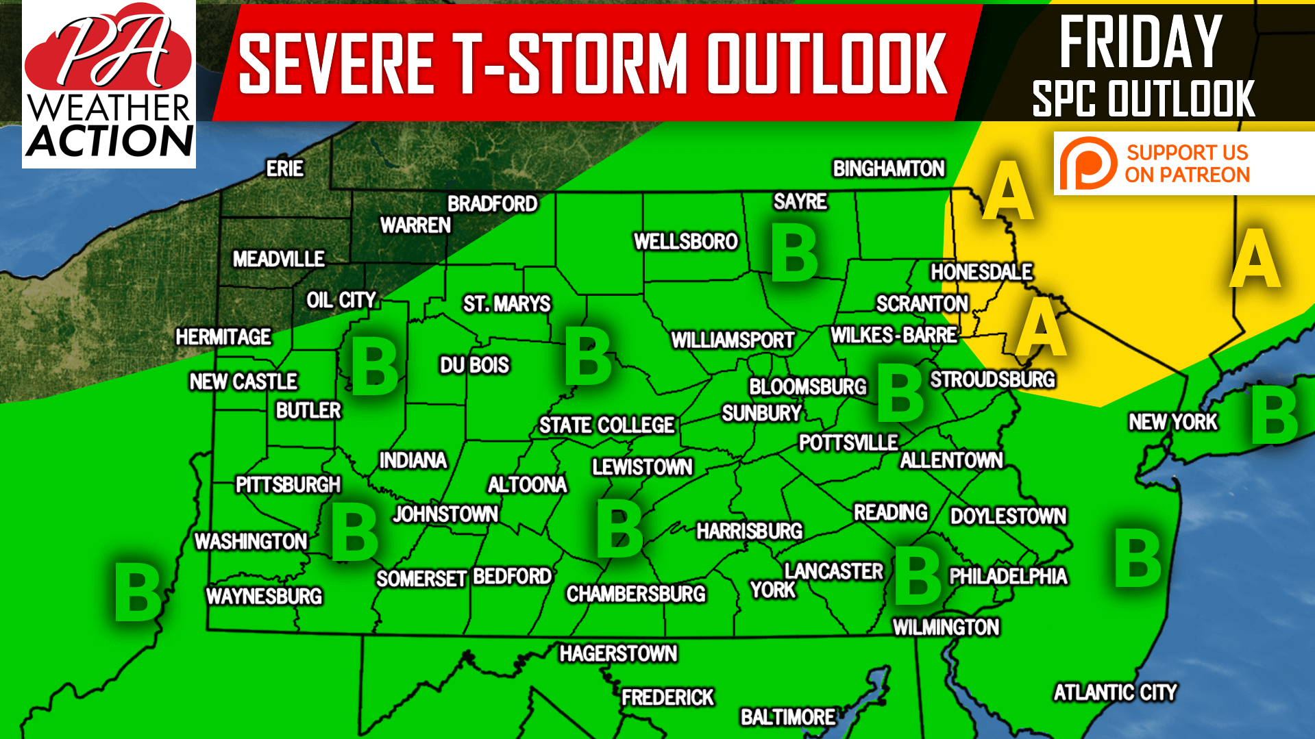
Area A: Damaging winds, hail, and an isolated tornado possible (Slight Risk). Flash flooding is likely to occur in areas that receive over an inch of rain in under two hours.
Area B: Damaging winds, hail, and an isolated tornado possible (Marginal Risk). Flash flooding is likely to occur in areas of Eastern PA that receive over an inch of rain in under two hours.
If you appreciate our efforts and would like to make a small donation along with some extra perks, click here>>>Support PA Weather Action on Patreon!
Also, be sure to download our free app for your latest forecast, interactive radar, alerts, and more >>> Download Our App Here!
Share this important update with your family and friends using the button below, stay safe!
You must be logged in to post a comment.