


After another hot and humid day, we are tracking another round of severe weather expected for the state tomorrow and on top of it, some areas may even experience warmer temperatures than today!
The primary severe weather threat is expected to arrive later in the day tomorrow, likely after 6 PM for our northwestern counties and will slowly drift southeastward throughout the remaining evening hours. As it does so, it is anticipated that the storms will weaken and eventually fall apart. Because of this many areas south and east of I-81 will remain dry tomorrow.
Below is our short term futurecast radar using the 3km NAM model for tomorrow evening from 8 PM through 2 AM Friday morning: Make sure to click play!
PICTURED BELOW IS THE LATEST STORM PREDICTION CENTER’S FORECAST FOR TOMORROW:
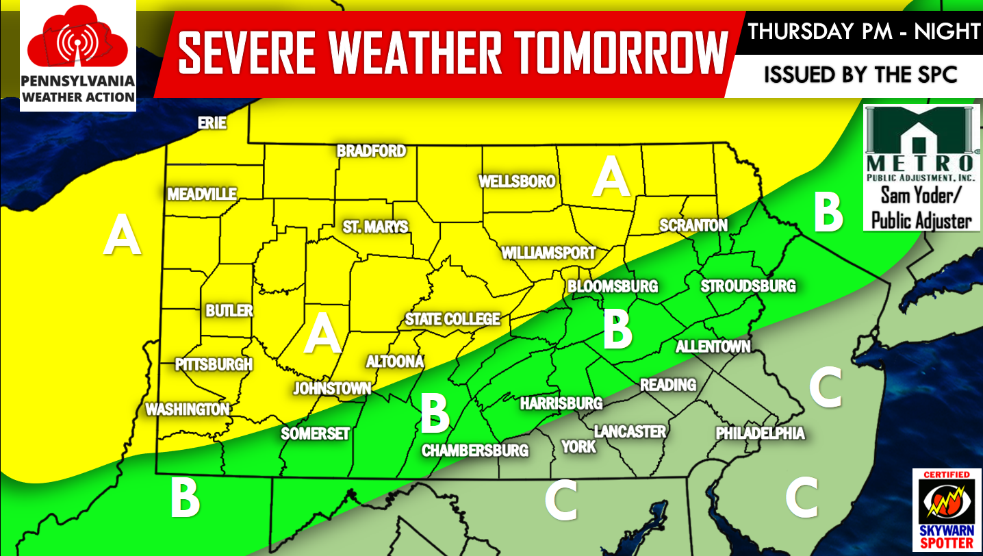
AREA A – Greatest risk for severe weather. The Storm Prediction Center has placed this area under a SLIGHT RISK for severe weather. Most of the severe activity will occur after 6 PM. Primary threat is for heavy downpours and damaging winds of 60mph or greater.
AREA B – The Storm Prediction Center has placed this area under a MARGINAL RISK for severe weather. The best chance for any severe weather will occur between 9 PM and 3 AM early Friday morning. Primary threat is for heavy downpours and damaging winds of 60mph or greater. Isolated storms may occur during the afternoon hours.
AREA C – Thunderstorms are possible, but should remain under severe criteria.
Aside from the severe weather, temperatures will once again be a concern as real feel values will near and surpass 100 degrees for many locations tomorrow.
EXPECTED REAL FEEL VALUES FOR THURSDAY 7/20:
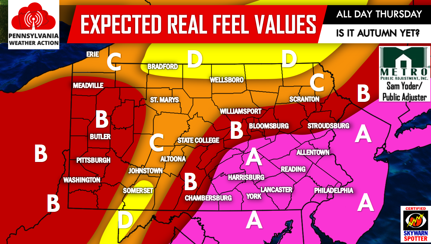
AREA A – Actual high temperatures will sore into the 90s, with real feel values surpassing 100 degrees at times. Please, if you live anywhere in the pink shade, stay indoors as much as possible, drink plenty of fluids and check on your elderly family members and friends. Do not forget about your pets too!
AREA B – Actual high temperatures will approach 90 degrees, with real feel values up to 95 degrees. If you have plans outside, limit your time outside as much as possible, and stay hydrated. Check on your elder family and friends as well as your pets!
AREA C – Actual high temperatures will approach 85 degrees with real feel values nearing 90 degrees. If you go outside, make sure you stay hydrated! Check on your elder family and friends as well as your pets!
AREA D – Actual high temperatures will remain around 80 degrees with real feel values nearing 85 degrees. Nothing too excessive, but just another hot, humid, and sticky summer day!
With all this hot and humid weather lately, we are only left with one question…Is it autumn yet?
Be sure to have us liked on Facebook as we deliver the latest weather updates keeping you ahead of the action>>>PA Weather Action on Facebook!
Do not forget to share this article to warn your family and friends about the upcoming severe weather and scorching hot temperatures using our icons below, stay safe!

You must be logged in to post a comment.