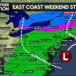
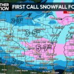
The latest from the Storm Prediction Center has now placed areas in Eastern PA under a SLIGHT RISK for severe weather. This is an upgrade from their last update from earlier this morning.
Timing: There will be TWO lines that will move through the area both impacting Eastern PA the greatest. The first line will deliver with it mainly heavy rain and few rumbles of thunder between 4 am and Noon. After that line passes through, a second line will develop, and depending on how much sunshine Eastern PA sees between the two different lines of storms, will determine if the second round produces Severe Weather. The more the sunshine your backyard sees, the greater the instability. The second line will pass through Eastern PA between 2 PM and 10 PM Tomorrow. Again, this line would be the line to produce the Severe Weather assuming there is a large enough gap between the two lines of rain enabling the sunshine to build up instability over the area.
Main impacts: The Storm Prediction Center has since dropped Hail as a main impact, and now states Damaging Winds will be the biggest impact from these storms.
Area A – The Storm Prediction Center has upgraded this area to a SLIGHT RISK for Severe Weather. This area will have the best chance for storms capable of producing damaging winds.
Area B – This area is under a MARGINAL RISK for Severe Weather. Most guidance keeps the storms away from those on the Western fringe in this particular area. Better chance for storms as you head closer to Philadelphia in the green shade.
Area C – All thunderstorm activity should remain below Severe Criteria. Most locations in this area will remain dry, however a pop-up shower/thunderstorm is not out of the question.
Stay tuned to our Facebook page for the latest>>>>>PA Weather Action on Facebook!

[facebook_share url=”https://paweatheraction.com/severe-weather-threat-upgraded-for-parts-of-pa-tomorrow” width=”” layout=”button_count”]


You must be logged in to post a comment.