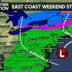
It is hard to believe we are already at the end of June and forecasting the 4th of July Weekend. Time is truly flying by this year! Like the title states, there is the potential of some showers and storms for the 4th of July Weekend. They will come in 2 waves.
Wave #1: Much like Tuesday’s Weather where Eastern PA took the brunt of the storms, the potential exists for a similar scenario late Friday Afternoon and into the nighttime hours. However, the severity of these storms will not be as powerful as Tuesday’s, nor will they be as widespread. These storms will be very isolated. Unfortunately, these storms will pack enough punch to have local fireworks cancelled during the night Friday. Now, that’s assuming your location falls under these isolated cells.
Main impacts: Most cells will remain below severe criteria. But, heavy downpours, along with a few rumbles of thunder are possible.
Area A – This is the area of concern for isolated showers and storms to pop during the Afternoon and Evening hours. Again, they will likely not be severe storms, but nevertheless, storms capable of cancelling local firework shows.

So what nights will be best to view fireworks? Saturday Night and Sunday Night. Both nights will remain dry with no chance of precipitation in the forecast.
Wave 2: This wave is still 5 days away and of course has some big question marks around it. First, the timing. The American Model holds the rain off until Tuesday Morning, while the European Model (Statistically the most accurate) has the rain approaching the state by Friday Evening. The next question, will be the exact track this low pressure takes. The American Model takes the majority of the rain over the Northern half of the state, while the European Model takes the majority of the rain over the Southern half of the state. Our final question is exact rainfall estimates. The American model is a bit more aggressive currently, but both show the potential of over 1 inch of rainfall for many areas sometime during this Monday Night – Tuesday Morning time-frame.
So what do we know about wave 2? So far we know it will likely come in form of heavy rain, with some embedded severe thunderstorms. Also, this will be a much more widespread threat than wave #1. If you have fireworks planned for Monday Night, we suggest you to move them forward to either Saturday or Sunday Night.
Because this is a day 5 threat, the area shaded is much larger than usual. Once we get a few days closer, we will have this threat area narrowed.
Area A – The potential exists for heavy rain and severe storms Monday Night into Tuesday Morning. Early thoughts suggests Southwest PA has the best chance to have rain falling Monday Night during fireworks. This is still 5 days away, so stay tuned for later updates.
You can catch these updates and much more on our Facebook Page>>>>PA Weather Action on Facebook!

[facebook_share url=”https://paweatheraction.com/showers-and-storms-to-impact-parts-of-the-4th-of-july-weekend” width=”” layout=”button_count”]


You must be logged in to post a comment.