

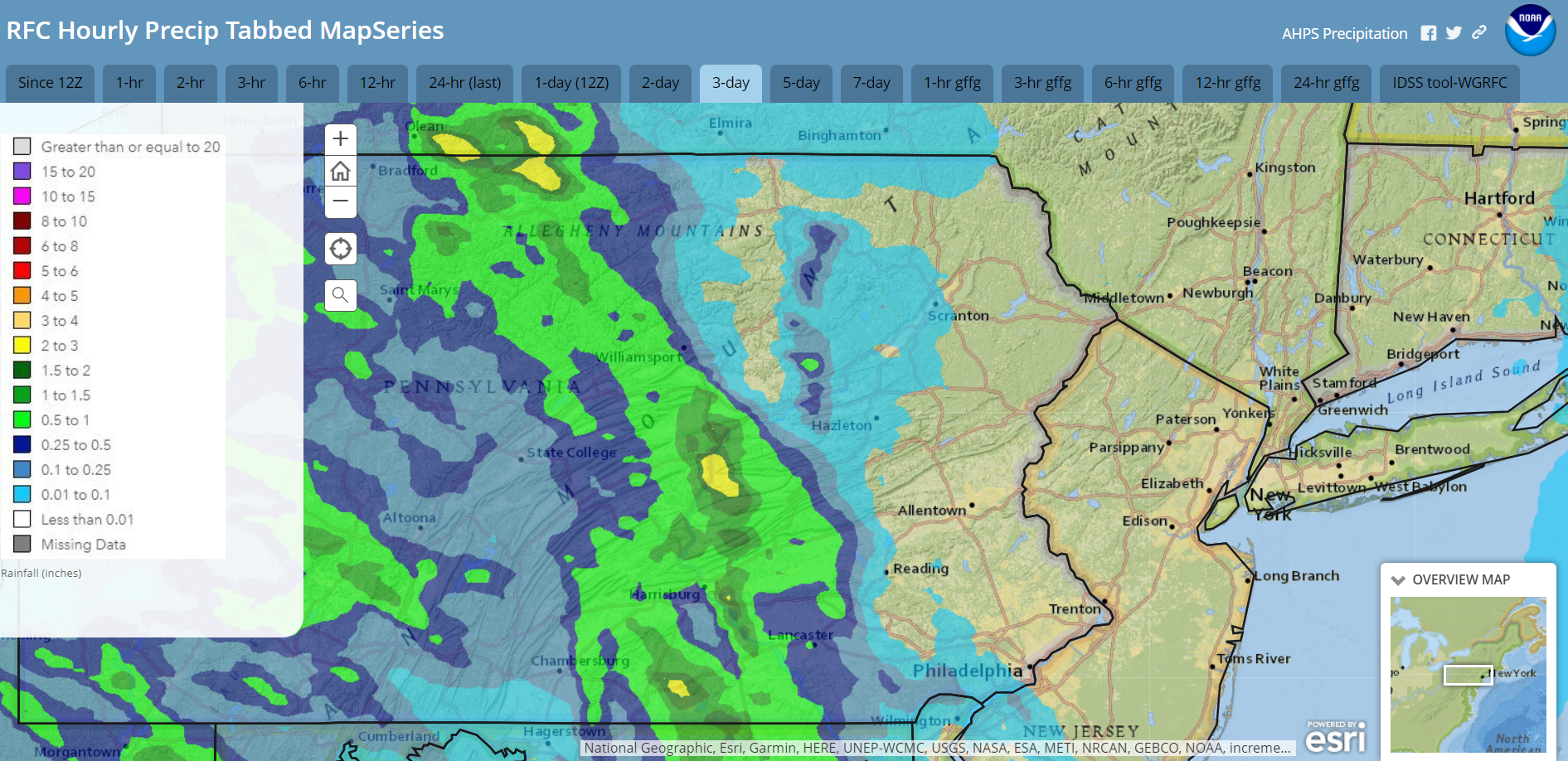
Autumn began Sunday at 8:44 AM. Right on cue, leaves have started changing rapidly despite the recent mild weather. While most of our area enjoyed a warm dry final few days of Summer, some heavy showers did track southeastward through central Pennsylvania, where some areas had over 2″!
Radar-estimated rainfall Friday-Sunday September 20-22:
A sliver of high pressure currently noses southward into our area. However, an upper-level disturbance is delivering some showers to our area this afternoon and evening. Those showers will exit overnight and allow daytime Tuesday to be mostly dry.
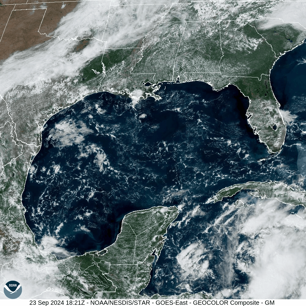
Meanwhile, tropical excitement is brewing in the western Caribbean as a tropical cyclone is pulling itself together. This system is expected to explosively intensify as it moves northward between the Yucatan Peninsula and Cuba with it’s aim on the Panhandle of Florida Thursday night. It could attain strong Cat 2 or even Cat 3 status before landfall! This will be a major weather news story later this week!
You can see the system congealing in the Caribbean in this visible satellite loop from Monday afternoon:
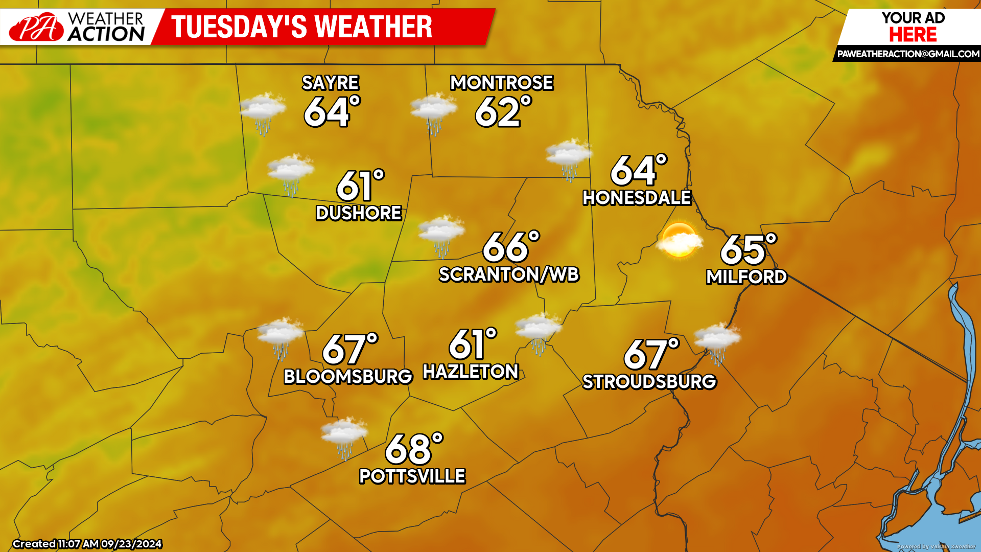
TUESDAY
A surface low will move northward into the Great Lakes. While most of the day will be dry in our area, that low will spread showers into western and central Pennsylvania by evening. Those showers will move into our area during the evening and overnight hours.
For those watching the excitement brewing in the Caribbean, that system will be approaching the narrow strip of water between the Yucatan and Cuba by evening as Tropical Storm Helene.
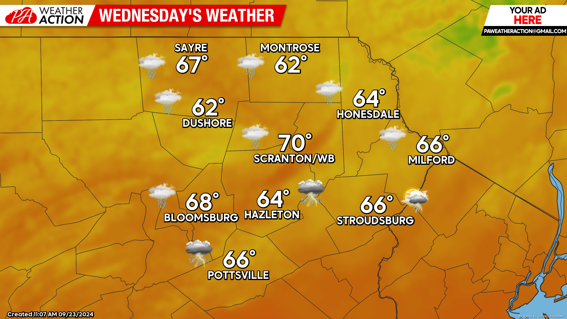
WEDNESDAY
That surface low will move northward into Canada as an upper-level trough digs southward over the Plains / Mississippi River. By evening, the northern part of this trough will continue to move eastward toward the Great Lakes while the southern portion will pinch off into a cut-off upper-level low over Arkansas / Missouri. This will draw increasingly humid air northward into our area, along with the potential for showers and thunderstorms. Locally heavy rain is possible, which would be quite beneficial as we have been quite dry the last couple of weeks.
Helene will continue to intensify as it moves northward into the eastern Gulf of Mexico as a hurricane. Once Helene enters the Gulf of Mexico, explosive development is likely.
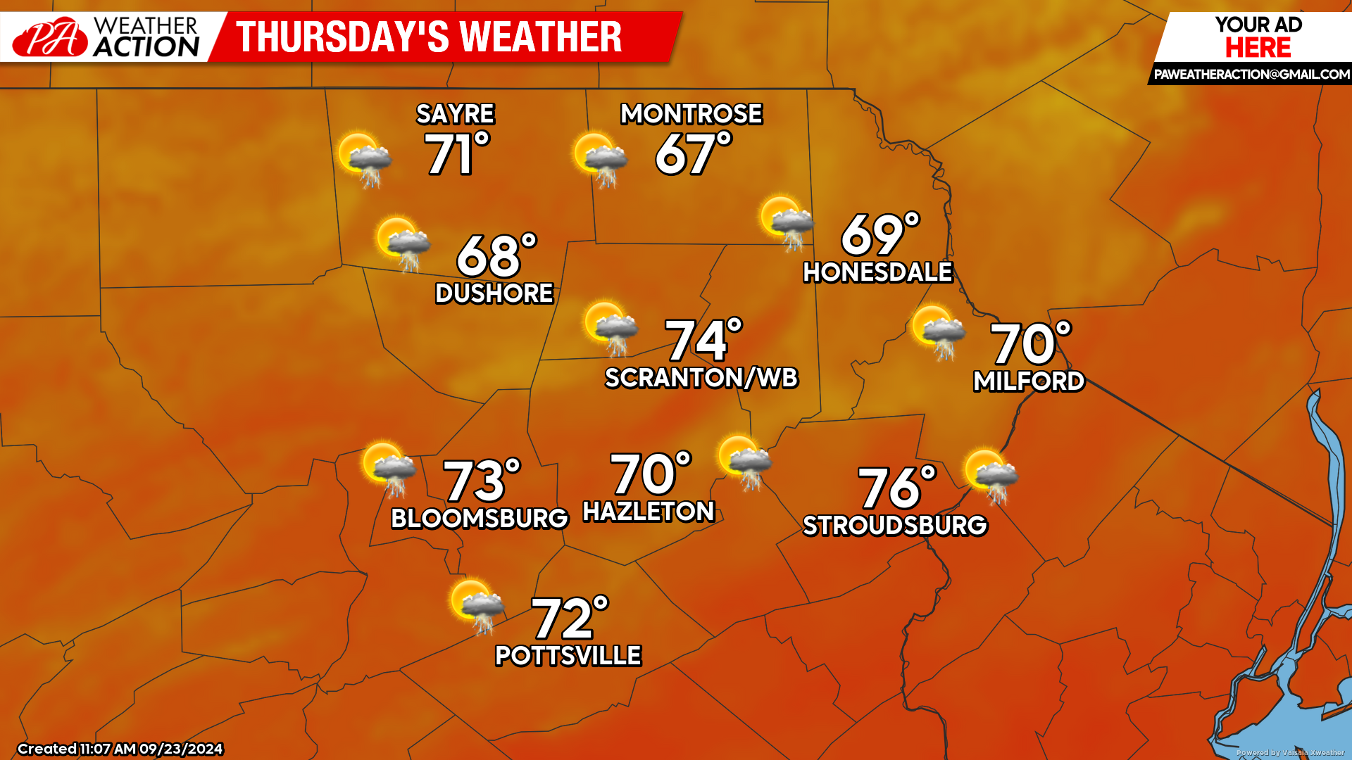
THURSDAY
The opportunity for showers will continue in our area. There could be partial clearing during the afternoon along with decreasing humidity. Hurricane Helene will continue to intensify as it churns toward the Florida Panhandle, where it will make landfall as a Cat 2 or even Cat 3 storm Thursday night! The aforementioned cut-off upper-level low will remain over Arkansas and Missouri, which will play a role in the fate of Helene’s remnants after landfall.
BEYOND THURSDAY (Friday-Sunday September 27-29)
Similar to hurricane Francine earlier this month, much of the tropical moisture and heavy rainfall from hurricane Helene will be pulled westward into that cut-off upper-level low , and the rest will be drawn eastward across Virginia / North Carolina and into the Atlantic. Unfortunately this means that the much-needed rainfall looks like it will avoid us this time. Thus we will be in another extended dry and mild period, with daytime highs ranging from the upper 60s in the high elevations to the low/mid 70s in the low elevations. Overnight lows will be in the upper 40s and low 50s.


You must be logged in to post a comment.