


Model data over the past 24 hours has consistently suggested higher and higher snowfall amounts with this surprisingly long-duration clipper system. Time to nail down timing and amounts for this storm!
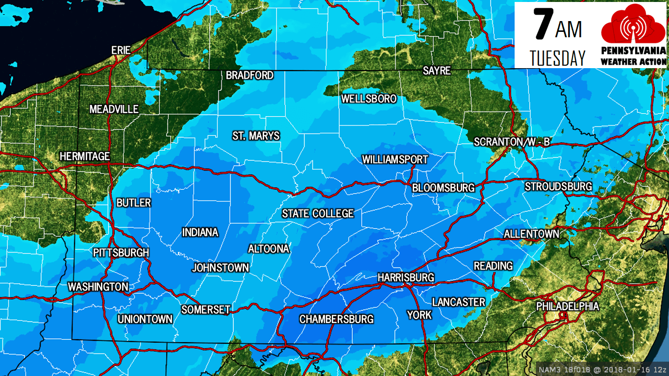
Snow is beginning to move into Western PA right now, and will continue through the evening and into the night in many locations. By 7 AM Tuesday, snow will likely be falling in a good portion of Western PA, as well as Central PA. It will begin pushing into the Lehigh Valley around this time. Below is the future radar for 7 AM Tuesday.
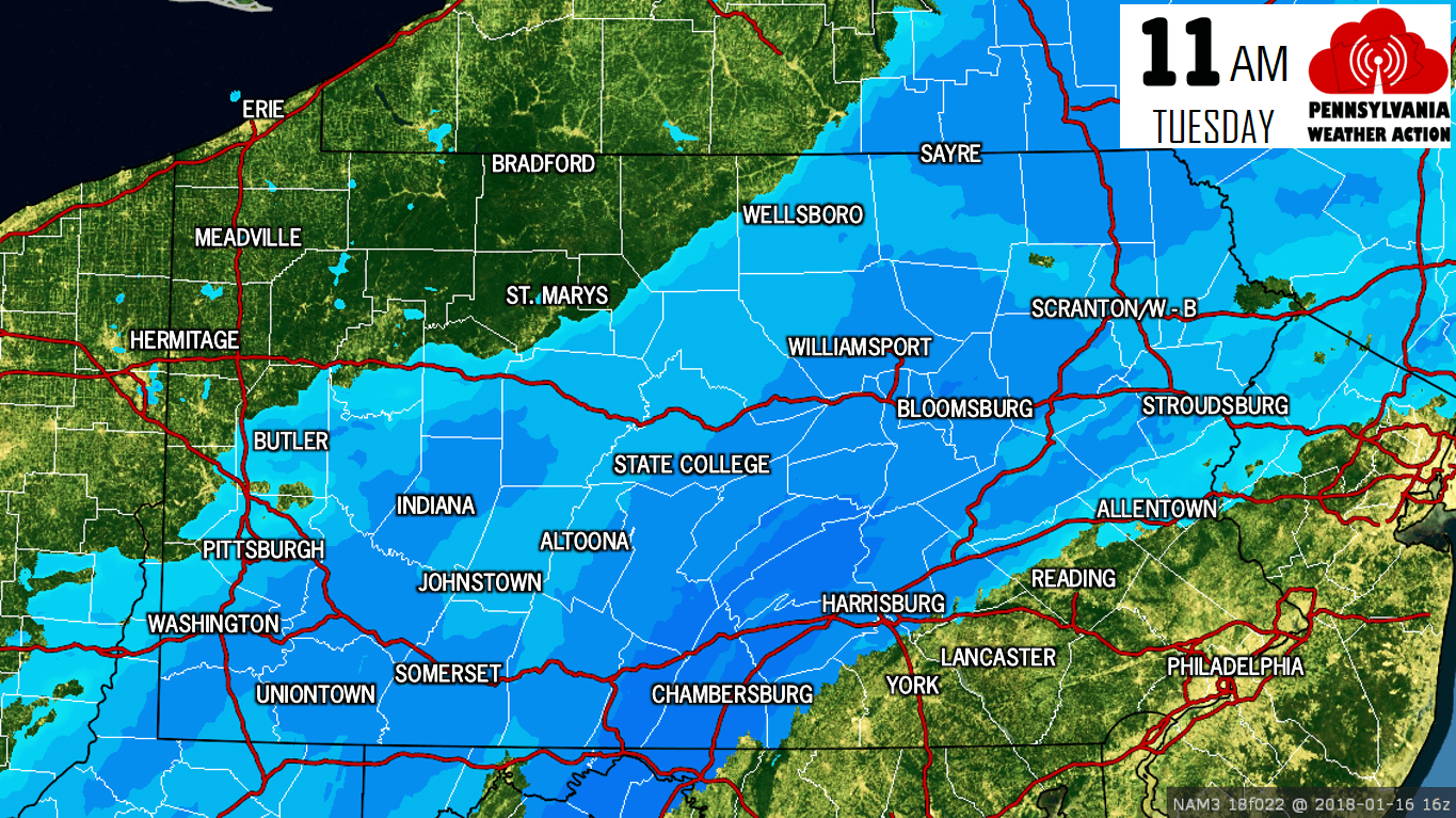
Snow will continue to fall at a good clip across much of Southern PA and up through the Poconos. Notice the sharp cutoff line in the Lehigh Valley. This will play a role in our snowfall forecast. Here is the future radar for 11 AM.
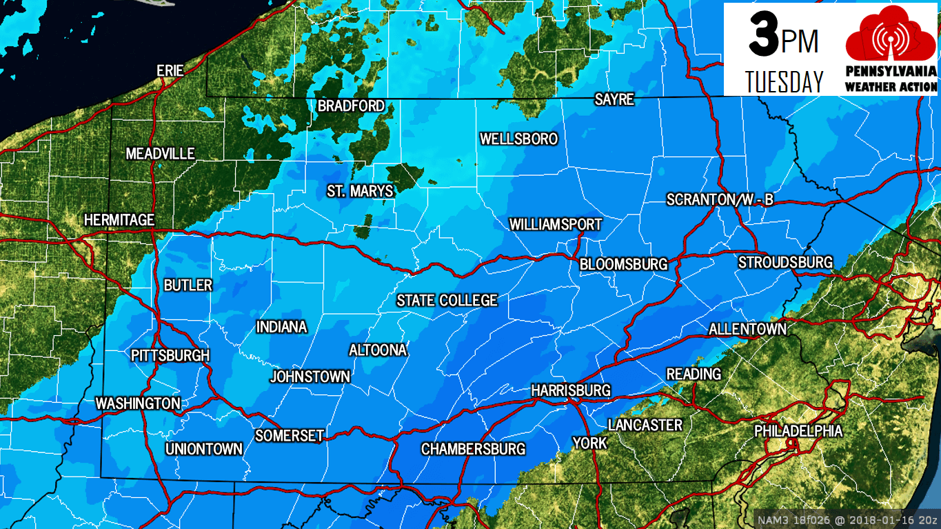
As we move into the mid-afternoon, it will be more of the same. Snow will continue to stick around as far west as Pittsburgh, but really be falling the heaviest from Chambersburg to Allentown. Here is the future radar for 3 PM Tuesday.
Typically clipper systems only bring snow for a short period of time, but that will not be the case this time around as the snow continues to dump right into Tuesday Evening. Heaviest snowfall rates will remain across Southcentral PA and up into the Lehigh Valley. Here is the future radar for 7 PM.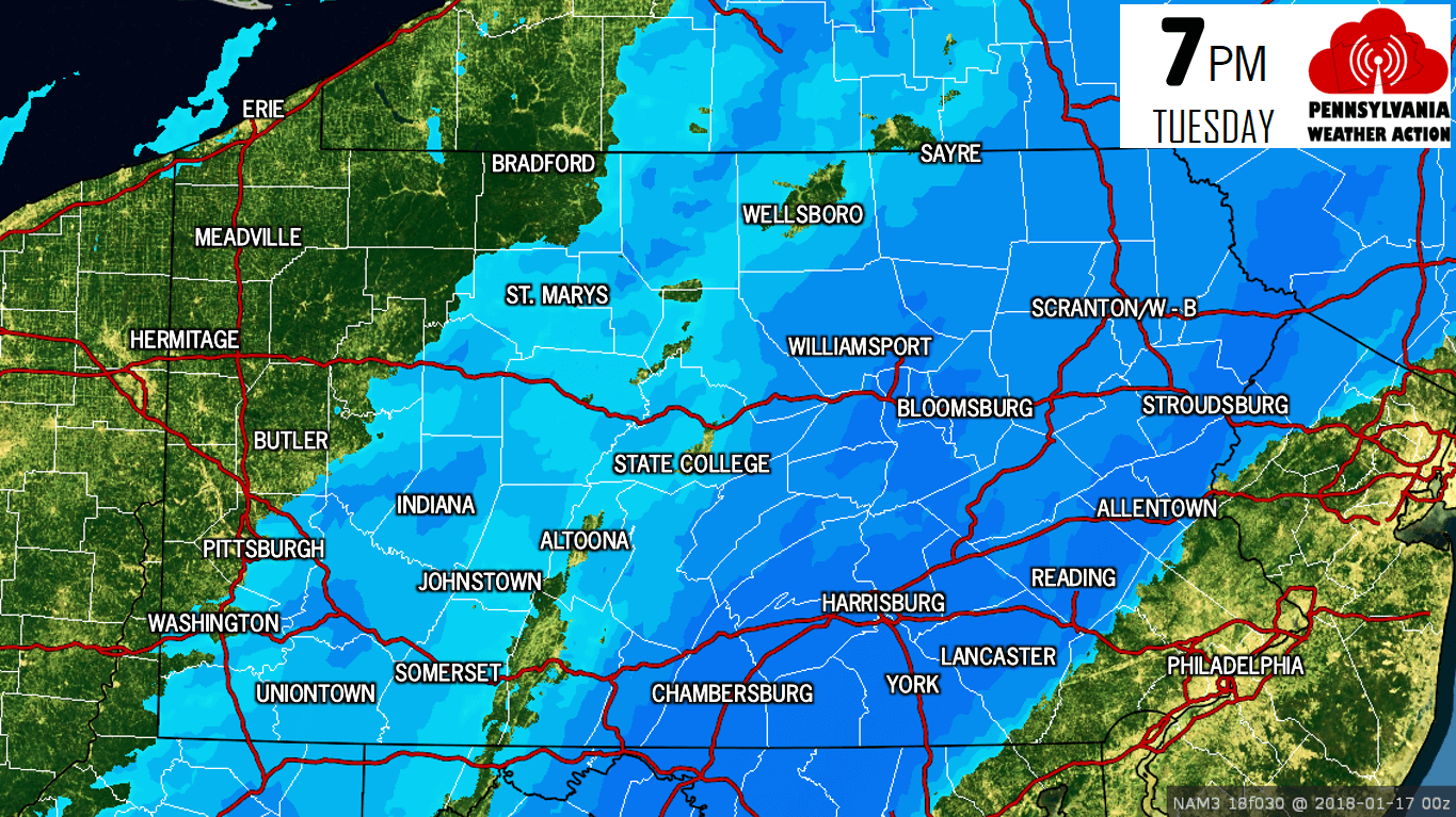
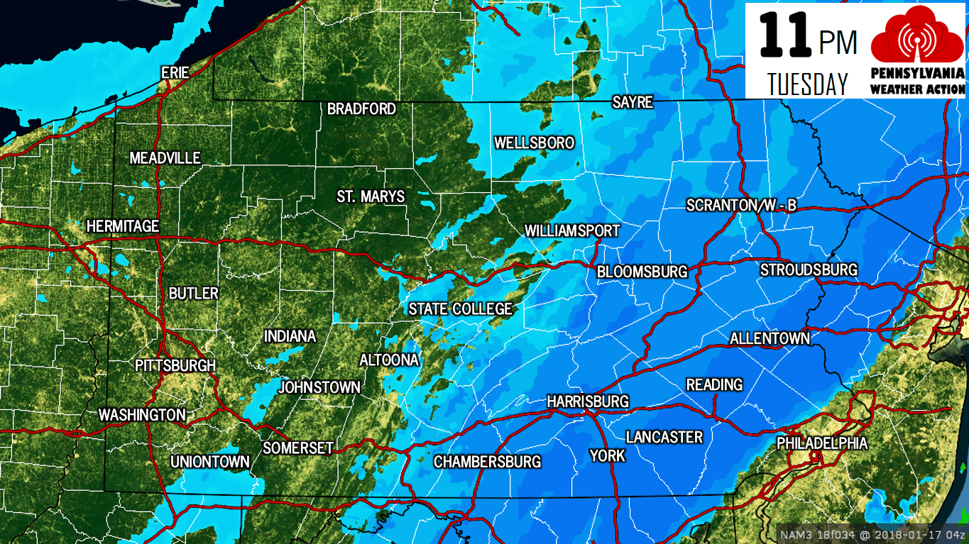
As we head into late night Tuesday, snow will end in Western PA. However, it just keeps falling in much of Eastern PA and the Lower Susquehanna Valley. Below is the future radar for 11 PM Tuesday.
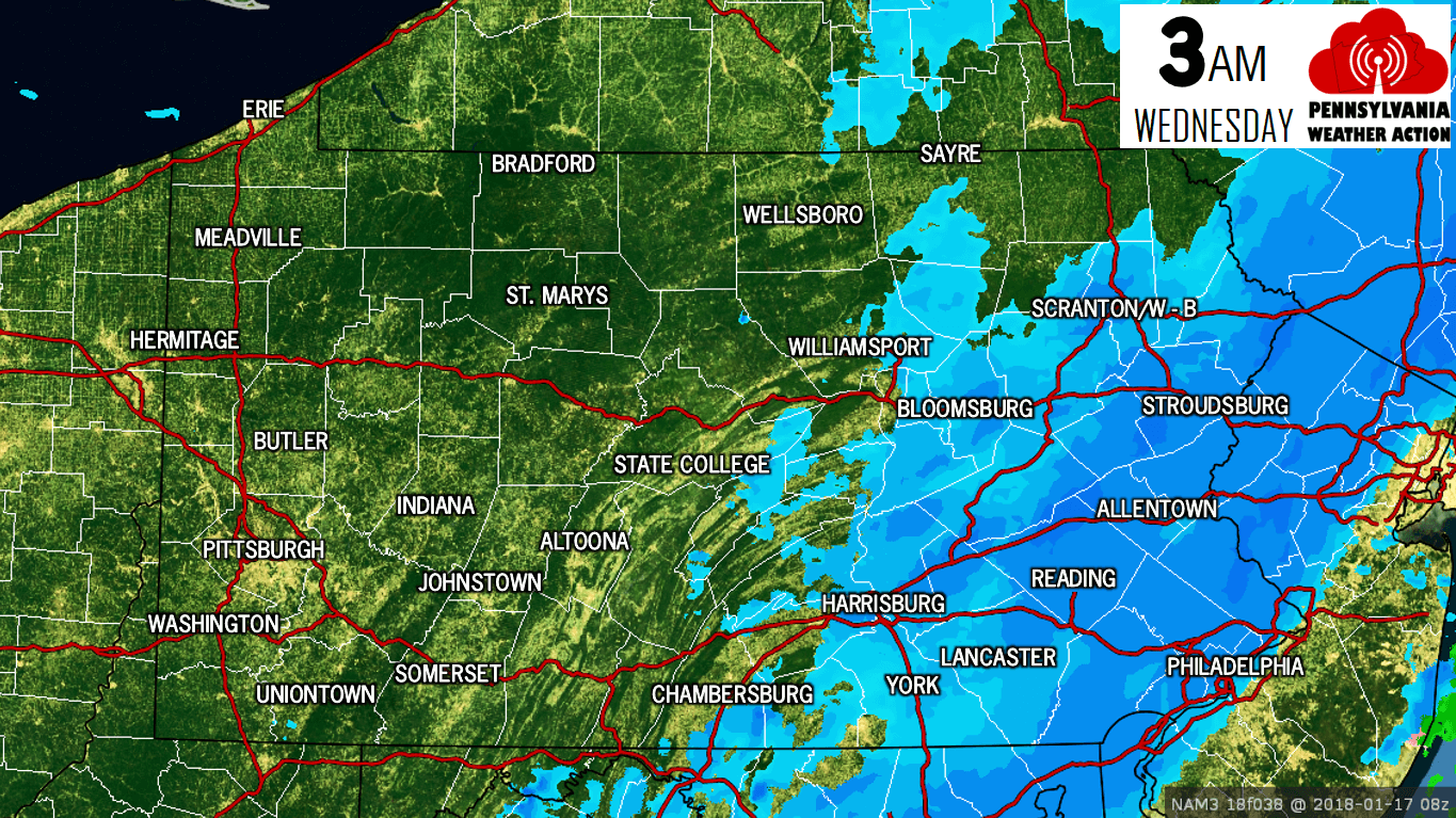
The storm will finally begin to pull away from the coast by Wednesday Morning. Snow will finally dissipate in Eastern PA after almost 24 hours of snowfall in some areas. Here is the future radar for 3 AM Wednesday.
Now that we have timing worked out, let’s get into amounts. First of all, temperatures will be in the low to mid 20s Tuesday Morning, meaning snow to liquid ratios of 15:1 are expected. By the afternoon, many areas east of i-83 and south of i-78 will be near freezing, meaning 10:1 ratios. The Poconos will remain in the mid 20s, which is why they will likely see the most snow out of this system.
There is the potential for this storm to overachieve given that the system will produce snow for almost 24 hours in some areas. Below is our Final Call Snowfall Forecast.
FINAL CALL SNOWFALL FORECAST
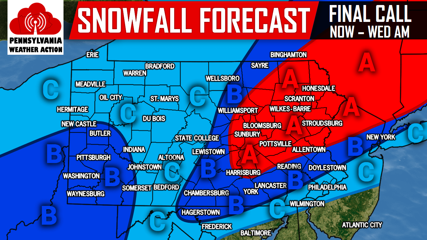
Area A: 4 to 6 inches of snowfall is expected. Some locations may see over a half foot. Snow packed roads will create hazardous travel.
Area B: 2 to 4 inches of snowfall is expected, with the potential for isolated areas of over 4″. Snow covered roads will create hazardous travel.
Area C: 1 to 2 inches of snowfall is expected. Untreated roads will be snow covered.
For updates during the storm and more, be sure to have us liked on Facebook by clicking here>>>Pennsylvania Weather Action’s Facebook Page
Get our free app to track the storm with our interactive radar and road condition page by clicking here>>>PA Weather App
Remember to share this important update with your family and friends using our icon below! Stay safe!
You must be logged in to post a comment.