


Strong storms will move southeast in Northern PA this morning, making their way into the i-80 corridor by early afternoon. As these storms move southeast, one, possibly two lines will develop in Northwest PA in the afternoon and evening. Some locations in the slight risk area will receive potentially three rounds of storms, some of which will be strong to severe.
Future radar for 4 PM: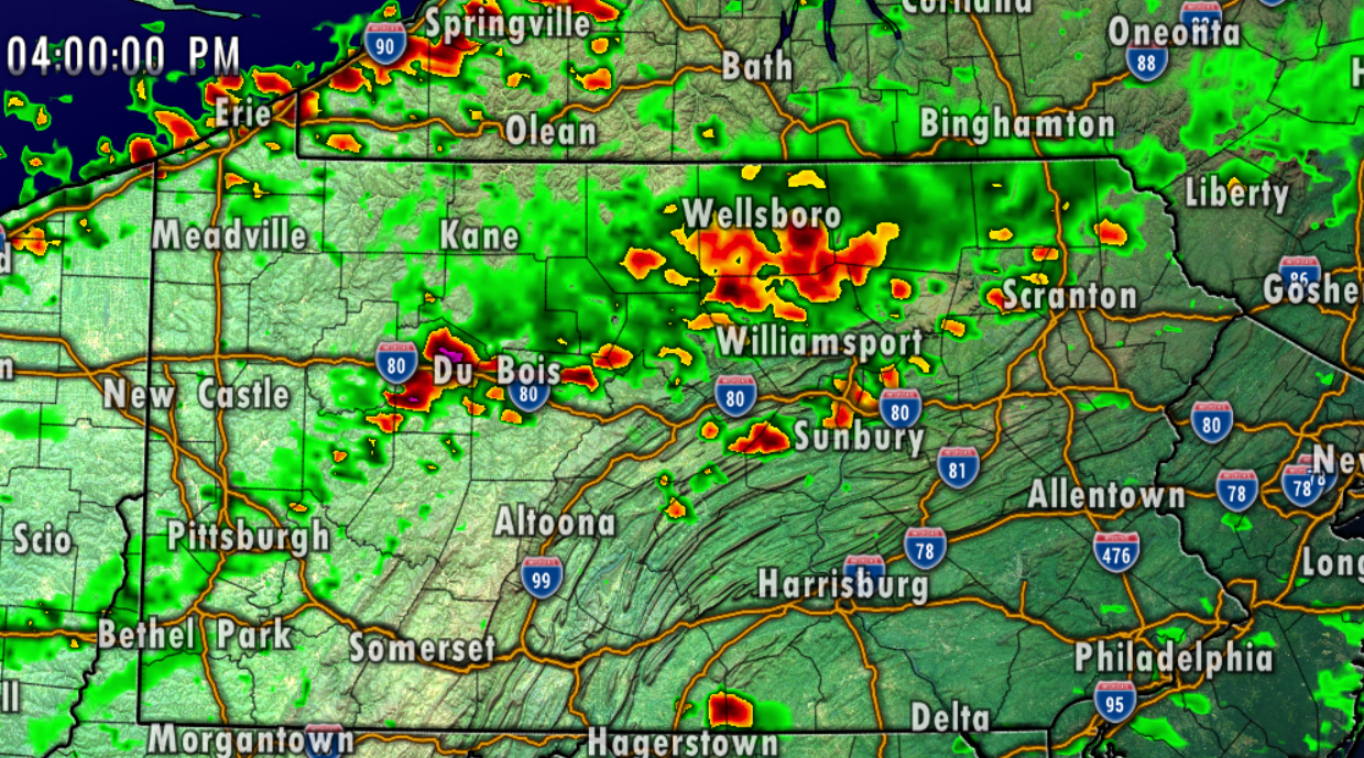
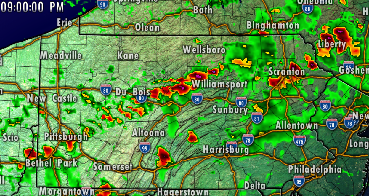
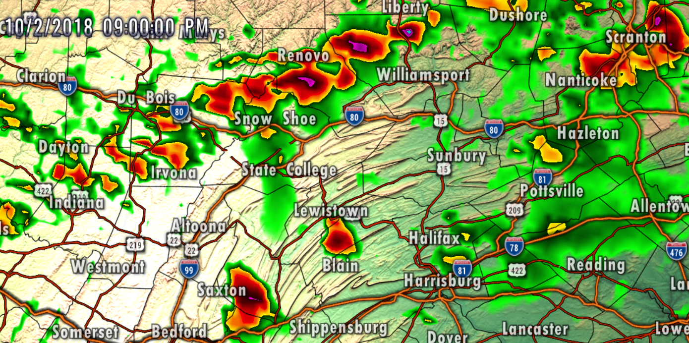
Future radar for 9 PM:
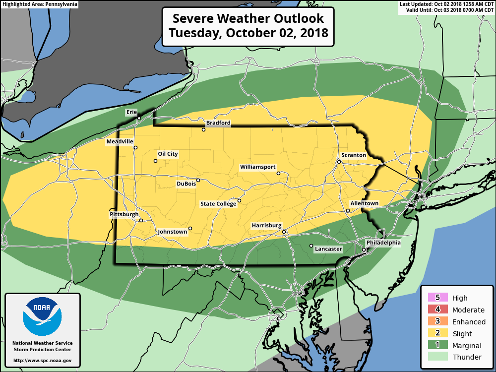
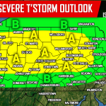
Here is the updated risk map from the SPC:
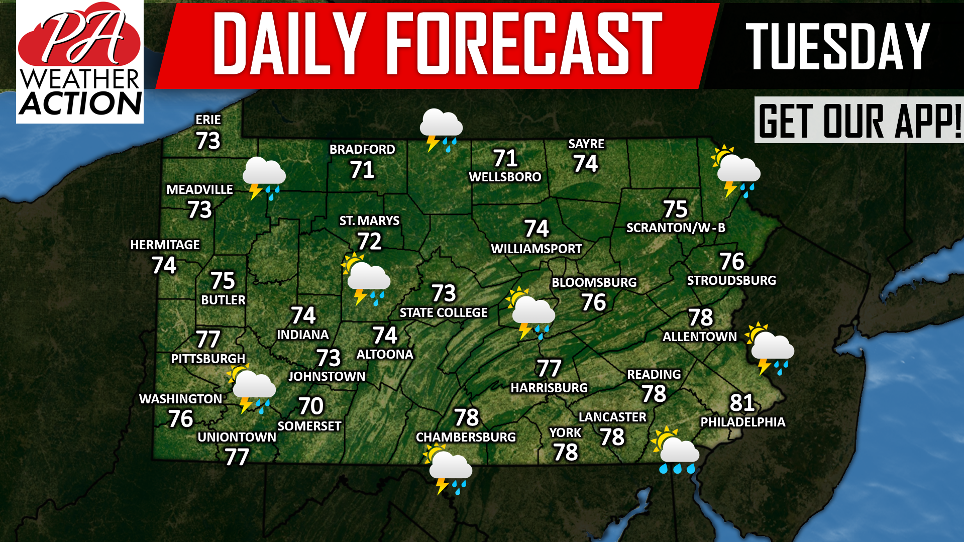
 Highs will top out in the 70s today, here is your daily forecast in graphic form:
Download our app for latest hourly forecast and alerts for your area >>> App Link

You must be logged in to post a comment.