
The NWS Storm Prediction Center has labeled much of Western and Central PA in a Slight Risk Sunday. With the ground already saturated throughout much of the western part of the state, the flash flooding risk will be particularly high. Even pop-up, non-severe storms may cause flooding in flood-prone regions.
MAP: SEVERE THUNDERSTORM RISK ON SUNDAY
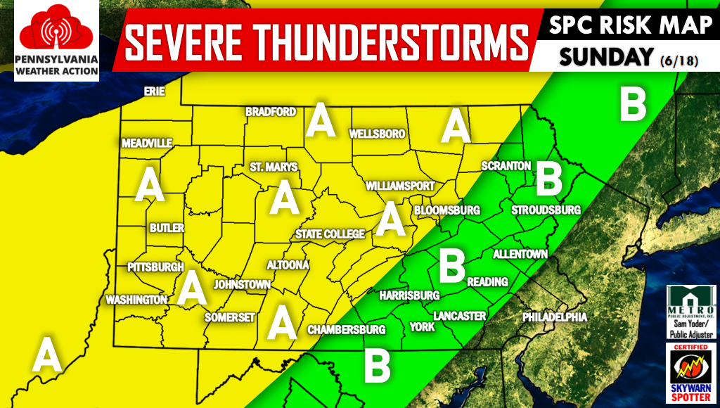
Area A – Locations included in this region are under a Slight Risk. This means scattered severe thunderstorms are expected.
Area B – Locations included in this region are under a Marginal Risk. This means isolated severe thunderstorms are expected, and mainly short-lived.
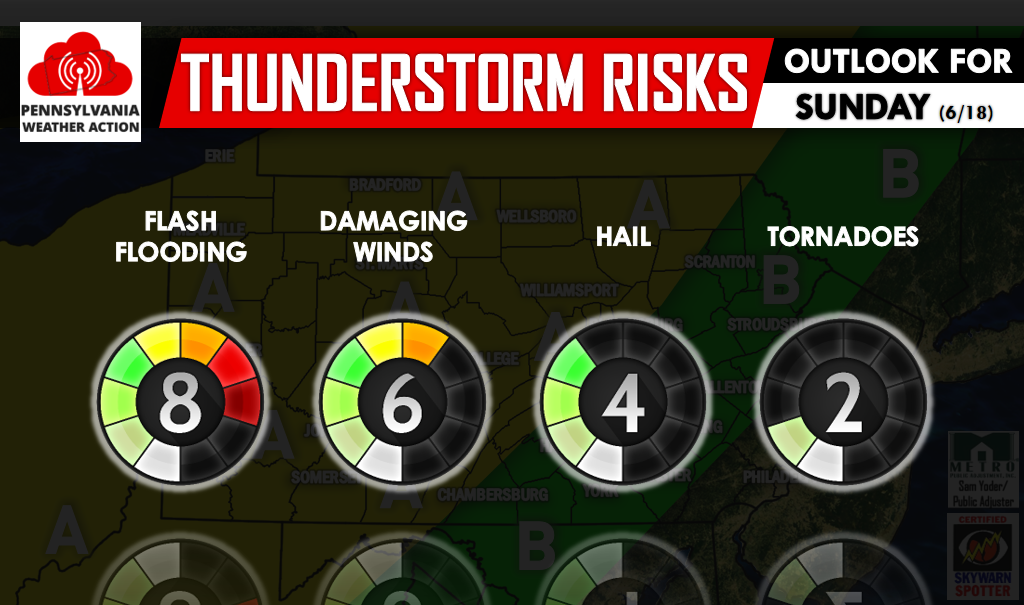
The greatest risk Sunday will be flash flooding, followed by damaging winds. There is a low-moderate hail risk, and a low tornado risk.
Strong storms will form in Western and Central PA Sunday Afternoon. A line of strong to severe storms will be possible in Western PA in the late evening.
If you approach a flooded roadway, turn around. It only takes 6″ to disable most passenger cars. We will be posting all alerts on our facebook page >> Click Here to Like PA Weather Action on facebook! Warn your friends and family by sharing this article using the icons below, stay safe!
You must be logged in to post a comment.