


Another round of storms is likely today, this time in Eastern and Central PA. The SPC has put much of Eastern PA and eastern parts of Northcentral PA under an enhanced risk today. Central PA is under a slight risk, with a marginal risk in western parts of the state. Below is a table explaining what each risk is.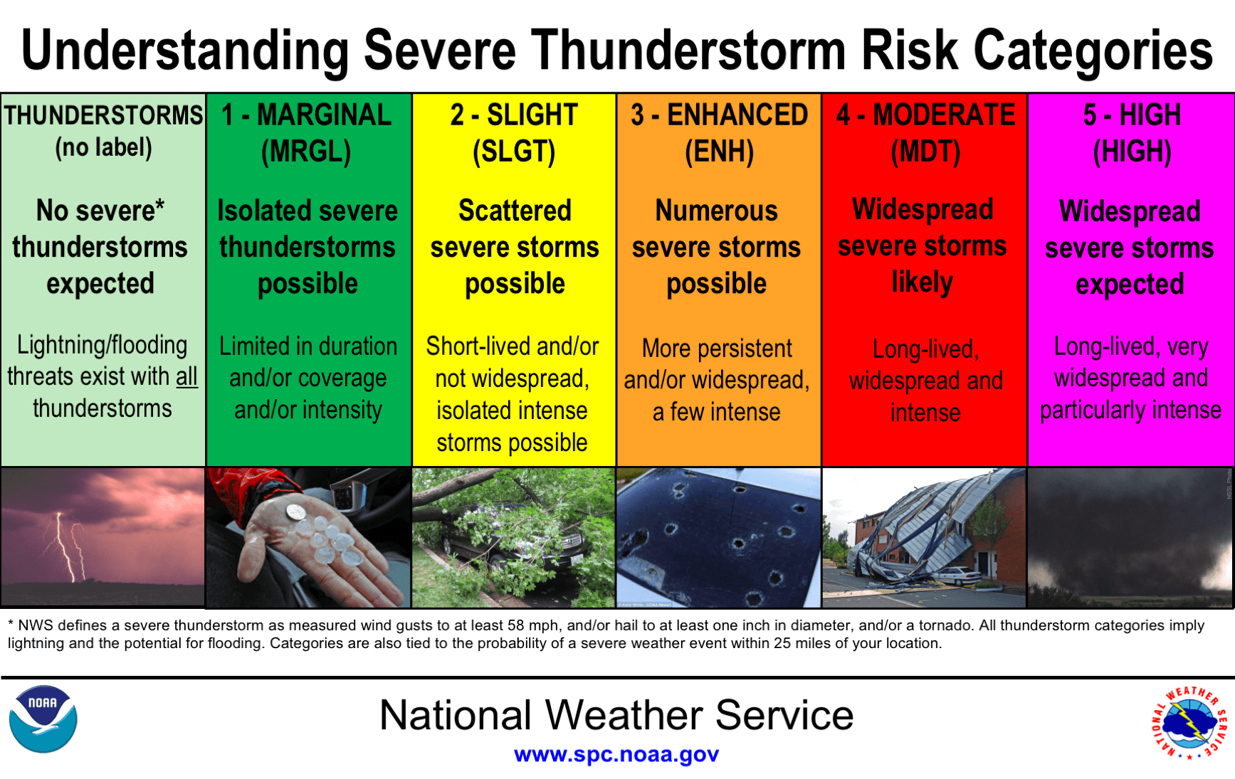
Here is today’s risk map:
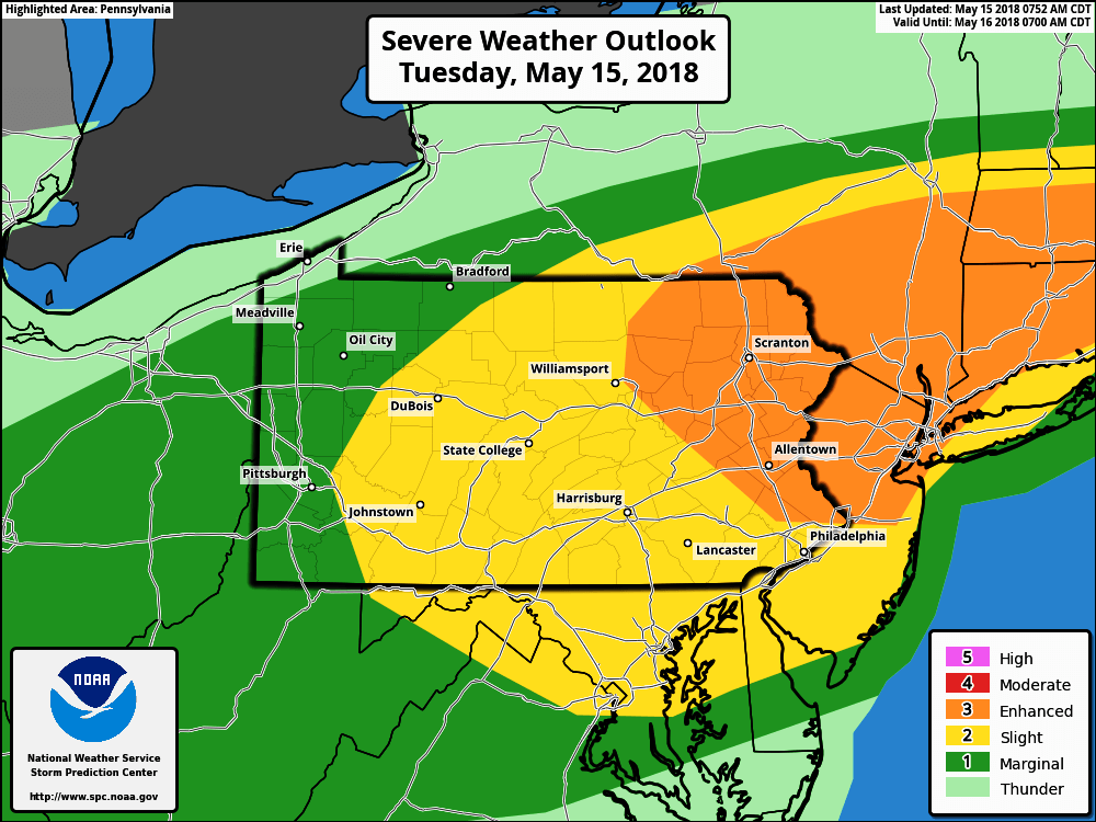
The area most at risk for supercell thunderstorms capable of producing hail and a few tornadoes is Northeast PA. An organized line of strong to severe storms is then anticipated from the Lehigh Valley to the Susquehanna Valley, down into Philadelphia.
Although the threat for hail and tornadoes is somewhat less outside of Northeast PA, it still exists in all of Eastern and Central PA.
TIMING OF STORMS
Altoona, State College, Williamsport, Montrose: 2-3 PM
Bedford, Carlisle, Harrisburg, Lebanon, Pottsville, Scranton, Honesdale: 3-4 PM
Chambersburg, York, Lancaster, Reading, Allentown, East Stroudsburg: 4-5 PM
Coatesville, Norristown, Doylestown: 5-6 PM
West Chester, Philadelphia, Levittown: 6-7 PM
Keep in mind not every location will be hit equally. Some regions will be missed, other areas will be hit hard. It’s impossible to predict exacts.
FUTURE RADAR
Be sure to monitor the radar this afternoon and evening if you are in Eastern or Central PA.
Download our app to view interactive radar, as well as receive notifications for any weather alerts issued for your area >>> Tap Here to Get Our App
Check our Facebook page for any watches issued along with any forecast updates that may be posted. Stay safe!

You must be logged in to post a comment.