


For the last week or so, we have been tracking what was once Tropical Invest 99L, which has recently been upgraded to a Tropical Depression. At first it had seemed that most of the concern would be centered around the Gulf Coast states and the Southeast Coast. However, recent trends have shifted the concern for not just those areas, but also now the Mid-Atlantic and even potentially the Northeast coastline.
Here is the latest forecast graphic from the National Hurricane Center regarding the projected path of Tropical Depression 9: 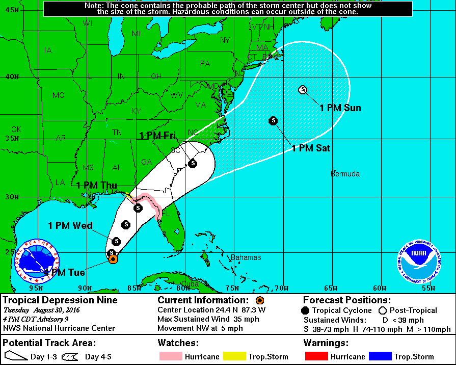
This is a significant shift Northwest from their recent outlooks. Another shift NW and it puts Eastern PA/New Jersey/Delaware/Long Island/Maryland in the area of concern.
Timing: For the Southeast Coast States, Thursday through Friday. Mid-Atlantic, Friday through Saturday. For PA/NJ/MD/DE/Long Island, IF it were to make impact it would be between Saturday and Sunday.
Please note, if you have beach plans this weekend, you may want to stay out of the water as the current will be very strong and the waves will be much taller than normal.
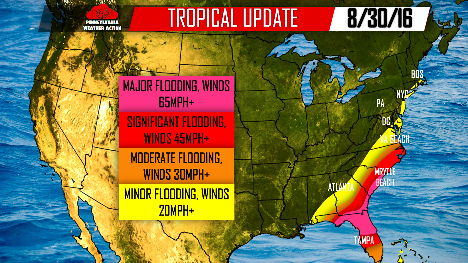
Below is our latest forecast graphic regarding Tropical Depression 9:
Areas in Pink: Flooding rains of 6 inches or more is possible. Winds sustained at 65mph or greater, with gusts higher.
Areas in Red: Rainfall may exceed 4 inches, causing many areas to flood. Winds sustained at 45mph or greater is possible.
Areas in Orange: Moderate flooding of 2 inches is possible. Winds sustained at 30mph or greater.
Areas in Yellow: Rainfall will remain below 2 inches which will lead to only minor flooding. Winds sustained at 20mph or greater is possible. This area now includes the beaches of MD/DE/DE/Long Island/CT/RI/MA.
We will have daily updates throughout the rest of the week, be sure to follow our Facebook page>>>PA Weather Action on Facebook!
[facebook_share url=”https://paweatheraction.com/tropical-depression-9-may-impact-labor-day-weekend-plans” width=”” layout=”button_count”]
You must be logged in to post a comment.