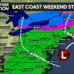
After a beautiful weekend and Monday as well, all eyes turn to the potential of two Winter Storm threats. The first one will arrive here Tuesday Night into the day Wednesday. Then a second system we will be keeping an eye on will arrive here by Friday.
For the first system, the energy of the low pressure will be dropping out of the Pacific Northwest and will develop a stronger low over the middle of the country and head Northeastward. From this point on, the exact track remains unclear. All three major guidance models, show a slightly different solution.
First off, the GFS…the warmest solution: 
Verbatim, the low pressure tracks right through Central PA, leaving Northwest PA with accumulating snows, while the rest of the state rains.
Canadian (middle ground solution as of now): 
The Canadian packs a harder punch than the GFS in terms of the intensity of the precip. However, the track is similar enough that Northwest PA remains the only areas too see wintry precipitation. Verbatim, Northwest PA would see a moderate snowfall, while the rest of have a wet, rather than white, Wednesday.
European (coldest solution): 
Instead of taking a track across Central PA, the Euro takes the low pressure across Southeast PA and continues Northeastward over New York City. This allows the Rain/Snow line to sag further South and East. Areas circled in red receive accumulating snows verbatim, NOT A FORECAST, during the day Wednesday.
Summary for storm threat #1: Timing will be between Tuesday Night and during the day Wednesday. Right now, western half of PA has the best chance at receiving at least some snowfall out of this. Eastern PA, with the except of Northeastern PA should receive just a plain rainfall, with maybe backside snow showers. With that being said, even those who do receive all snow from this system, it will not accumulate to anything major. Max snowfall amounts will probably be in the 4-8 inch range. First call on this storm will be Tomorrow Evening.
Storm threat #2 has the potential to be the bigger of the two storms.
Taking a look at the GFS, the storm gains its strength over the south, whether it takes track 1 or track 2 remains the BIG question:  This threat is still 5-6 days away, so there are a lot of questions yet to be answered. What we can tell you, is unlike storm #1, this storm everybody is in play for Wintry Precipitation. And all the guidance agrees on exploding this system offshore. If this storm explodes, meaning the precip shield expands and strengthens, onshore, a lot of us will be dealing with quite the Winter Storm. If you are a snow lover, root for track #1, if you are sick and tired of Winter, root for #2. We are currently 50/50 right now. Either track is certainly possible.
Summary for storm threat #2: Timing: Friday into Saturday. Everybody is in the ball game for Wintry Precipitation. If the storm takes track #1, the potential is there for a big Winter Storm. If the storm takes track #2, expect nothing more than clouds Friday and Saturday. More questions will be answered with this storm, as we head into Monday and Tuesday.
Interested in promoting your company’s business and being a sponsor for PA Weather Action? Then click on this link and fill out the form for a great opportunity>>>>>> Sponsorship Form
Please make sure you give us a “like” on Facebook to keep up to date with the upcoming storm threats>>>>>>>Pennsylvania Weather Action Facebook Page!


You must be logged in to post a comment.