


Do you remember the last two Decembers? If not, here’s a short description: Foggy, Rainy, October-like weather. While areas of Northern PA did alright in the snow department, it was an absolute nightmare for snow lovers south of i-80. Many locations in Southern PA recorded absolutely no snow the entire month. Back in December 2015, we were wearing shorts on Christmas Eve.
This trend is about to change in a big way, as predicted in our winter outlook a few weeks ago. There will be a short period of above average temperatures to start the month of December. However, by around December 7th a major pattern change is expected. Yes, we are still 9 days out from this change, but literally everything is in favor for this change.
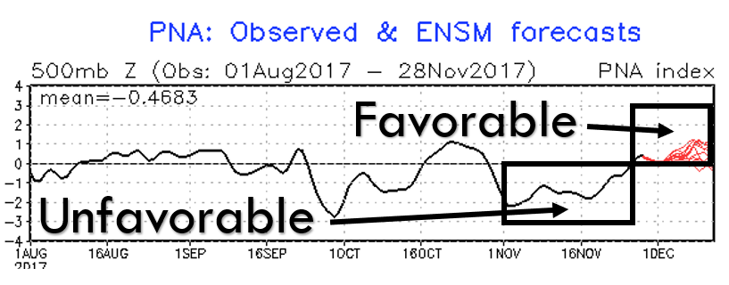
Moving into December, many factors that strongly impact the jet stream will become much more favorable. The PNA is finally moving positive, and the EPO is heading negative. For the past month, these teleconnections have been in an unfavorable phase. Furthermore, we will be seeing a low AAM phase, and the MJO moving towards phase 7 which typically favors a cold pattern in the Central and Eastern US.
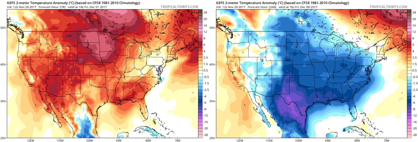
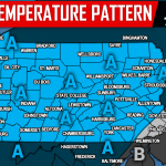
 The models have been picking up on this change in a big way. The American, European, and Canadian model has been indicating this change for a while. Even the usual “blow torch” CFSv2 long range model is predicting this change. Here is the GEFS model, comparing December 1st to December 8th.
We expect to see multiple snow chances leading up to Christmas. The potential will be there for bigger winter storms, but smaller snow events (below 6″) look more likely. For those that enjoy having snow on the ground as much as possible during the holiday season, even small events will do the job thanks to the freezing daytime highs anticipated.
As winter begins to get cranking, be sure to have our facebook page liked >>> Click Here to Like PA Weather Action on facebook. Also, download our app as we will be putting exclusive region-by-region maps on it ahead of winter weather events >>> Click Here to Download the PA Weather App!
Are you excited by this wintry news? If so, or maybe even if not, remember to share the news with your friends using the button below!
You must be logged in to post a comment.