
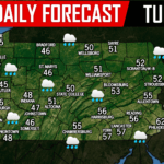
Break out the shorts! Many areas today will reach the 50s and even 60s, rivaling all time record high temperatures. There is the chance for scattered light rain showers throughout the day, especially in the morning hours area wide. 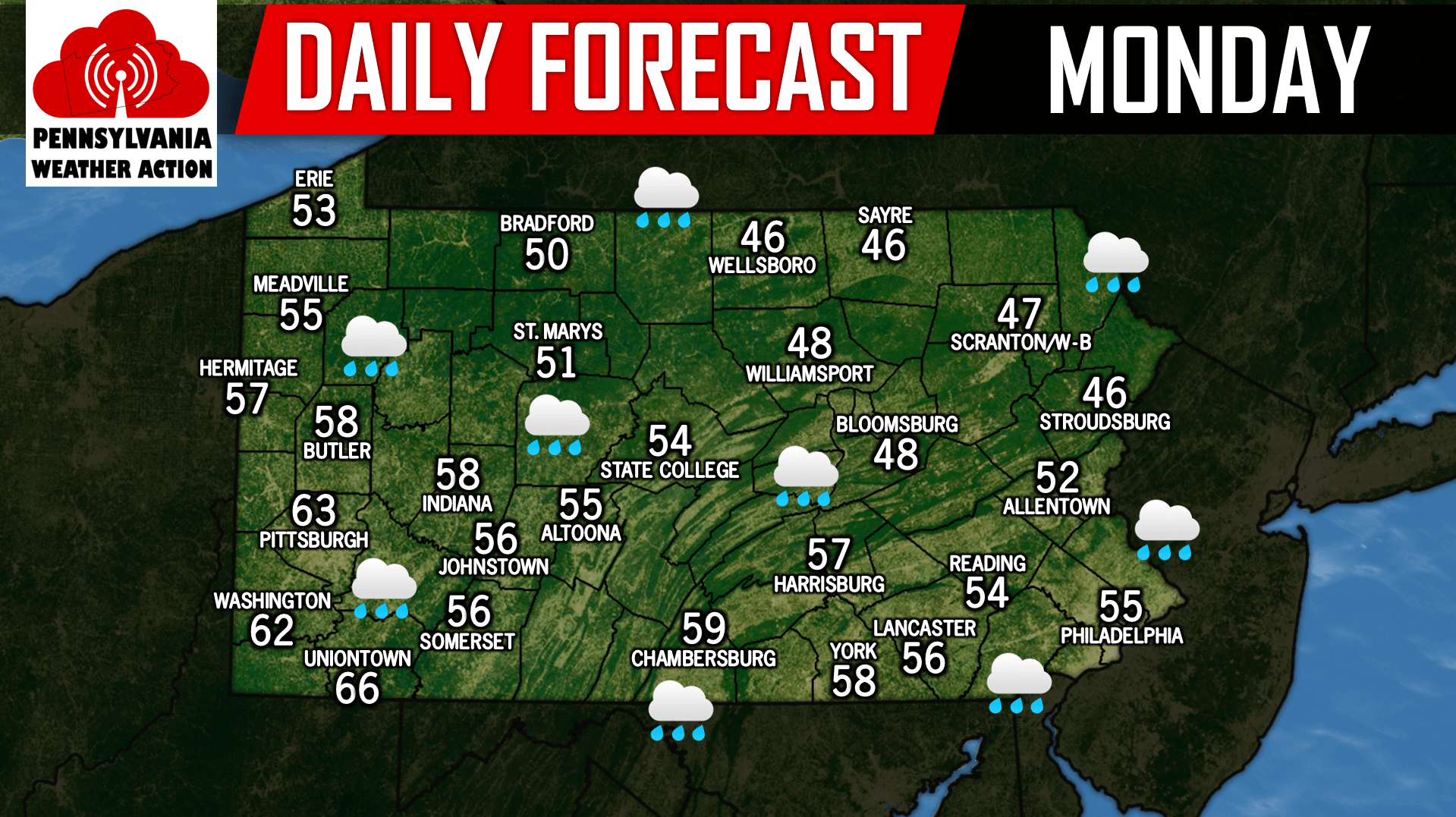
We are still anticipating a soaking rainfall across the state from a Great Lakes Cutter system likely arriving after midnight for Western Pennsylvania and shortly after for Central and Eastern Pennsylvania. The Tuesday morning rush hour will be a washout, expect travel delays. We are expecting areas to receive between 1/2 inch to an inch of rainfall. The rain will end for all areas late Tuesday afternoon and early evening. Below is the GFS valid for 7:00 AM Tuesday morning: 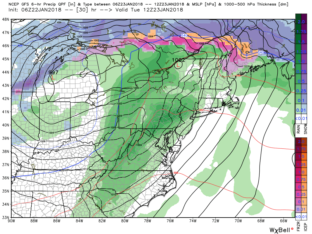
Today marks the 2 year anniversary of the blizzard of 2016, also known as Winter Storm Jonas. The blizzard began during the day on the 22nd of 2016 and continued right through the 23rd. The blizzard dropped a widespread 2 to 3 feet of snow across Southern Pennsylvania smashing records in many places. Take a look at the snowfall totals below!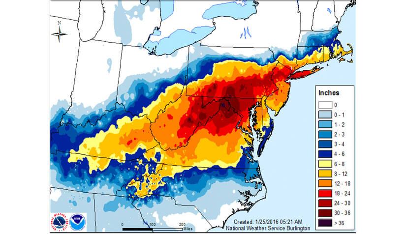
While we do not expect much in the way of snow to close out January, February continues to look like it will offer plenty of opportunities for snow!
You must be logged in to post a comment.