
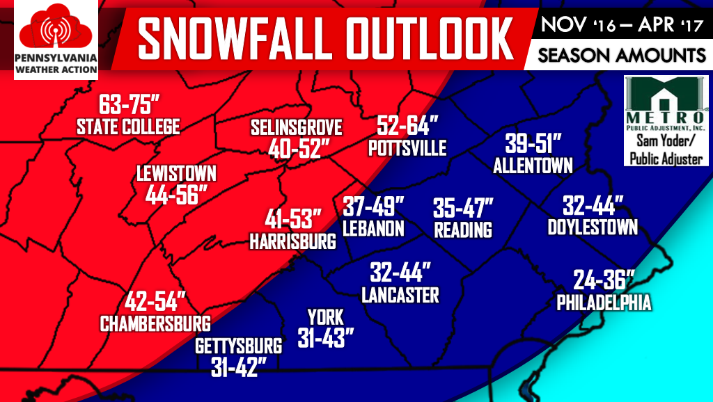
In general the farther south and east you live, the less snow you will receive. However regardless of where you live, an above average snowfall is expected this Winter. For extreme Southeast PA in the light blue, 20% more than your average snowfall is expected. Areas in the dark blue, 35% more than your average snowfall is expected, and then areas farther Northwest in the red, more than 50% of your average snowfall is expected. Southeast PA will likely have multiple Wintry Mix events this year. By the end of the Winter, this area will average out to slightly below normal temperatures.
Stay ahead of the Winter Weather by subscribing to our Ahead of the Action Winter Text Alert Service. Sign up now to enter yourself in a $50 visa gift card drawing. First month is free! Click here>>>Ahead of the Action Winter Text Alert Service sign up!
Don’t forget to like Pennsylvania Weather Action on facebook and share this article below if you have family and/or friends in Southeast PA. Stay safe!
You must be logged in to post a comment.