

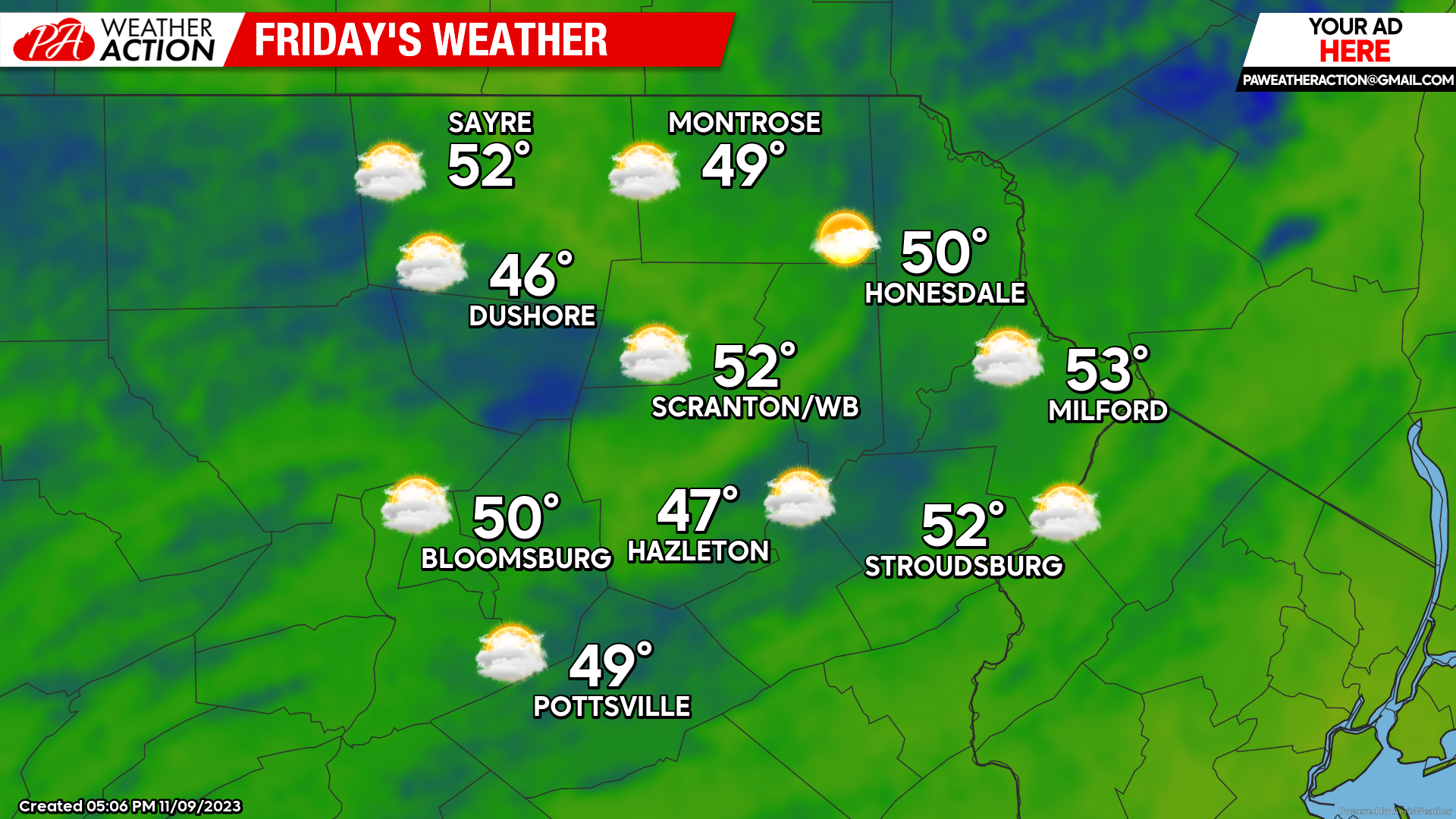
After a mild Thursday as a storm system slid mostly innocuously to our north, cooler air is now circulating into our region behind that system. After max temperatures soaring well into the 60s, tomorrow’s highs will be closer to normal, near 50. There could also be some rain encroaching on the southern areas from a disturbance slithering through the Mid-Atlantic, but at this time most areas look to remain dry.
SATURDAY
Dry and cooler air will enter the region, with perhaps some lake-effect snow showers surviving into the northern parts of the region.

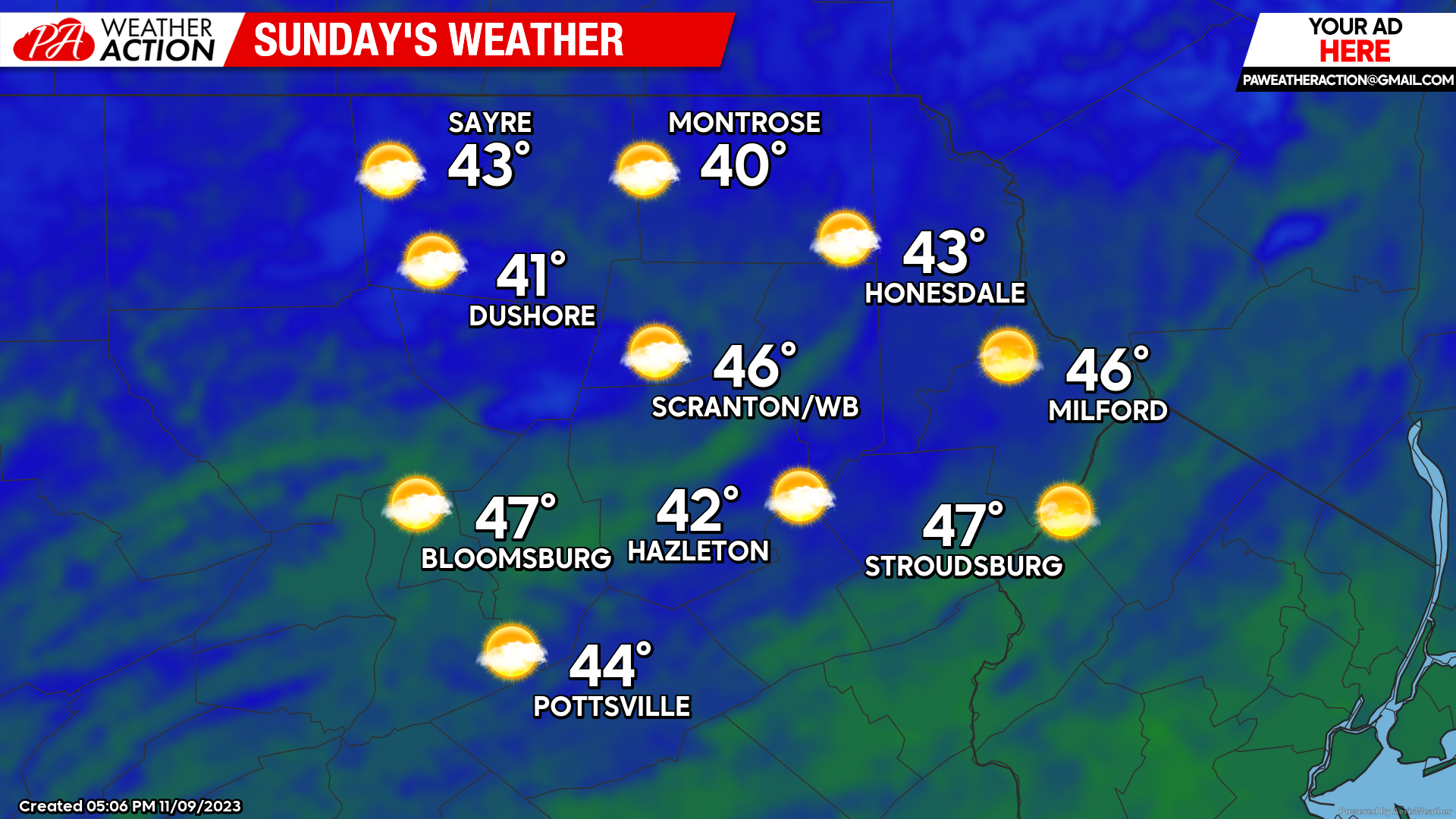
SUNDAY
Below-normal temperatures and dry weather will continue to be driven into the area, with a continuation of below-normal temperatures. Enjoy!

You must be logged in to post a comment.