EXTREMELY HIGH FIRE DANGER CONTINUES! The record-long stretch of days without measureable precipitation continues to lengthen. Please refrain from all outdoor burning as the fire danger is extremely high, and gusty wind over the next few days will only exasperate the threat. The layer of dry leaves on the ground provides an ample fuel source which can also be carried by the wind to start new fires.
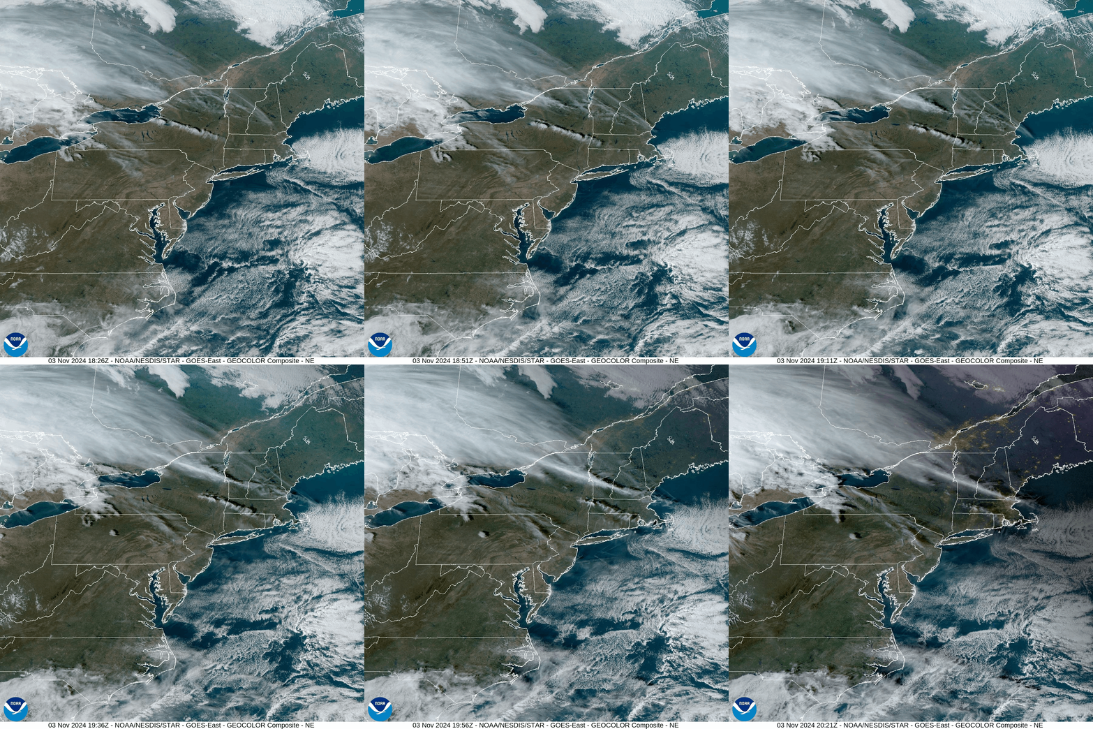
Unfortunately, a wildfire was ignited on the south side of Blue Mountain just east of the Lehigh Gap on Saturday. The fire continues to burn today, with nearly 200 acres scorched so far. The plume of smoke from the Lehigh Gap fire was so thick it could be seen in the visible satellite loop from Sunday evening. While difficult to spot, it is the stationary north-south oriented white line in east-central Pennsylvania. Yesterday the smoke was being blown southward from the fire, and today (Monday) it is blowing northward toward Jim Thorpe. (Note: This is the visible satellite loop from SUNDAY evening November 3)
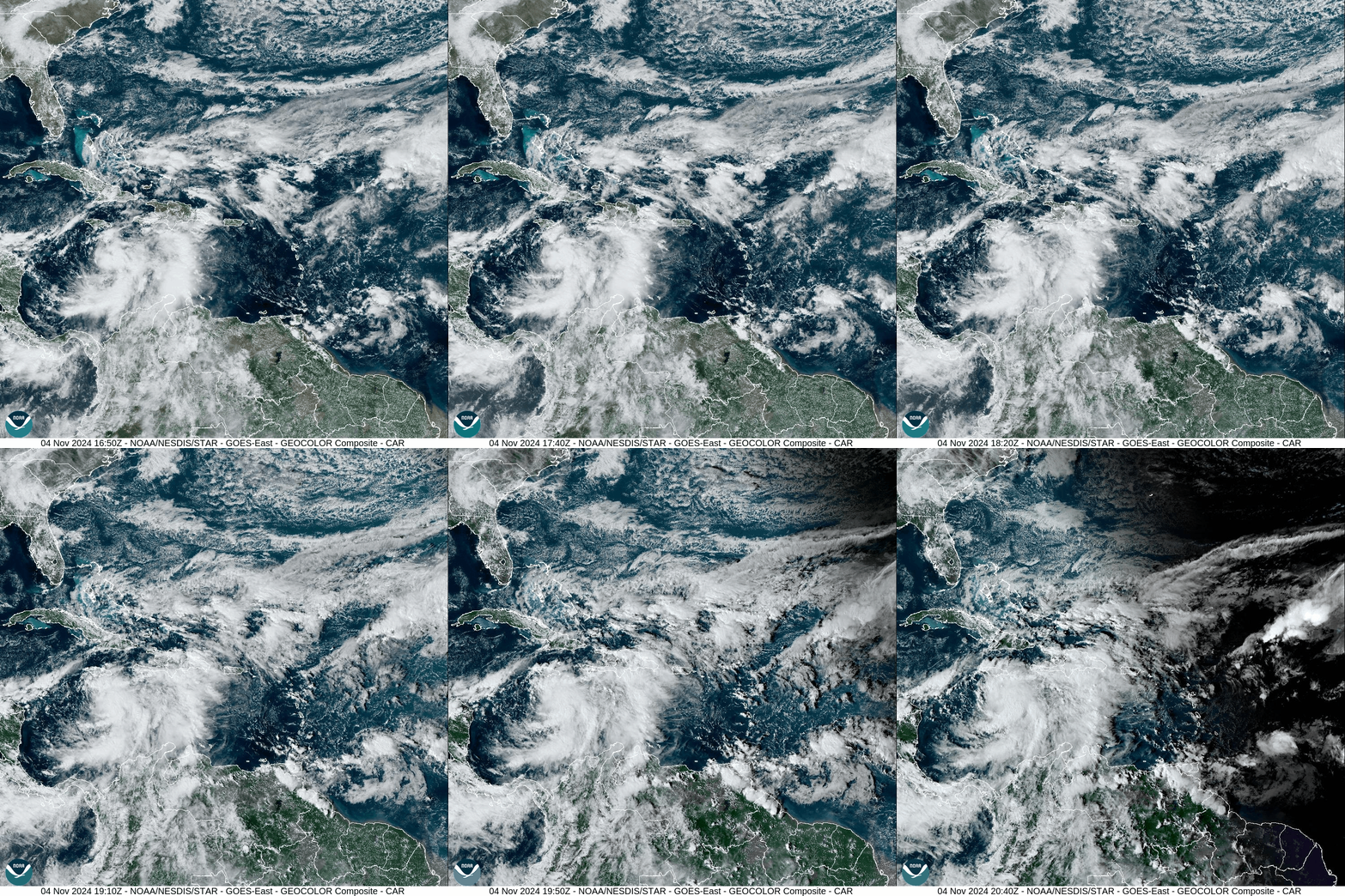
Meanwhile, the Caribbean birthed Tropical Storm Rafael about 175 mils south of Jamaica. Rafael currently has 45mph wind, and is expected to strengthen rapidly to a Cat 2 hurricane with 100 mph wind by the time it ravages Cuba on Wednesday. Rafael will likely weaken into a tropical storm by the time he reaches the northern Gulf later this week or early in the weekend.
There is some hope that Rafael’s moisture will then be entrained into an approaching system to provide some desperately-needed rain later in the upcoming weekend, but that is a long way away so don’t get your hopes up. You can see Rafael congealing southeast of Cuba in this visible satellite loop from Monday afternoon.
TUESDAY
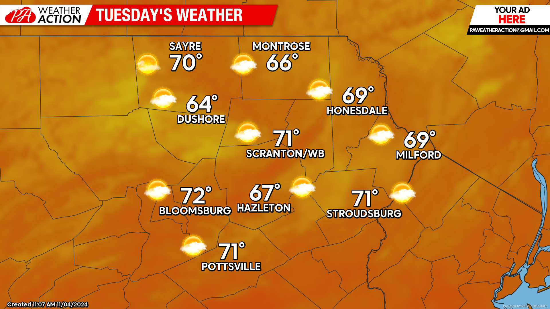
A surface high currently located over New England will slide southeastward toward Bermuda by Tuesday. Meanwhile a low pressure system will move into the Great Lakes. Between those two systems, very warm air will be pumped northward into our area to provide a very pleasant day at the polls. Morning will dawn quite warm, with widespread 40s at sunrise. Afternoon temperatures will top 70 in many locations!
WEDNESDAY
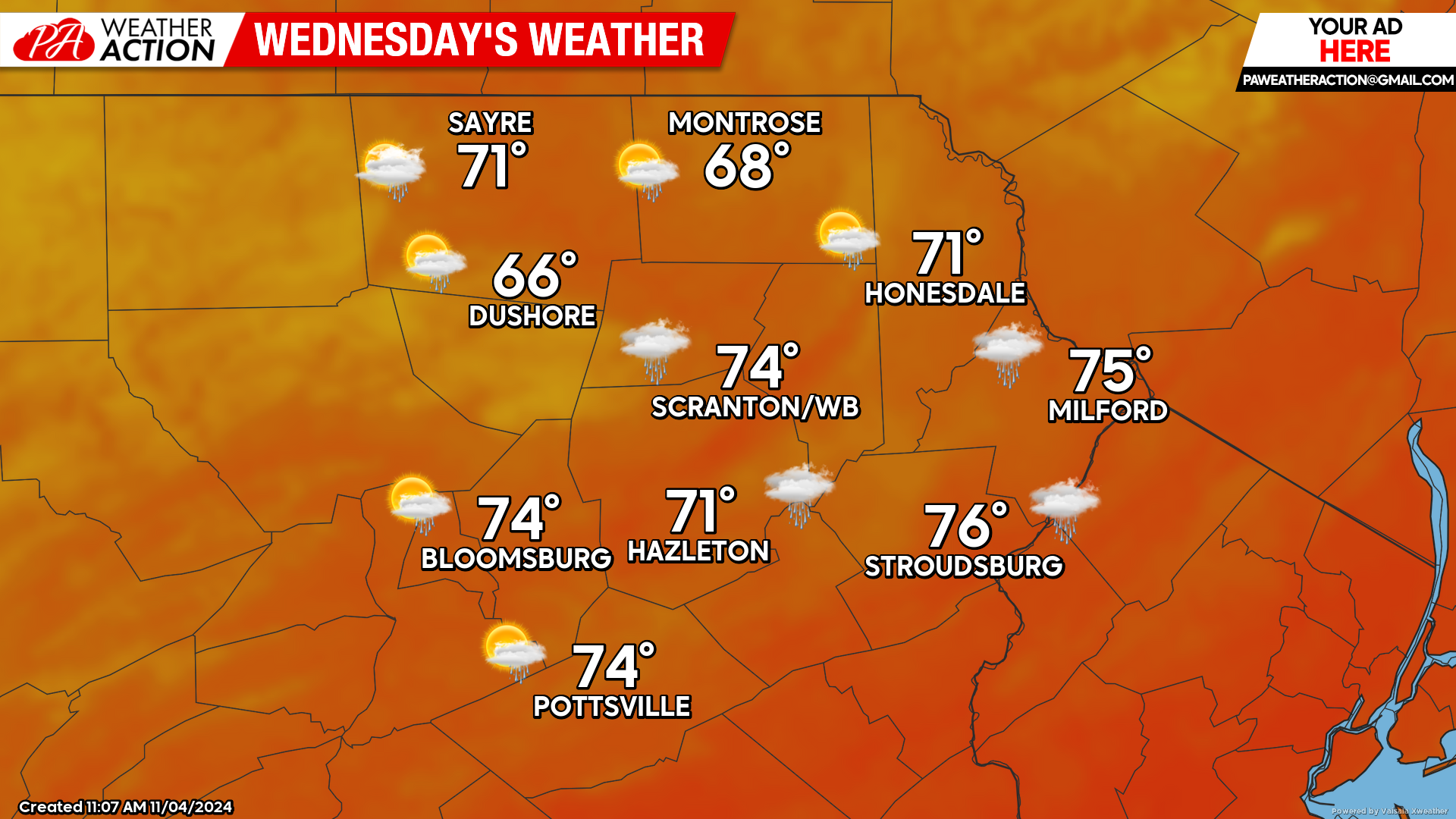
Gusty wind from the southwest will bake the region with near-record high temperatures. While there could be a few light showers or sprinkles courtesy of an approaching cold front, they will do nothing to squelch the drought or the high fire danger.
THURSDAY
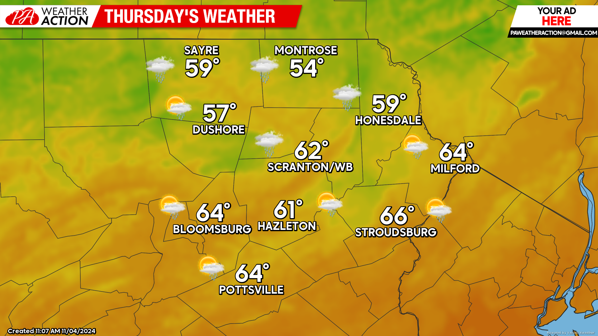
Wednesday night will be another mild night with widespread 40s and 50s for low temperatures. A weak cold front will wash out across the area Wednesday night, and there could be a few light showers or sprinkles lingering into Thursday, but barely enough to get the ground wet for those lucky enough to be teased by a shower. Thursday will be another very warm day, albeit not the near-record warmth of Wednesday.
BEYOND THURSDAY (Friday-Sunday Nov 8-10)
Temperatures will continue to be above-normal, with highs ranging from the upper 50s to near 60 for most locations, and lows in the 30s to near 40. Friday and Saturday should be dry and quite nice. There is some hope that moisture from Rafael will be drawn northward into our area late Sunday or Sunday night to provide a much-needed reprieve from the wildfire danger. However, that is still a week away so don’t get your hopes up.

You must be logged in to post a comment.