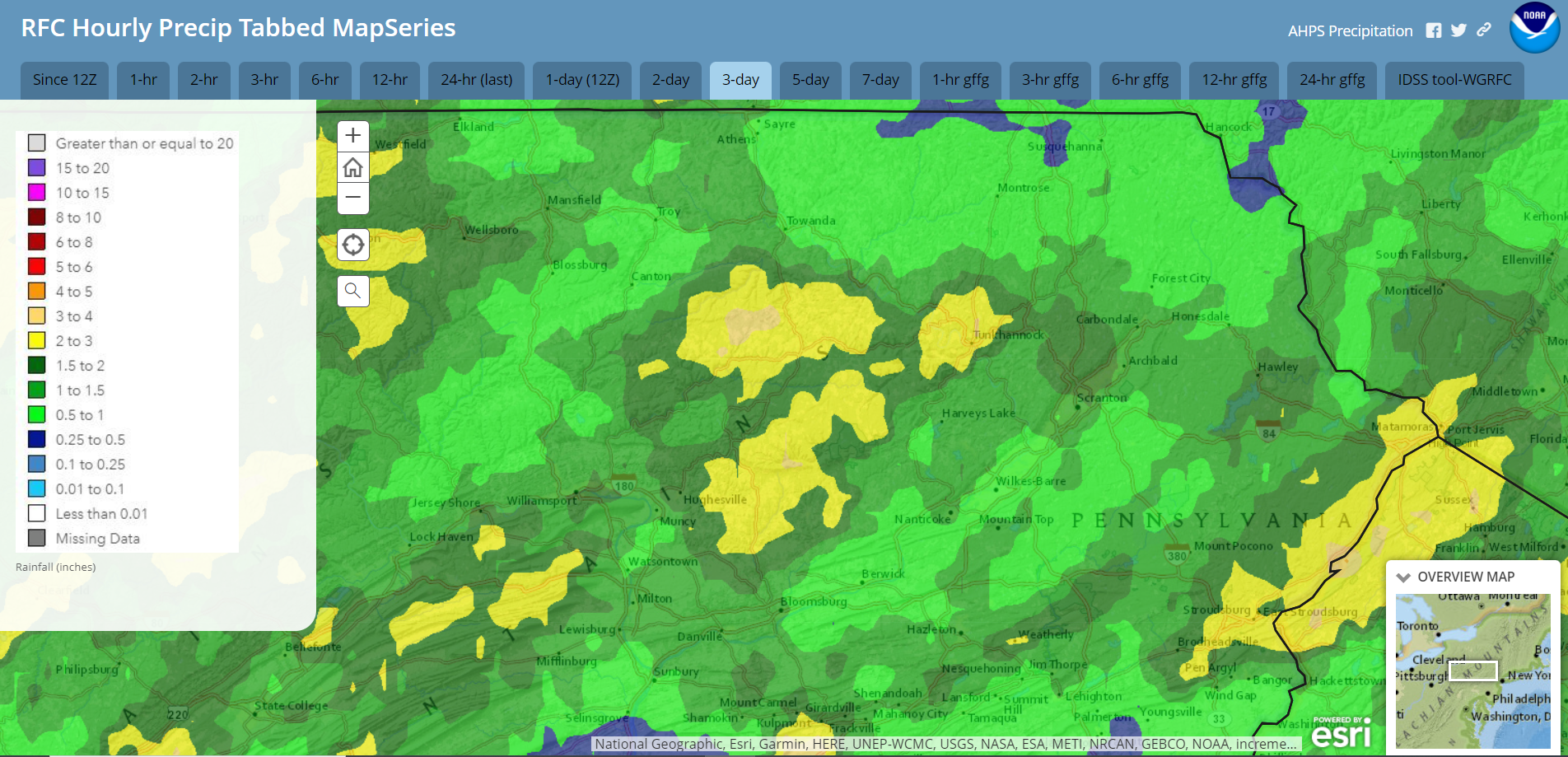
Weekend thunderstorms inundated parts of our area with over 3″ rain, along with widespread power outages. Tropical moisture, a stalled frontal zone, and Debby’s influence will bring heavy rain with potential flooding issues this week into the weekend.
Radar-derived rainfall last Fri-Sun Aug 2-4
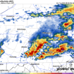
A cold front pushing into our area has ignited scattered strong to severe thunderstorms that will affect our area this evening. These storms will subside after sunset but scattered downpours will still be possible overnight.
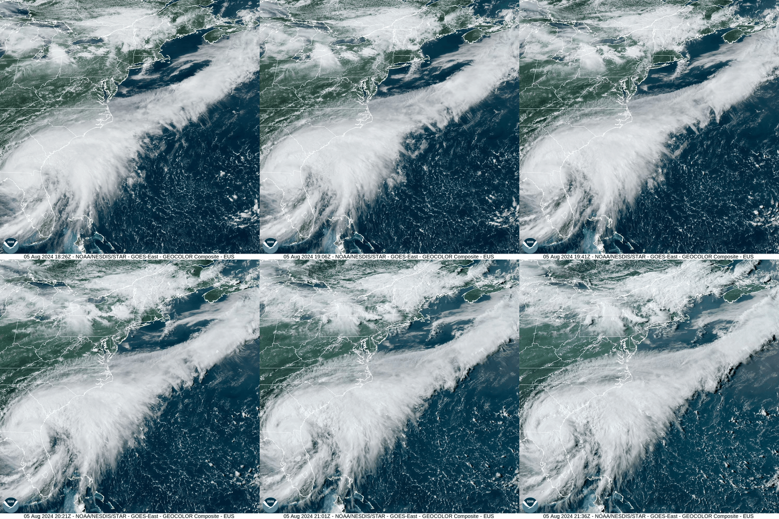
Meanwhile, Debby made landfall in Florida as a hurricane today. She will meander over the Southeast and eventually embark on a general northward journey throughout this week.
For a visual of Debby, please enjoy a visible satellite loop from this afternoon. You can also see the thunderstorms currently igniting over our area.
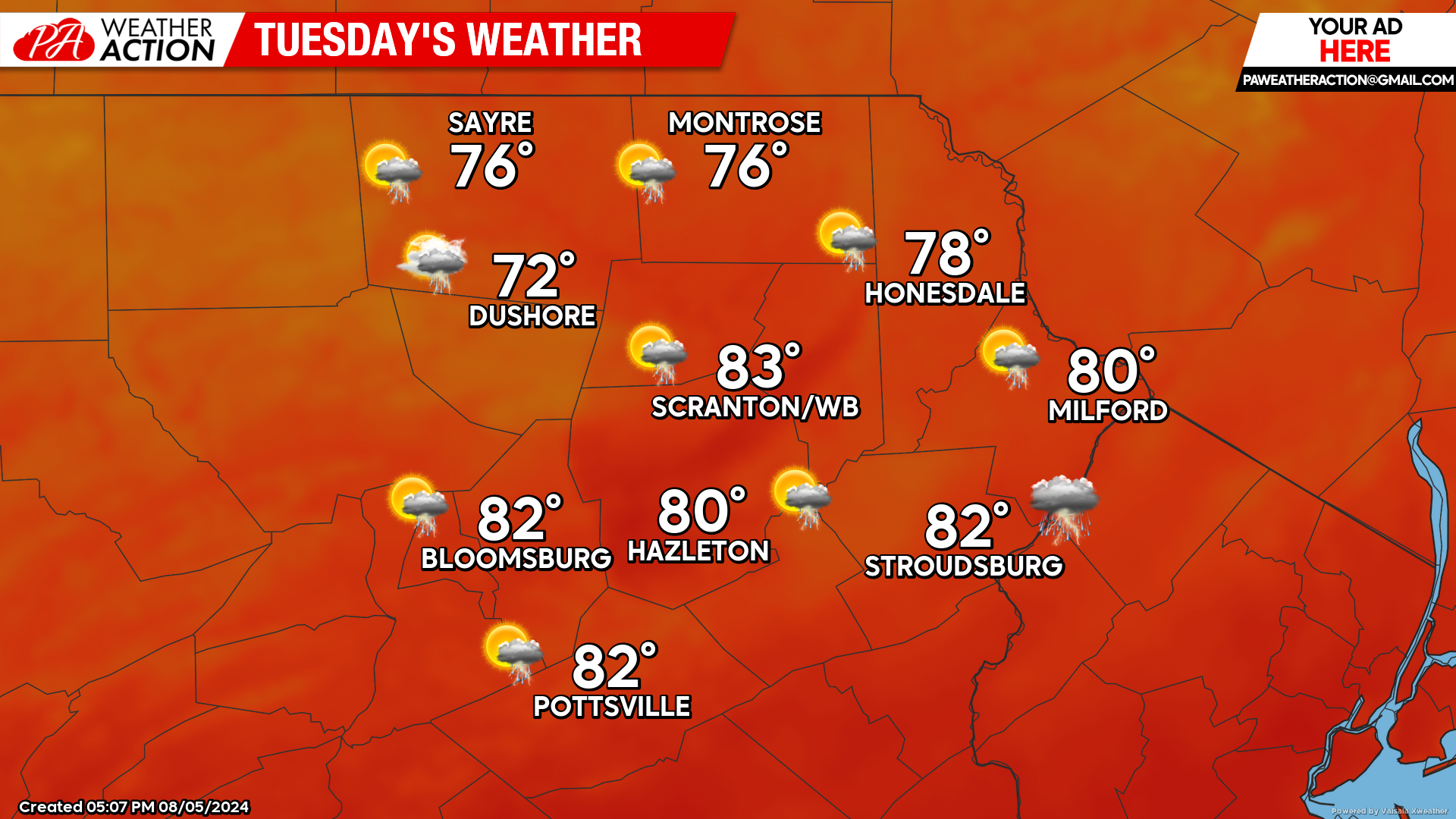
TUESDAY
The incessant humidity will continue. The morning into early afternoon will be mostly dry. A disturbance approaching from the west along with some influence from Debby (who will be along the South Carolina Coast as a tropical storm) will deliver thunderstorms with heavy downpours to the area during the afternoon.
A frontal zone associated with that disturbance will stall east-west across our area Tuesday night, prolonging the thunderstorms and heavy rain. Localized flooding will be possible, and as of Monday evening, the National Weather Service has issued flood watches for our southern counties for late Tuesday into Wednesday.
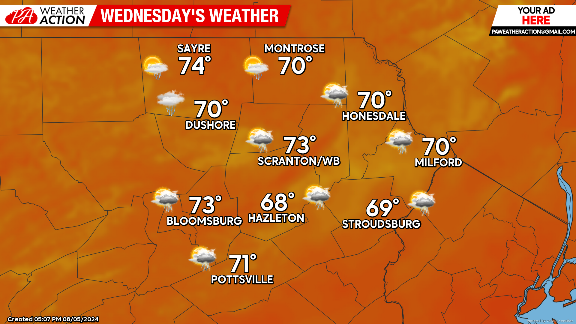
WEDNESDAY
The aforementioned frontal zone will sag southward somewhat, allowing lower temperatures and less-humid air to filter southward into northern Pennsylvania. This could allow for partial clearing over our northern counties, but showers and thunderstorms will persist longer across our southern counties.
Meanwhile Debby’s circulation will continue her moisture-laden creep northward, likely reaching North Carolina by sunset as a borderline tropical storm. Her slow crawl over the piedmont also will allow her to maintain organization while still drawing energy and moisture off the Atlantic.
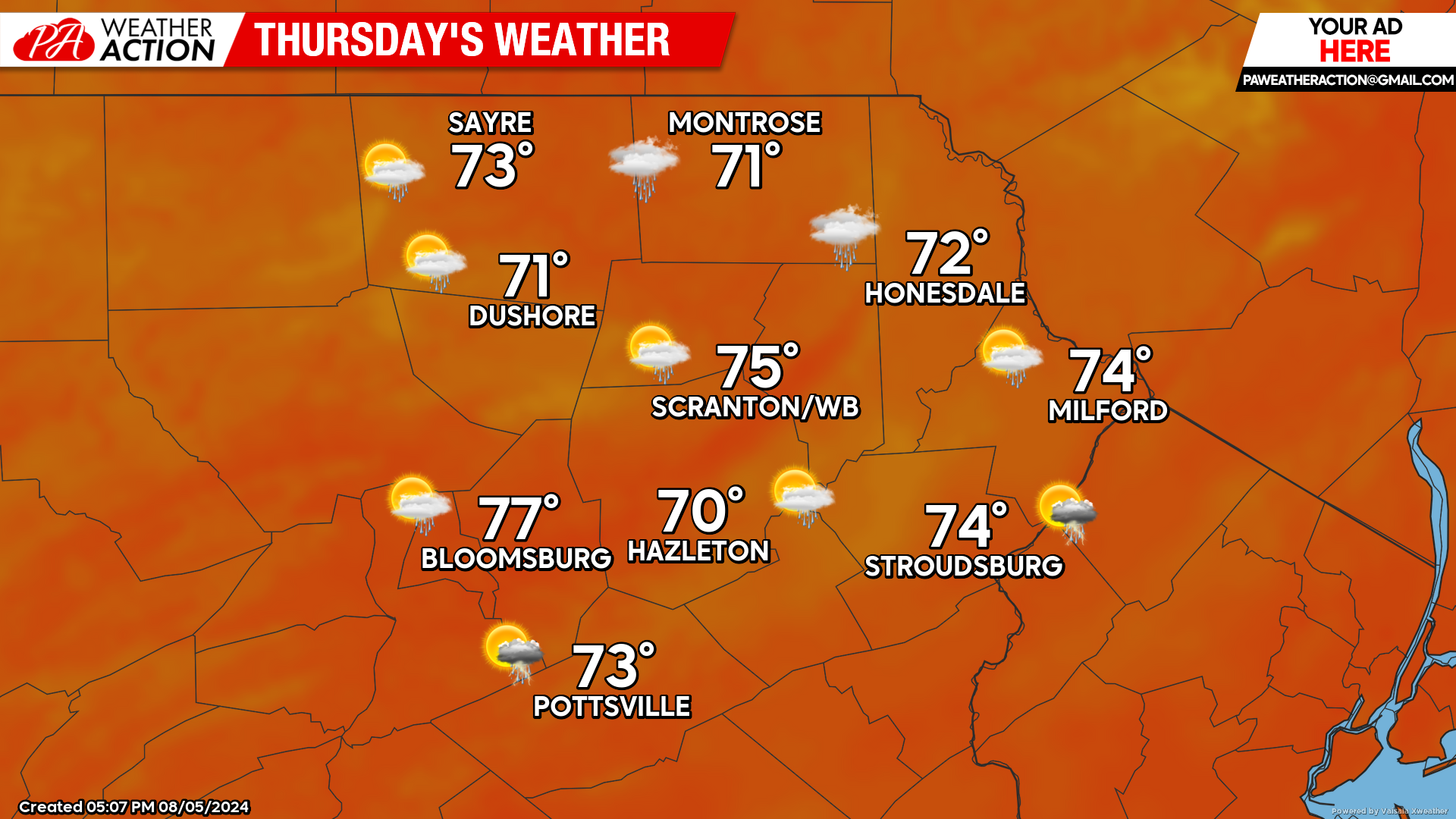
THURSDAY
That frontal zone will remain stalled just south of our area, and thus the low humidity and low temperatures will continue. Showers will expand northward into the region during the afternoon.
BEYOND THURSDAY (Fri-Sun Aug 9-11)
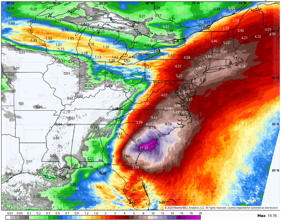
While there is uncertainty in Debby’s ultimate journey, this will be the time period when her moisture will directly interact with the frontal zone stalled across Pennsylvania. Prolonged and widespread heavy rain will be possible, with elevated flooding risks.
For a perspective of Debby’s rainfall potential this week and this weekend, here is the NBM (National Blend of Models) precipitation forecast valid Monday August 5 through Sunday August 11:

You must be logged in to post a comment.