
High pressure across the region will bring the return of above average temperatures through midweek before temperatures drop again Thursday bringing chances for rain and snow in some areas.
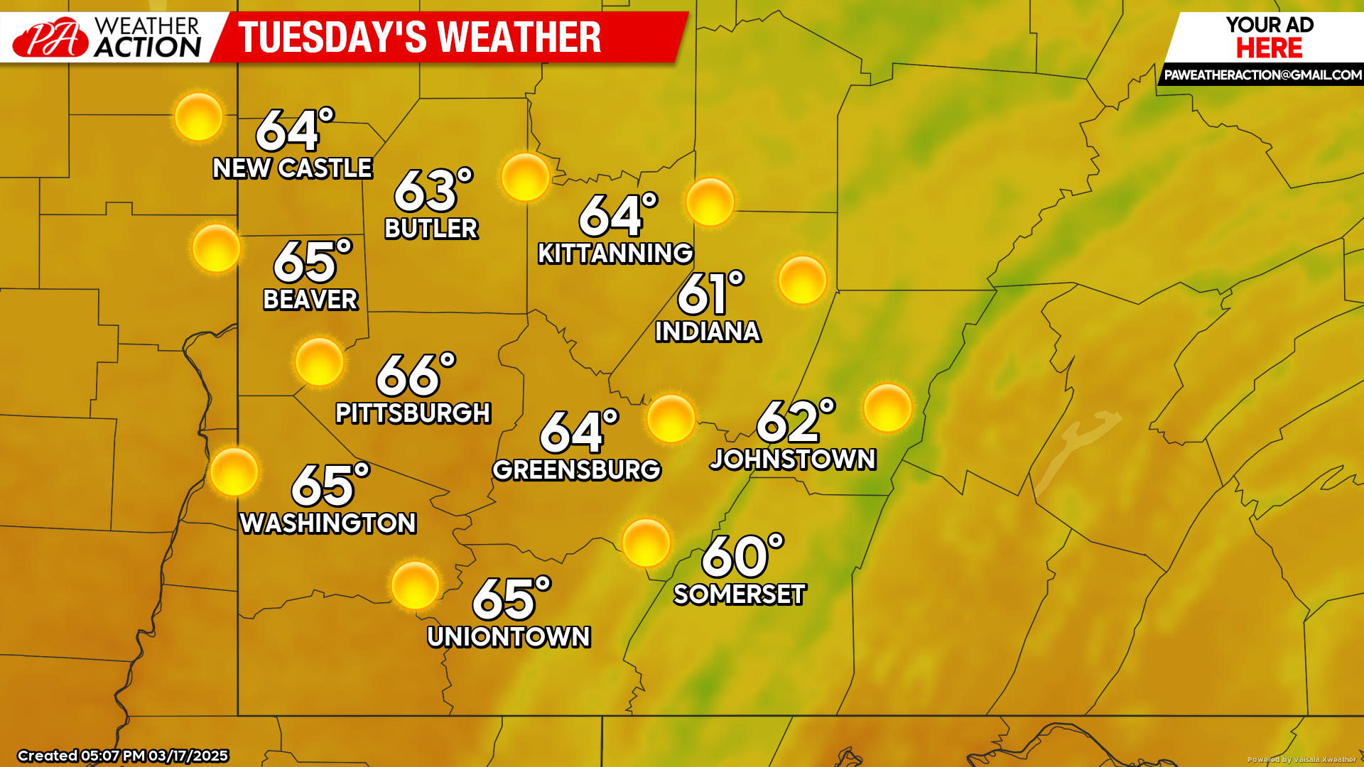
Tuesday
Sunny conditions. Highs will be in the mid to low 60s, lows will be in the mid to low 40s. Winds will be out of the west-southwest at 5-10 mph.
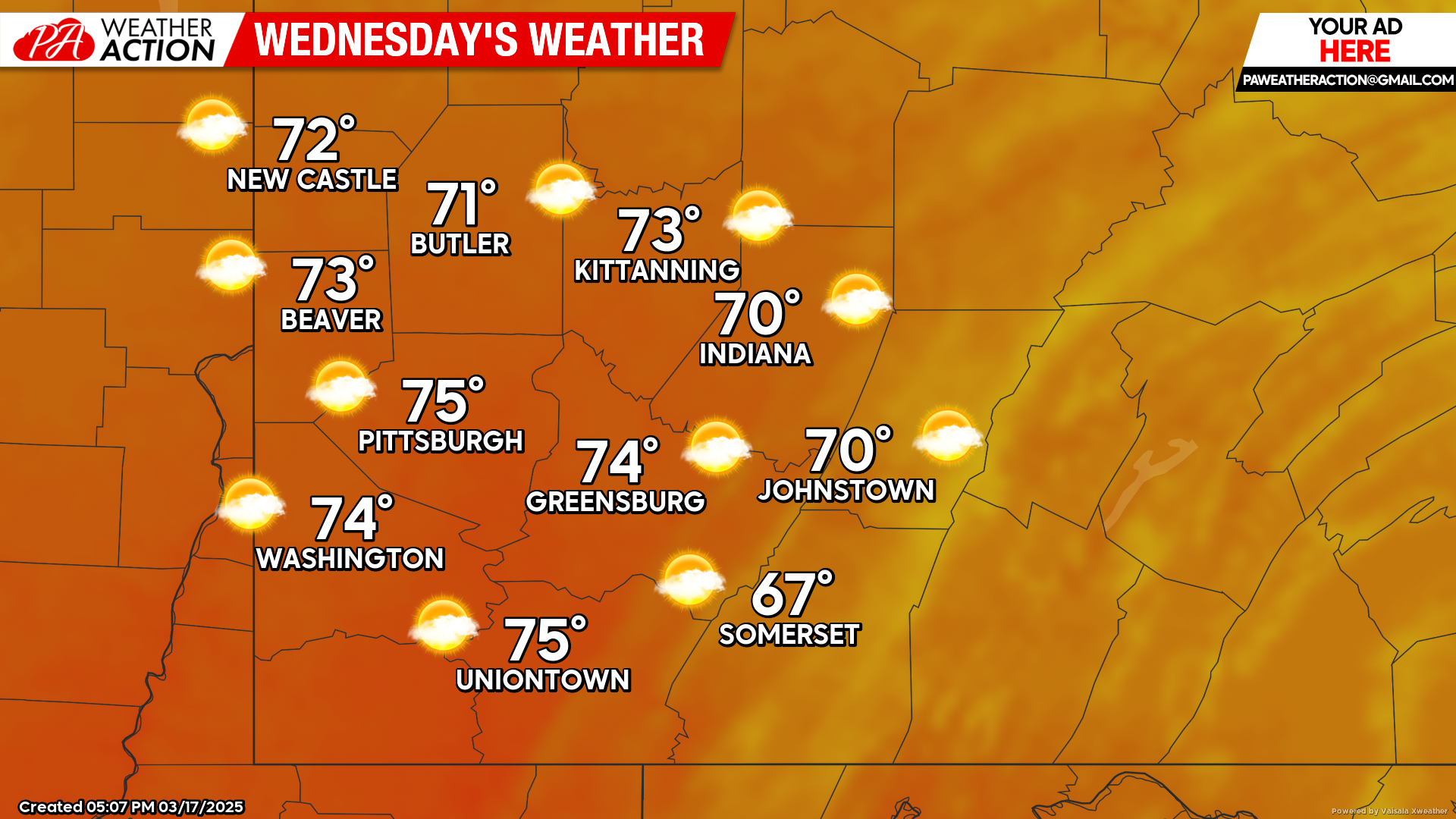
Wednesday
Mostly sunny and warm during the day, chance for showers during the overnight hours. Highs will be in the mid to low 70s, lows will be in the low 50 to upper 40s. Gusty conditions are expected, with winds out of the south at 5-15 mph, wind gusts approaching 25 mph are possible.
Thursday
Showers are expected throughout the day, rain and snow showers are possible in the evening and overnight hours. Highs will be in the mid to low 50s, lows will be in the low 30s to mid 20s. Breezy conditions are expected with a southerly wind expected to shift throughout the day to a northerly wind, wind speed will range between 8-18 mph, wind gusts as high as 45 mph are possible in some areas.

Temperatures are expected to be more seasonable this weekend. Be sure to follow PA Weather Action for more forecasts.

You must be logged in to post a comment.