

This week offered spectacular September weather, featuring blazing blue sky and crisp cool nights. As the Canadian surface high settled over our region Tuesday morning, some of the colder locations snuck beneath 40. There were even some mid 30s up in our northern counties near the New York border! The dog days of summer are now only memories.
The clear, calm overnights allowed fog to develop in the more-protected valleys overnight. The sun’s heat dissipates this fog within a couple hours of sunrise, as is illustrated by this morning’s visible satellite loop. The thin veil of ‘haze’ (not the solid-white of clouds) is high-level smoke from forest fires in the northern Rockies and western Canada.
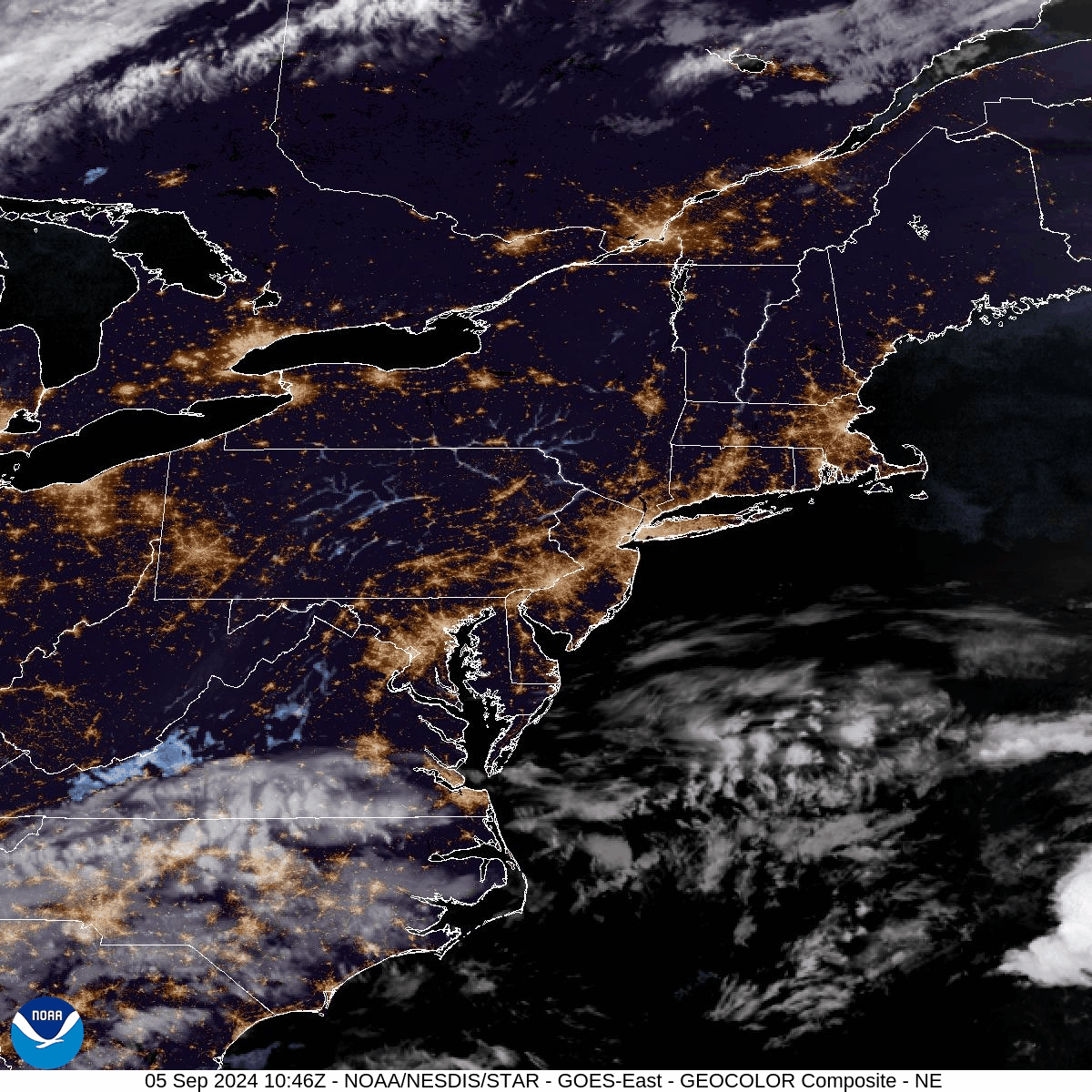
You can also see a system in the Atlantic to our southeast that has somewhat of a tropical appearance in its low-level circulation. As this system spends some quality time over the warm Gulf Stream through Friday night, it has a small chance of acquiring tropical characteristics and earning a name (albeit not very likely).
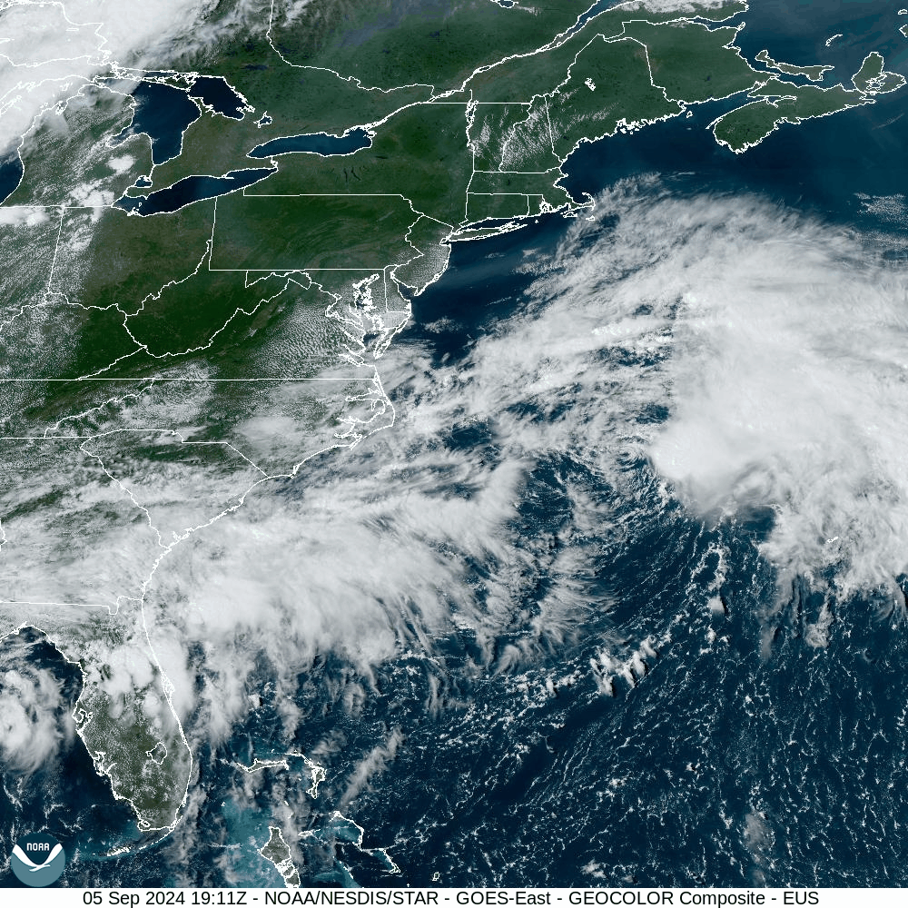
Regardless, it will continue its northward journey and primarily affect the Canadian Maritimes this weekend. Here is this evening’s visible satellite loop, where you can see its circulation pushing some low spotty clouds westward into New Jersey. This is indicative of maritime moisture which will affect our area Friday through the frontal passage on Saturday.
FRIDAY
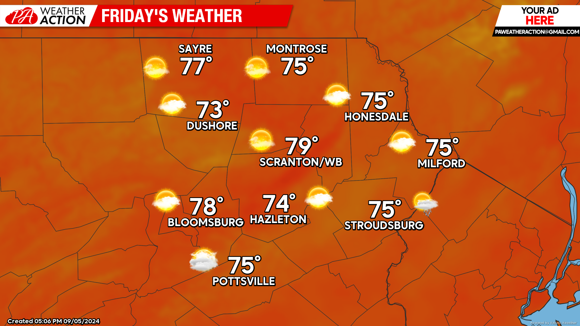
A cold front will push eastward into northwestern Pennsylvania during the afternoon. Meanwhile, inspired in part by the aforementioned offshore system, humid low-level air will be pushed westward into our area Thursday night through Friday. Low-level clouds and occasional sprinkles and light showers will move westward off the ocean. These will mostly affect our eastern counties.
SATURDAY
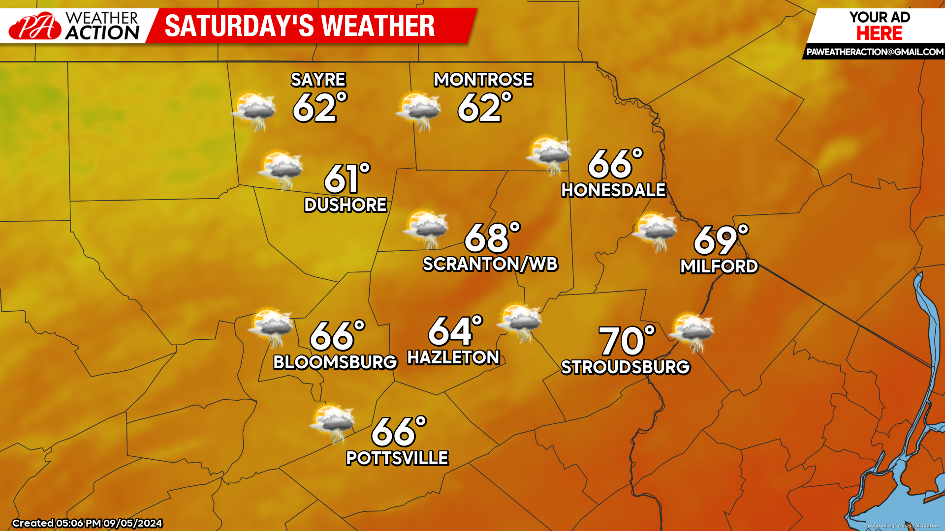
With humidity back to almost-summer levels, overnight lows Friday night into Saturday morning will be quite mild with widespread 60s. The low clouds and scattered light showers off the ocean will affect most of the area.
The cold front will push through Bradford and Sullivan counties early in the afternoon, and reach the Delaware River around 5 or 6pm. A line of gusty showers and thunderstorms will accompany the frontal passage, followed by an hour or so of residual showers. The front will quickly scour away the humidity and usher in much lower temperatures by Sunday morning.
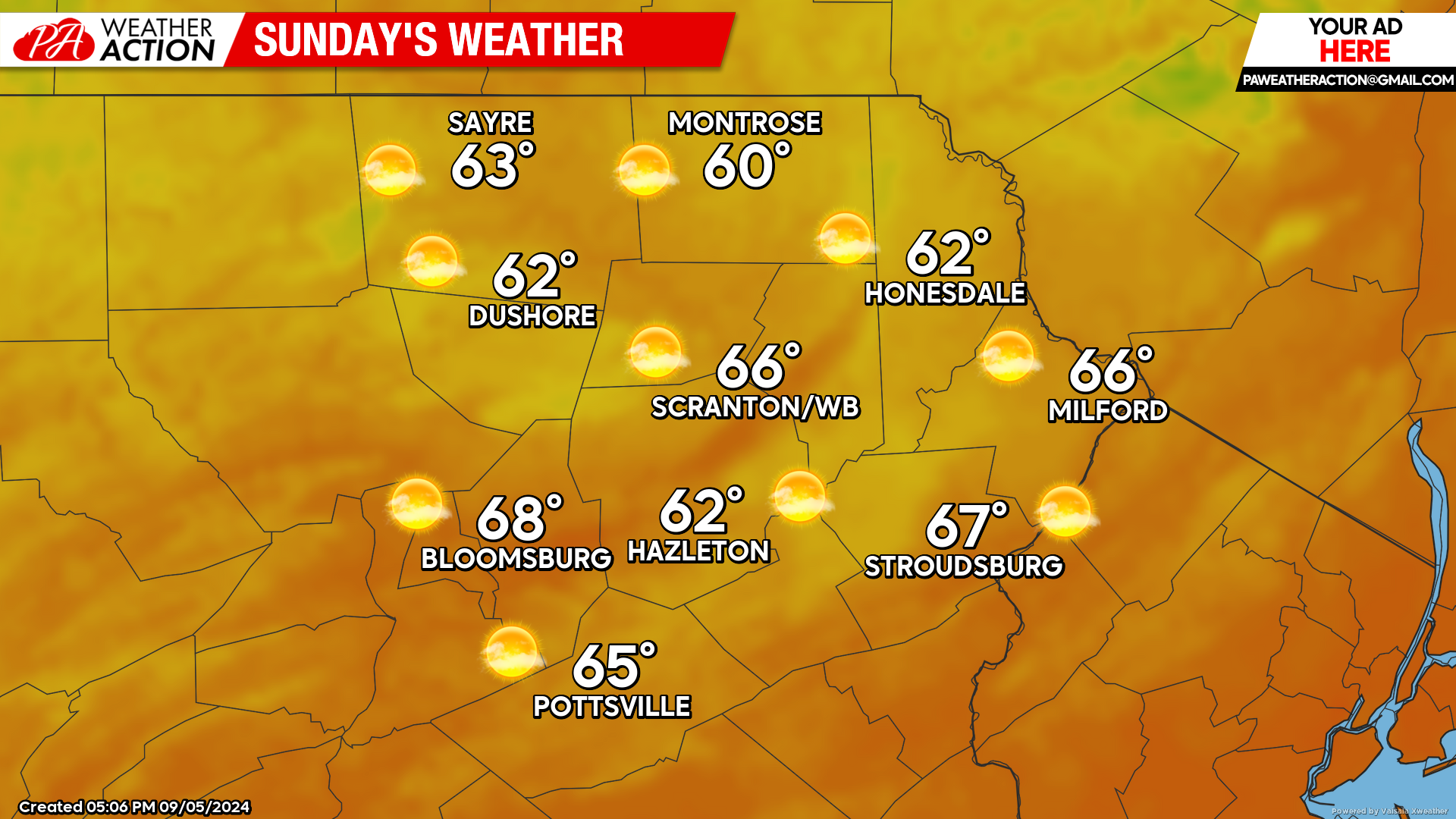
SUNDAY
Sunday morning will dawn with widespread lows in the 40s across the area. Blazing sunshine will warm temperatures into the 60s by afternoon.
BEYOND SUNDAY (Monday-Friday Sept 9-13)
If you enjoy warm September days and dry weather, you will be very happy with next week’s pattern. The early part of the week will feature sunny conditions and low humidity, with highs in the 70s and lows in the 40s. However, temperatures and humidity will slowly increase over the course of the week, with highs reaching into the 80s in the lower elevations for Wed-Fri period. Sunshine and dry weather should continue through Friday. Enjoy!

You must be logged in to post a comment.