Good afternoon, after a day of huge tropical downpours with major flooding in South Florida, we will see more of that tropical moisture into the weekend in the same areas. There is also a threat for more severe weather in the Midwest this week.
Severe Weather Outlook for Wednesday
An enhanced risk for severe weather today for the Upper Midwest today. Scattered severe storms are expected with significant damaging winds, large hail and tornadoes this afternoon and evening as a short wave trough moves into the area. Please see the SPC risk map 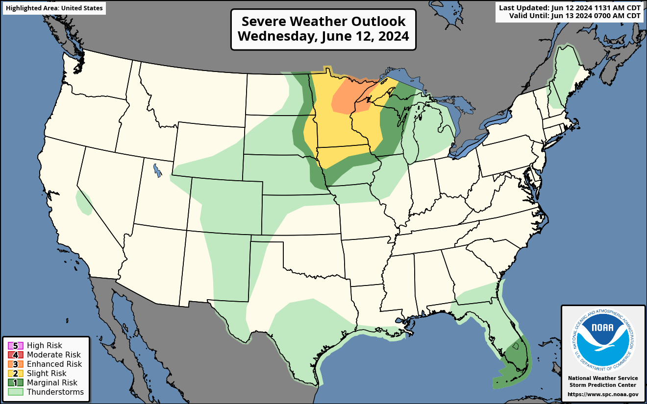
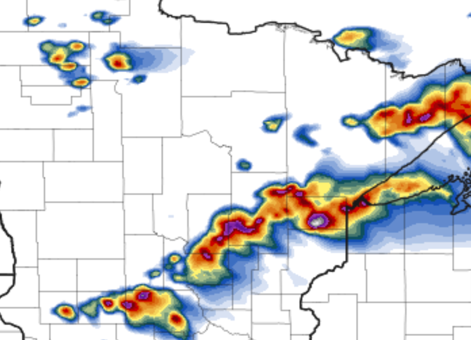
HRRR Future Radar for Wednesday
The HRRR future radar shows a line of storms moving through the Upper Midwest now with more of a severe risk of storms later tonight after 6 pm. This is the time of the greatest threat of significant damaging winds, large hail and a few tornadoes in MN and WI. There will be multiple lines of severe storms from afternoon through evening as the short wave trough moves East. 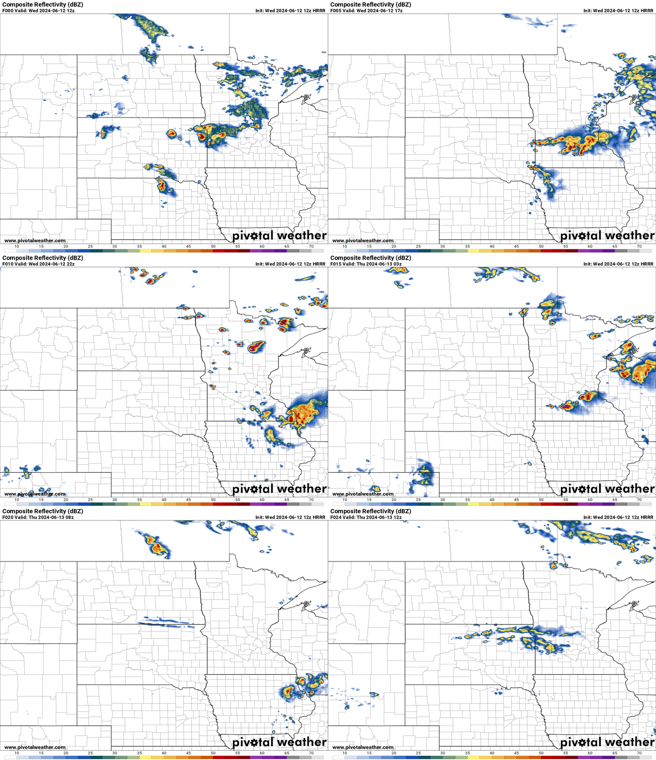
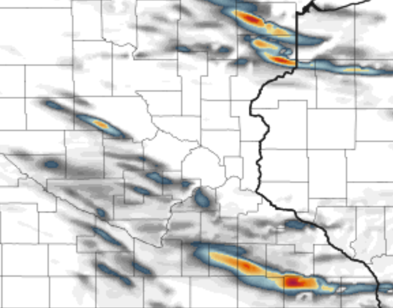
Helicity Storm Tracks for Wednesday
The HRRR model shows a swath of damaging winds, large hail and a few tornadoes are shown in parts of MN for this evening. A line of severe storms will be moving through the area as the short wave trough moves East.
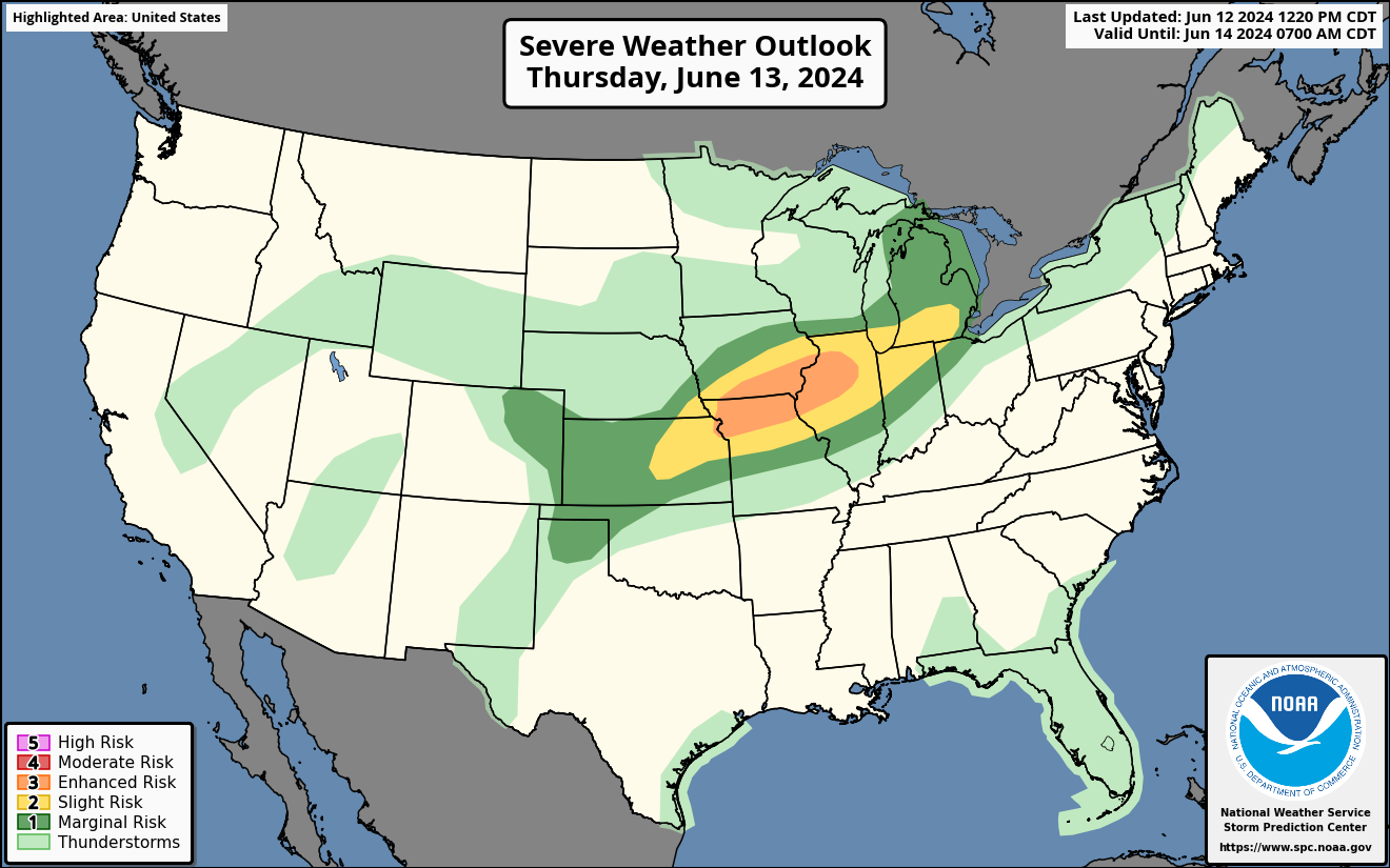
Severe Weather Outlook for Thursday
A enhanced risk of severe weather for Thursday in the Midwest. The threat for severe thunderstorms are most likely in IA, MO and IL on Thursday. Large hail, significant damaging winds and a couple of tornadoes are possible.
A couple of short wave troughs will be moving into the Midwest tomorrow afternoon and evening. As a strong jet stream moves over the top this will cause severe storms to form and move East.
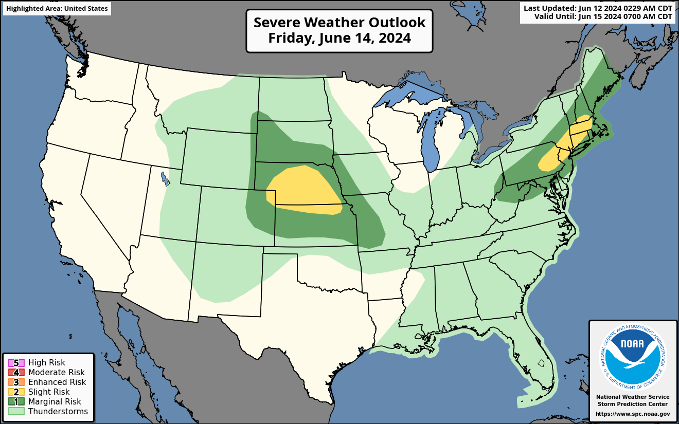
Severe Weather Outlook for Friday
A slight risk of severe weather for Friday in the Plains and also the Northeast states. Large hail and damaging winds are the main threat.
Scattered thunderstorms are expected on Friday in the Central Plains behind the high pressure ridge. A upper level low will be moving into the Northeast with a cold front. This is where storms will form on the line with damaging winds being the main threat.
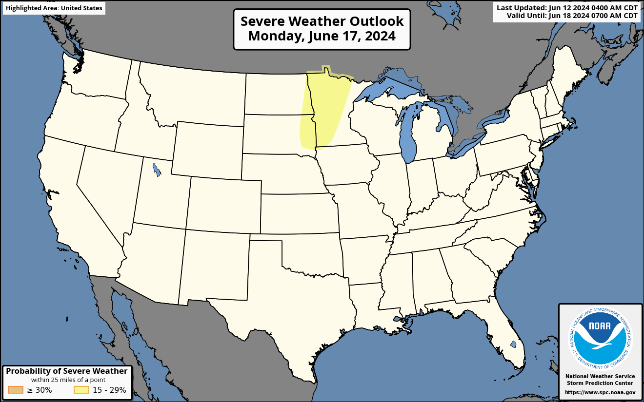
Severe Weather risk for the Northern Plains and Minnesota on Monday
A upper level low will be moving through the Northern Plains and Minnesota on Monday. This will cause an isolated storm threat to occur with large hail and severe winds as the main threat.
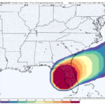
Another Round of Heavy Tropical Downpours Today in SW Florida
As the tropical wave interacts with the front over Florida, this will cause a monsoon flow with more heavy rains this week with another 10 inches or more of rain, on top of the 10 inches plus of rain that has already fallen. This will lead to more major flooding over those saturated areas.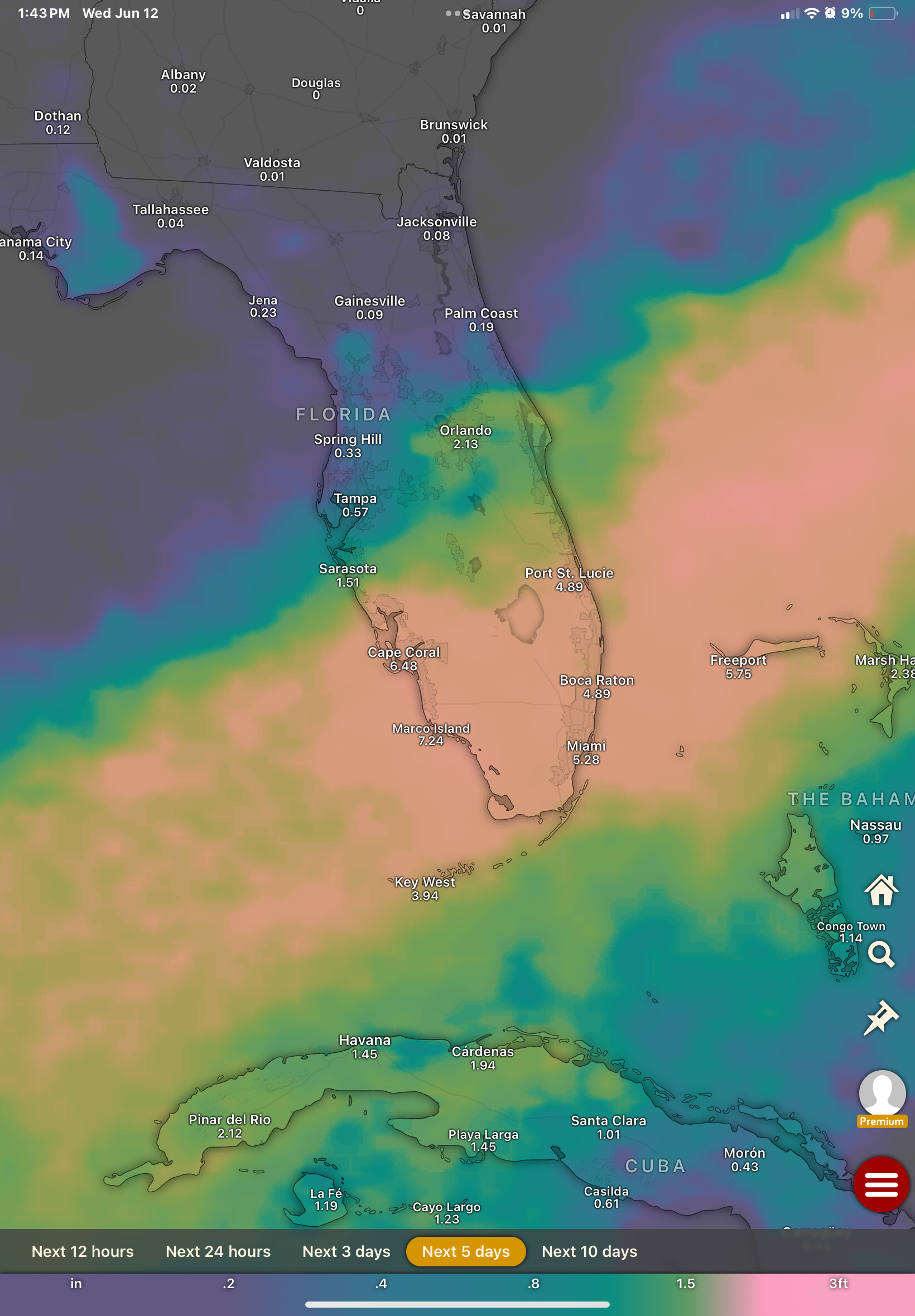


You must be logged in to post a comment.