Good morning everyone, after a rough night of severe weather with large hail, severe damaging winds and tornadoes, it’s time to get ready for more severe weather this week as a series of fronts move through.
Here is Monday’s Severe Weather Threat
An enhanced risk for the Central Plains on Monday. Significant hail and significant damaging winds with a chance of tornadoes for NE CO/Western NE. A slight chance of severe weather from Eastern CO/SE WY to Northern Illinois. Please see SPC threat map below. 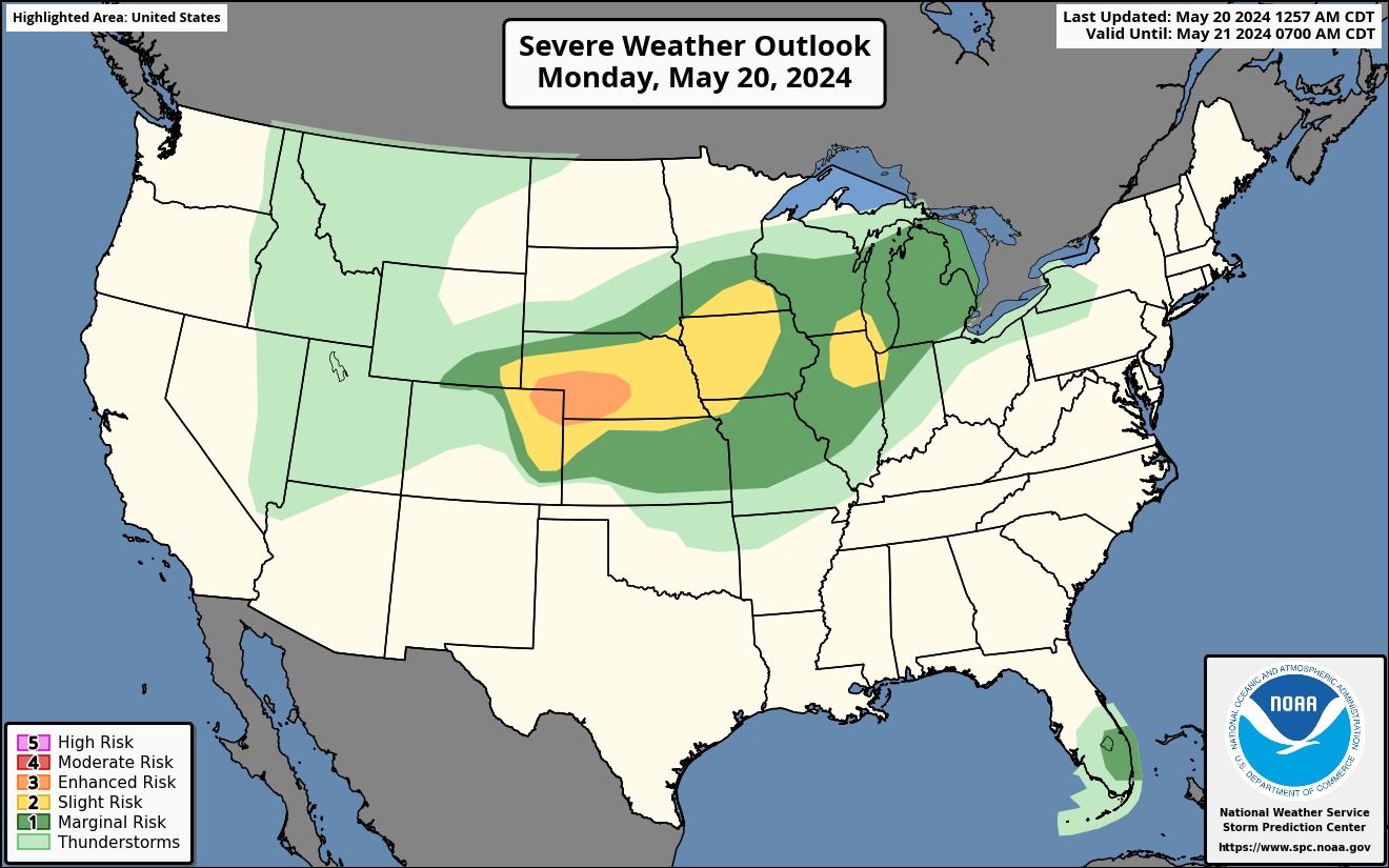
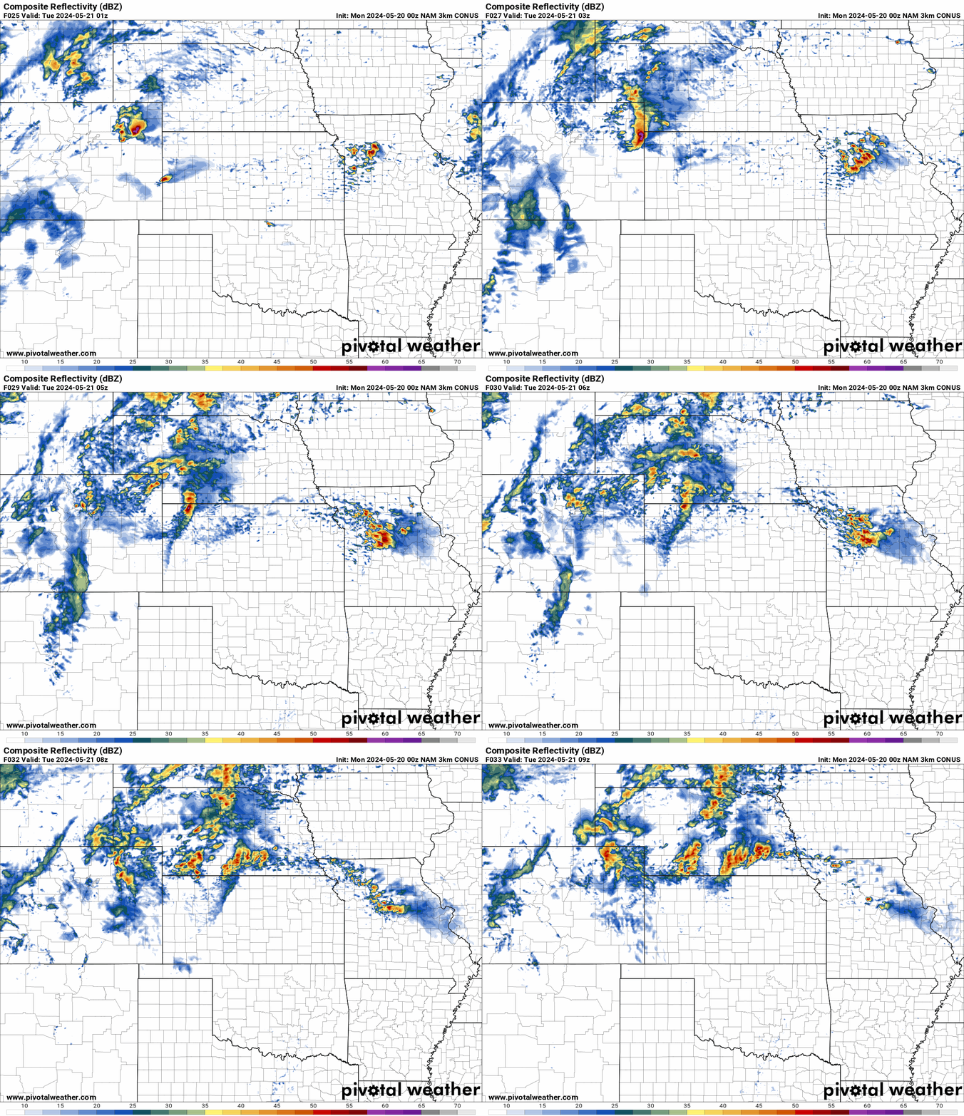
NAM Future Radar for Monday
The NAM future radar shows a line of severe storms starting after 6 pm in SE WY and NE CO with significant hail and significant damaging winds with a chance of tornadoes. The front will then move East into Western and Panhandle of NE, KS, Southeast SD, IA, Southern MN, SE WI, Northern IL and NW IN with damaging winds, large hail and a low risk of tornadoes.
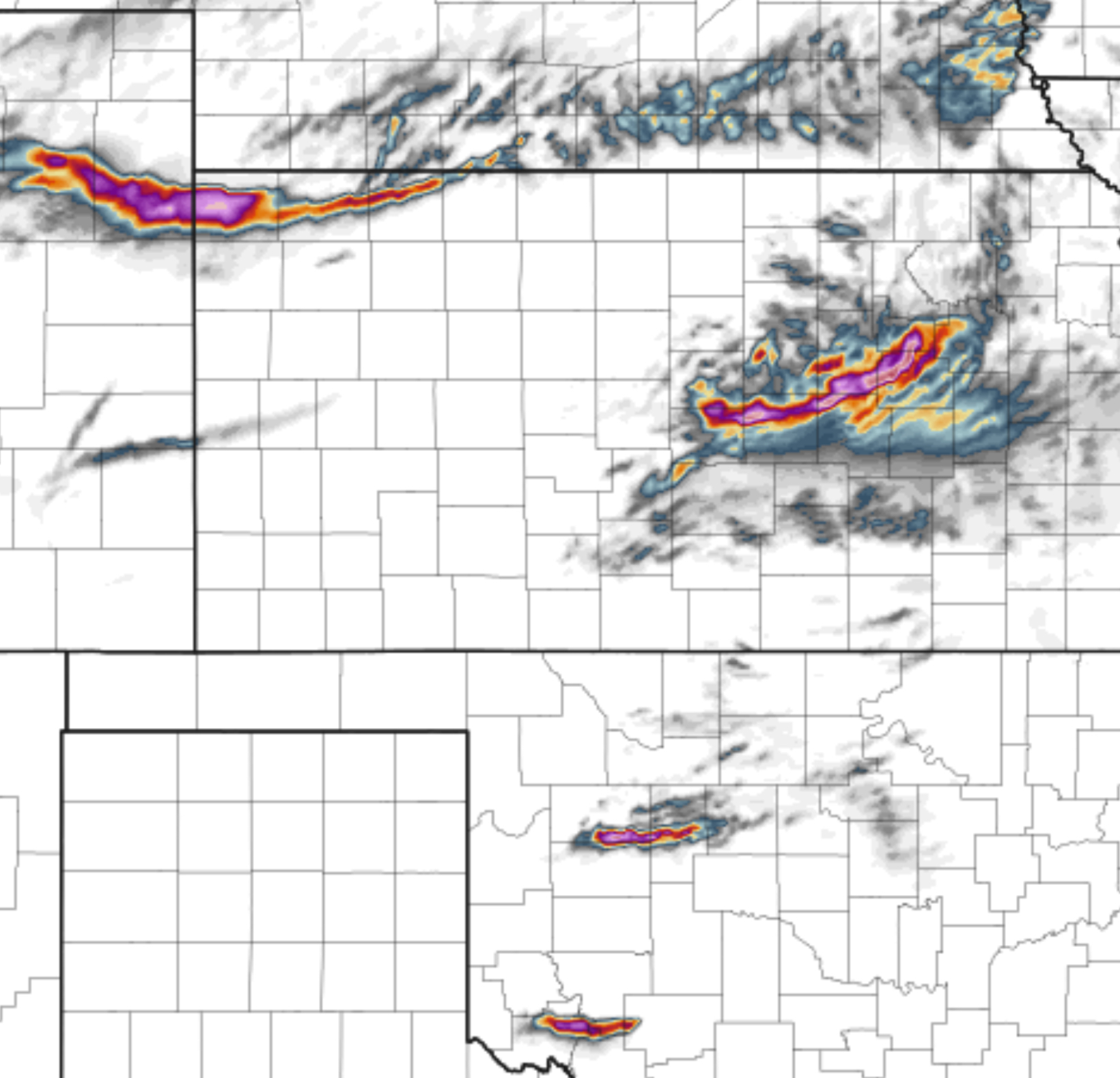
NAM Helicity Tracks for Monday
A swath of damaging winds and large hail tracks are highlighted with possible tornadoes on Monday afternoon. A line of storms are expected to begin developing after 3 pm tomorrow starting in NE CO, SE WY and Western/Panhandle of NE then move East tonight into overnight. Please see loop below.
Tuesday’s Severe Weather Threat
Significant Large hail, significant tornado risk and and damaging winds are expected in the Midwest as a powerful cyclone moves through the area on Tuesday. The highest threat for significant tornado risk and significant hail will be IA, SW WI, NW IL and parts of Northern MO. Please see SPC risk map below. 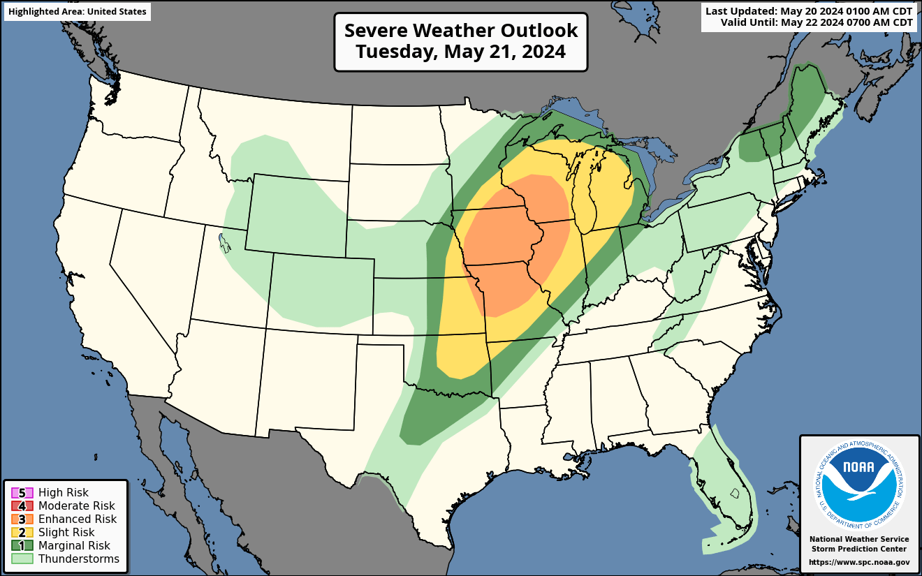
Significant Tornado Parameter for Tuesday
A significant tornado risk is expected in the Midwest on Tuesday afternoon after 3 pm cst. The greatest threat for significant tornadoes will be IA, SW WI, and NW IL. Please see map below. 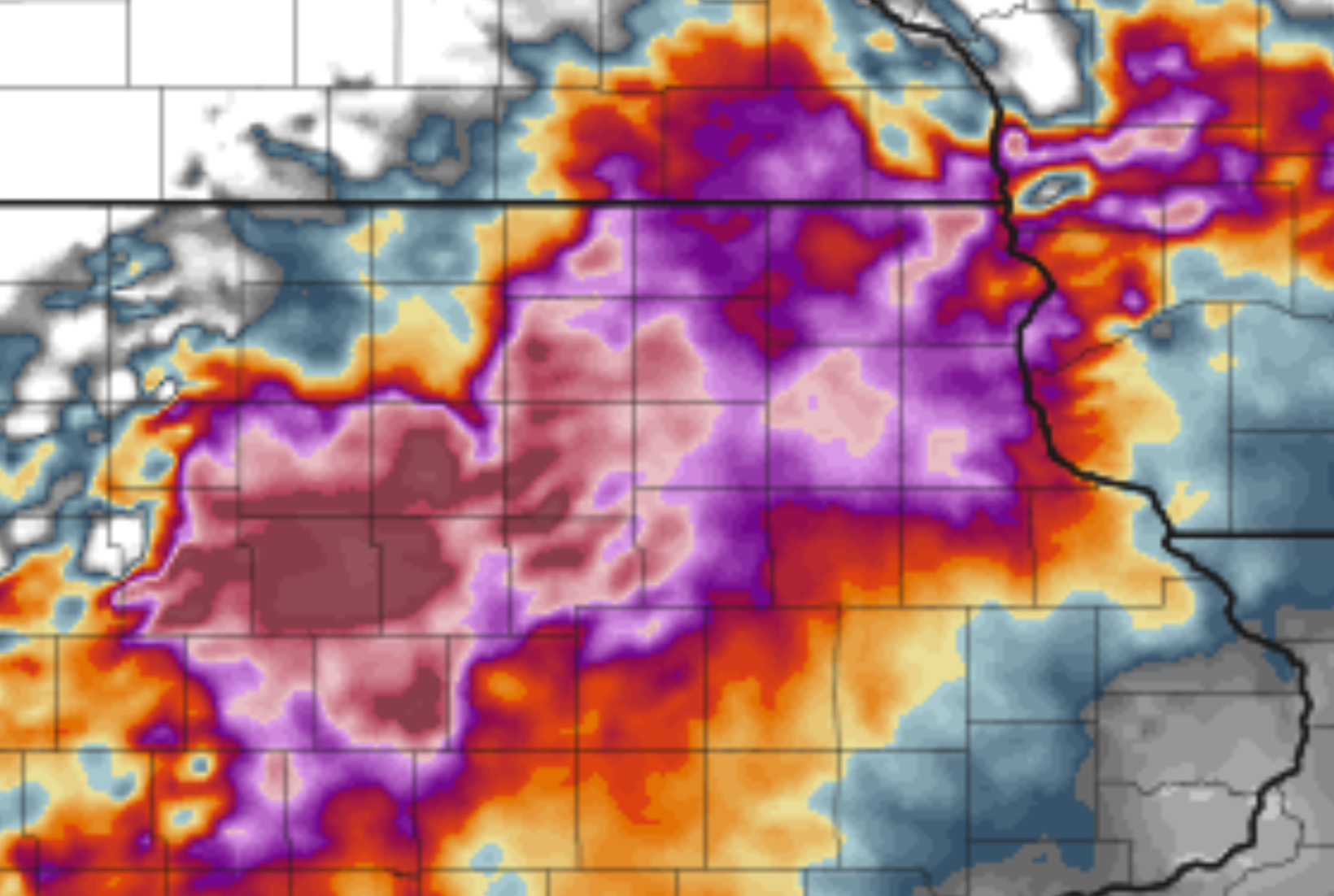
Wednesday’s Severe Weather Risk
Large hail, damaging winds with possible tornadoes on Wednesday as a trough of low pressure with a cold front will be moving through the plains, Midwest, and parts of Dixie Alley. This will include Central Texas to Ohio. Please see SPC risk map below. 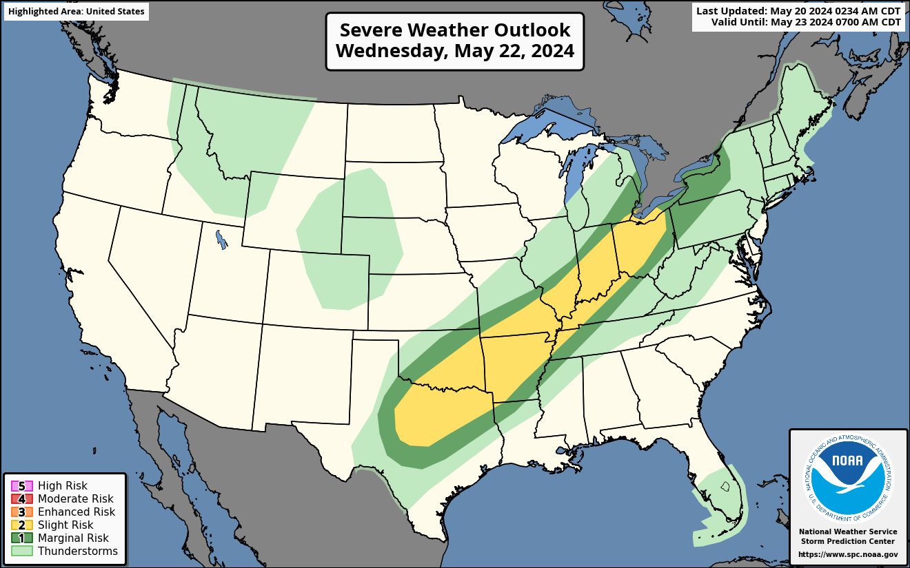
Severe Weather is expected through the end of the week.
A look into the rest of the week shows a very active weather pattern into Thursday for now with a possible threat this Memorial Day weekend into the Plains and parts of the Mid South. Stay tuned for further updates as we get them. Enjoy your Monday. 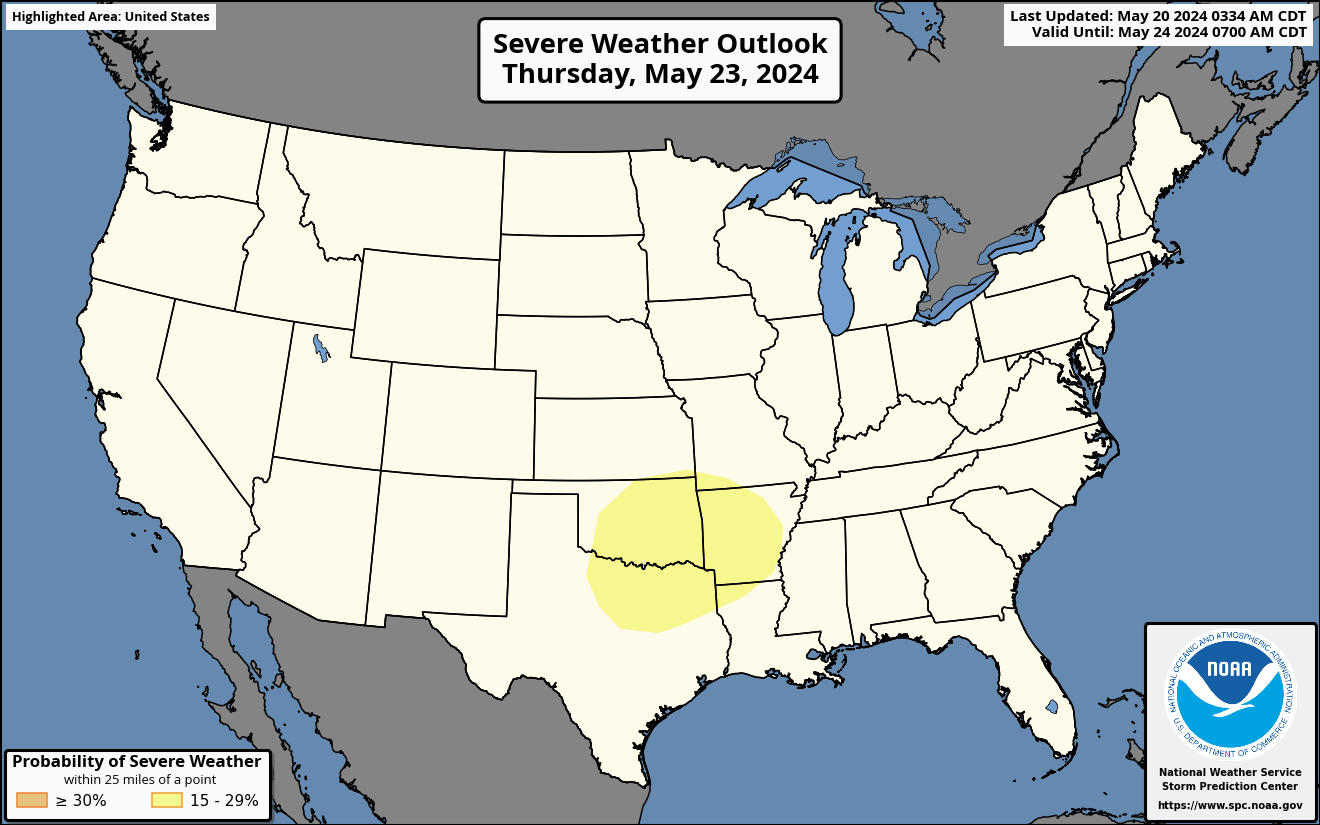


You must be logged in to post a comment.