After the start of the week with an active weather pattern of severe weather with lots of flooding, the severe weather now shifts to the Plains,Carolinas and Florida.
Severe weather pushes into the Southern Plains, Carolinas and Florida on Wednesday, May 15th.
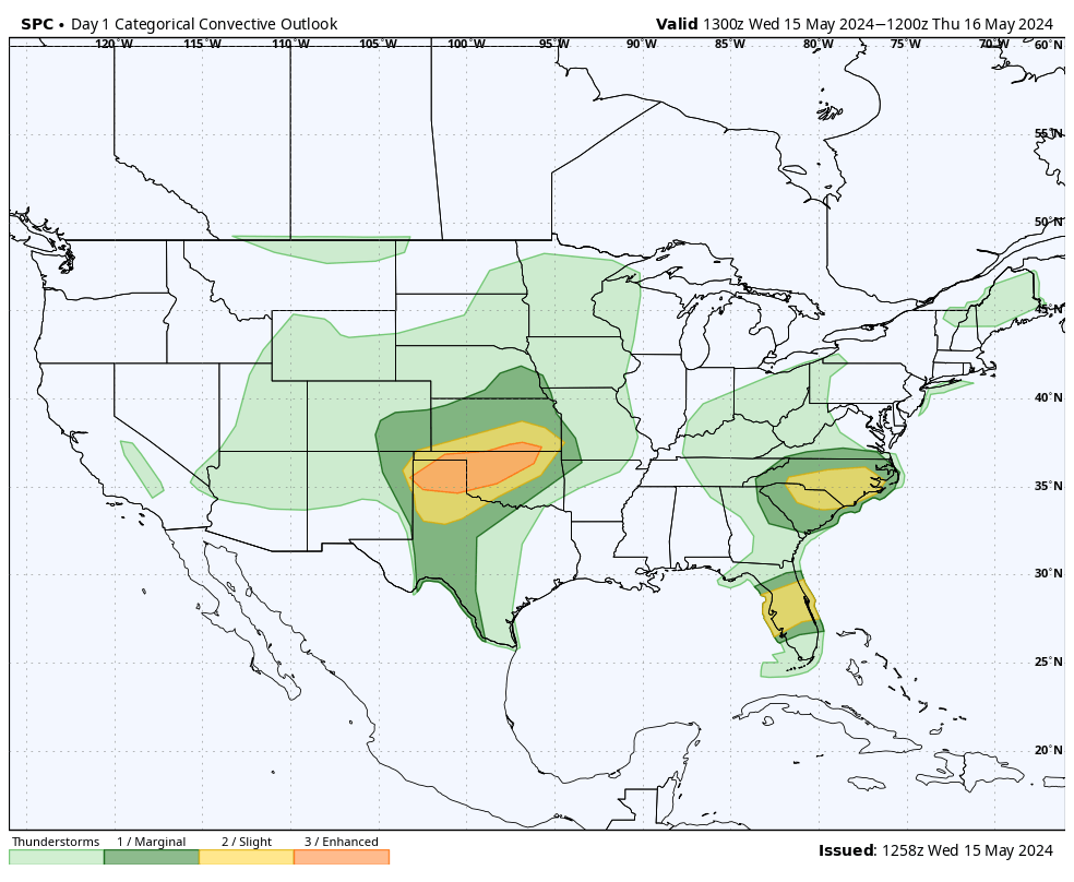
There is an enhanced risk of severe storms Wednesday pushing into the Southern Plains with all modes of severe weather, there is a slight risk of severe weather for the Southeast. View the SPC risk map below.
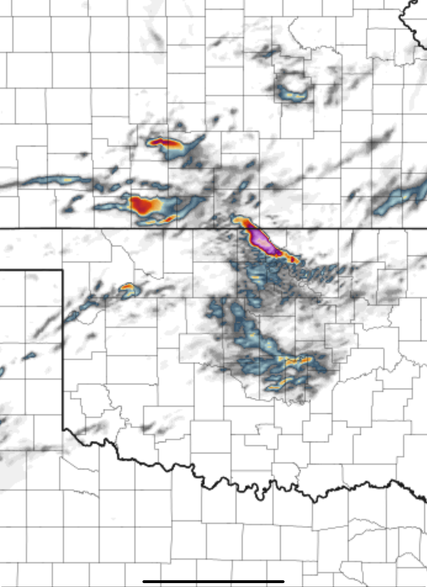
The HRRR Updraft Helicity 12z run for Wednesday
Storms are forecast to start firing after 6 pm tonight in the Texas Panhandle and will move East towards Kansas and Oklahoma by Midnight.
Large hail, tornadoes and damaging winds are all possible with this system. The tornado threat will increase later tonight as the low level jet kicks in. 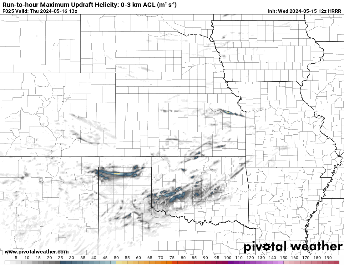
HRRR future radar for today in the Southern Plains
Discrete supercells are expected to form on the dry line later this afternoon in the Texas Panhandle and move East before the cold front takes over later tonight and into morning through Kansas, Texas and Oklahoma.
Large hail, tornadoes and damaging winds are all possible. 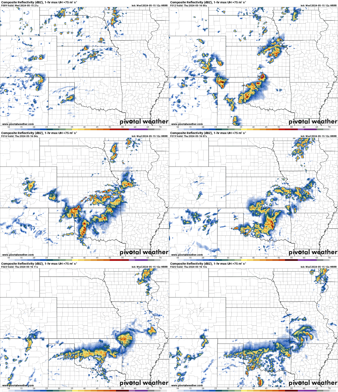
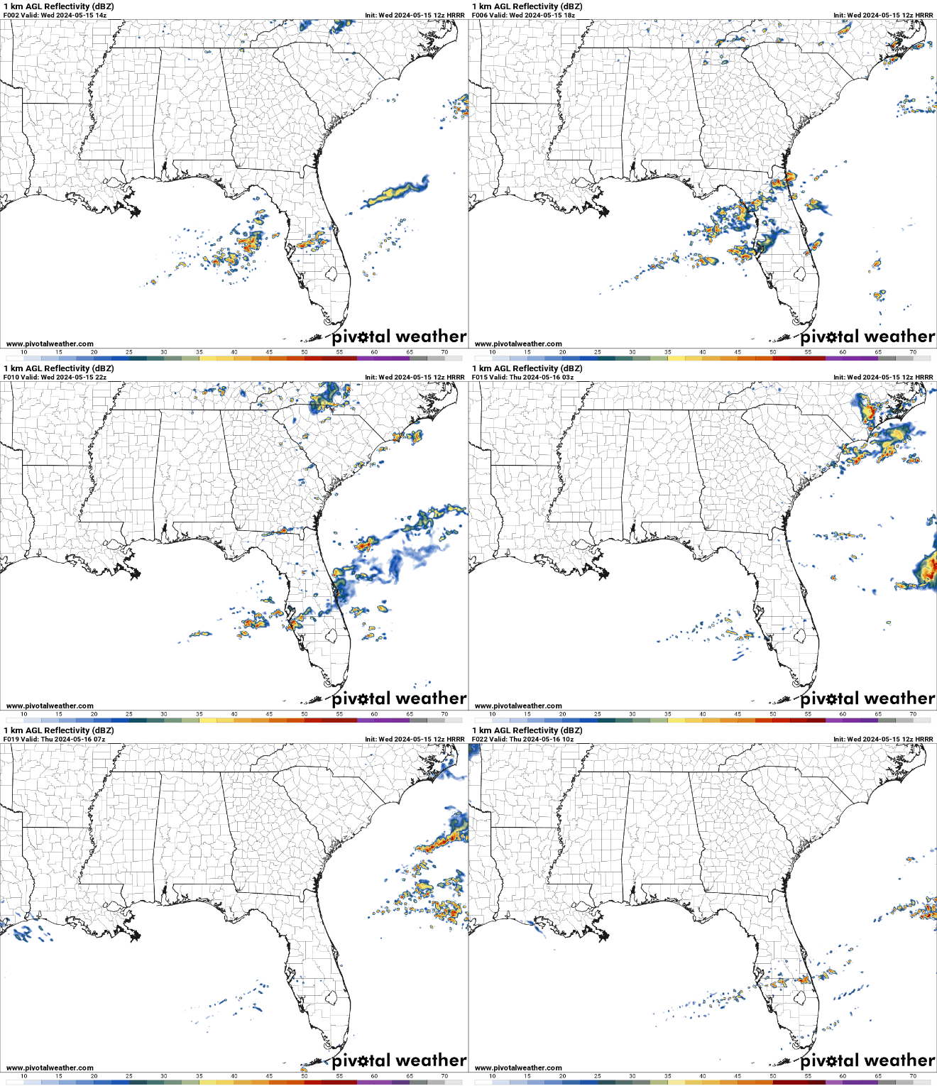
HRRR future radar loop for today in the Southeast
Scattered severe storms are expected this morning and afternoon for Florida and the Carolinas.
Large hail, tornadoes and damaging winds are possible today for Florida and the Carolinas as a cold front pushes through the area.
Nadocast tornado risk for today
Tornadoes are possible today for Oklahoma, Kansas, Texas, Florida and the Carolinas. The highest risks is in Northern Oklahoma, South Central Kansas and Central Florida.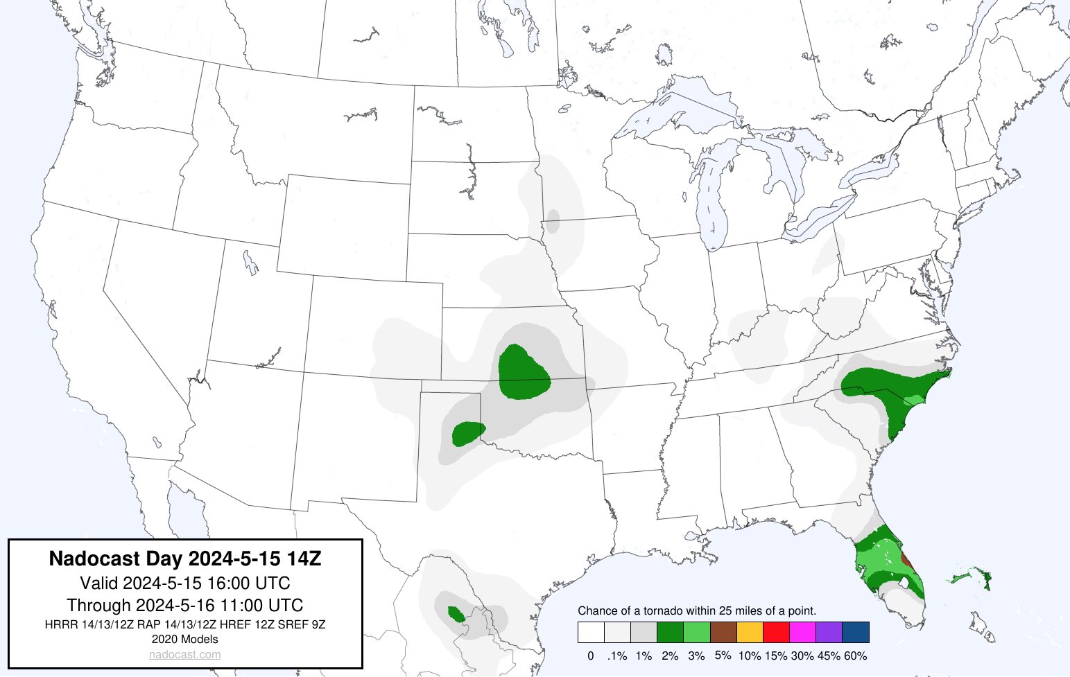
Another round of severe weather for the South Plains on Thursday.
There is a slight risk of severe weather on Thursday across Texas. Strong to severe thunderstorms are possible on Thursday for North/Central Texas into East/Southeast Texas.
Isolated thunderstorms are possible in the Mid Mississippi Valley. Large hail, tornadoes and damaging winds are possible in those mentioned areas. 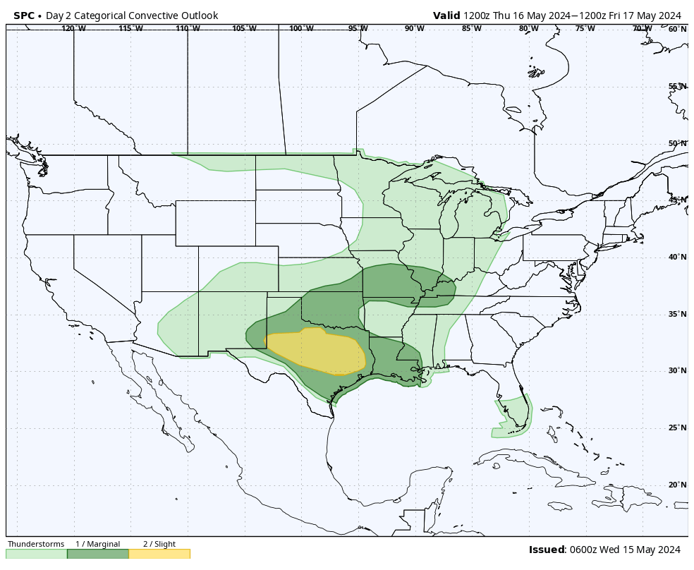 Nadocast tornado risk for Thursday, May 15th
A elevated risk for tornadoes on Thursday from West/Central Texas, East Texas into Louisiana.
A tornado threat is also there in the Mid Mississippi Valley for Eastern Missouri and Southern Illinois. 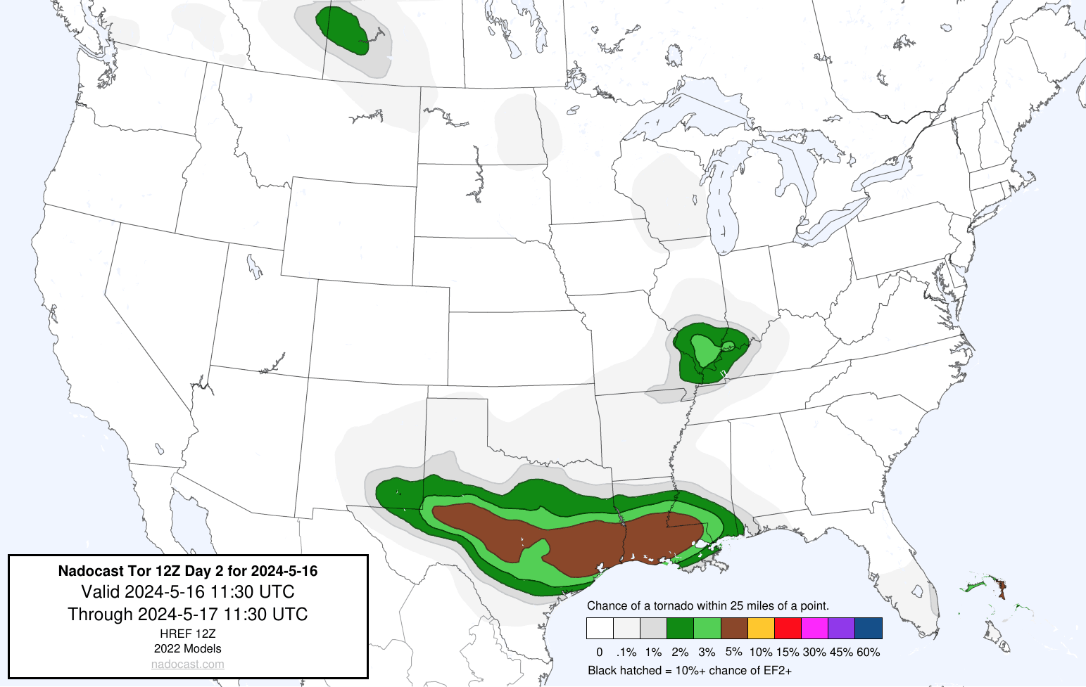
Severe weather threat continues for Friday
There is a slight risk for severe weather on Friday for far SE TX, much of Louisiana, Central/Southern Mississippi and Western Alabama.
Large hail, tornadoes and damaging winds are possible as the cold front pushes East. 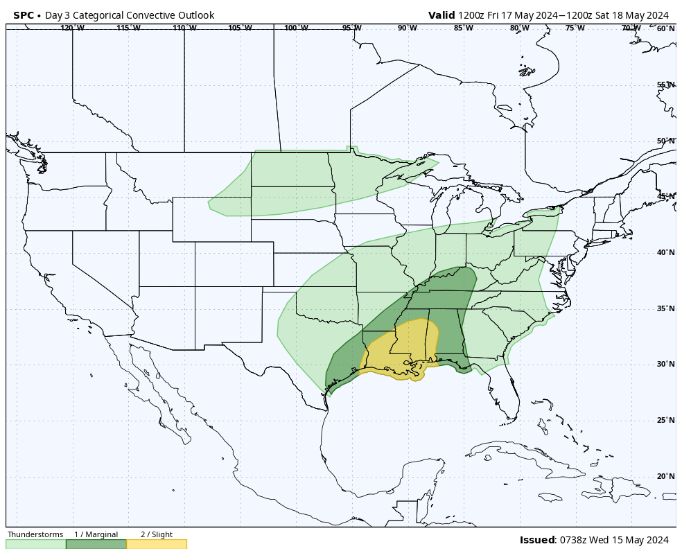
Stay tuned for our next severe weather update tomorrow morning.

You must be logged in to post a comment.