Good morning everyone, After a long week of severe weather, we look into the weekend with another round of severe weather
Severe Weather Outlook for Friday
A slight chance of severe weather on Friday in the Plains and Mid South.
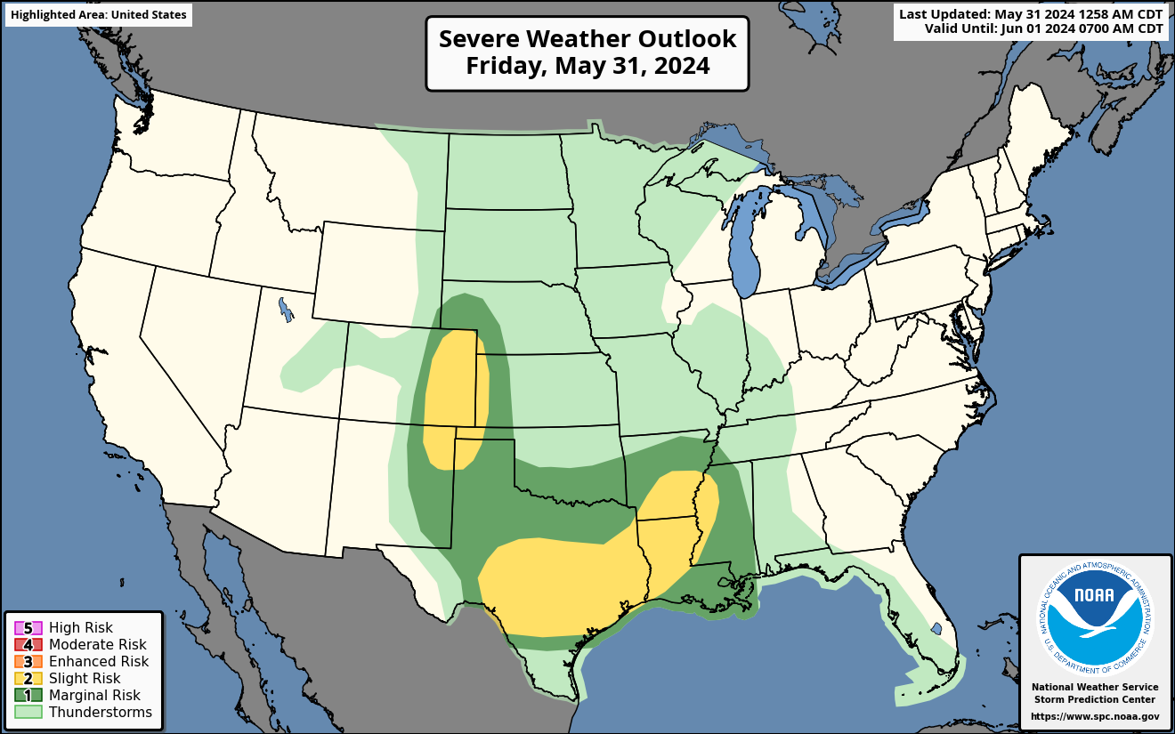
Scattered severe storms are possible today in the Mid South with large hail, severe wind gusts and an isolated tornado threat. There is also a severe weather threat for the plains later this evening with large hail, damaging winds and a low threat of tornadoes. Please see risk map below.
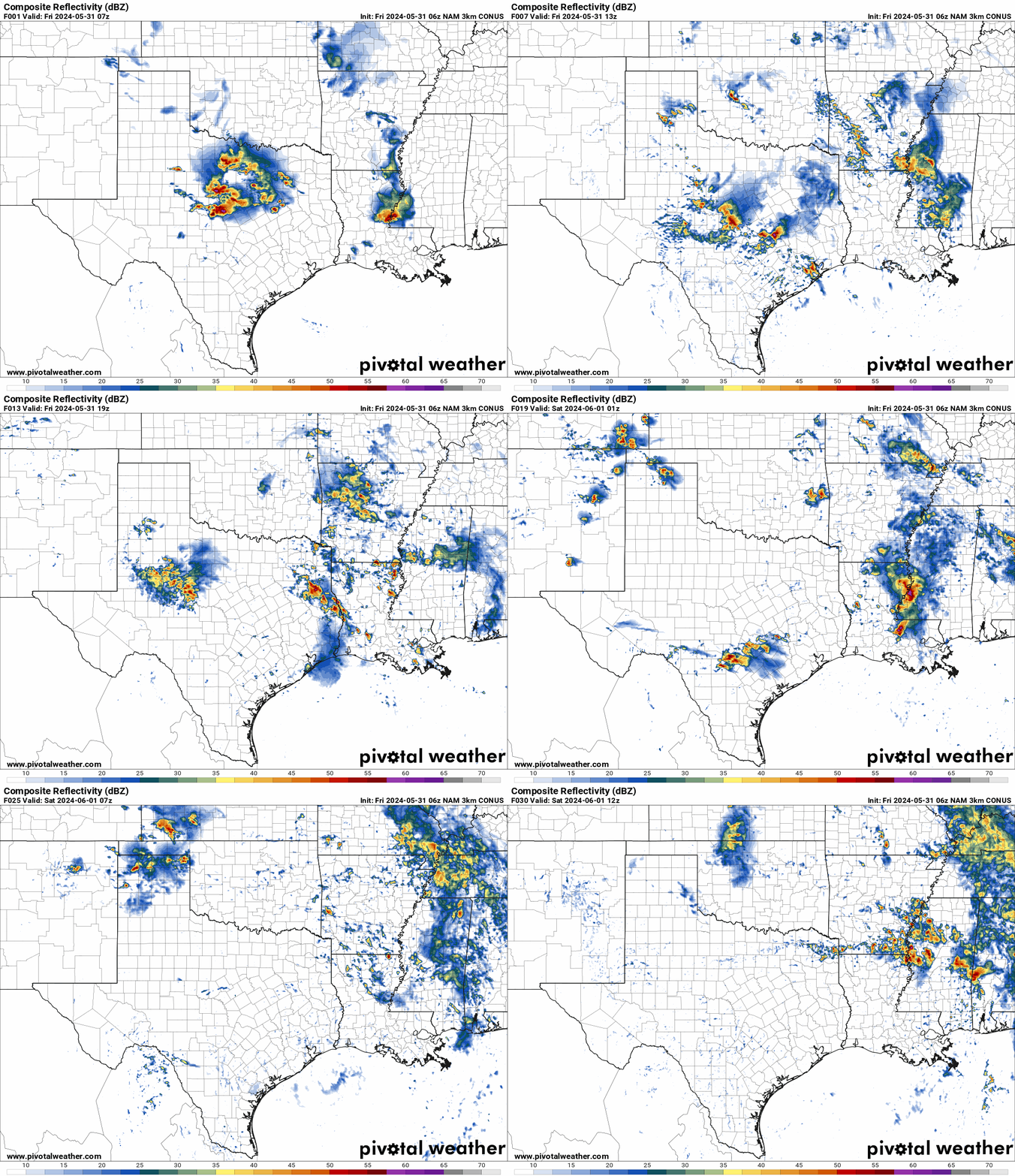
NAM Future Radar Loop for Friday
A line of severe weather will develop by mid morning and bring severe winds, large hail and an isolated tornado threat to the Mid South on Friday. This would include the Arklatex region of the South.
Very large hail, severe wind gusts and a low tornado threat is also possible this evening in the Plains. A system will move into the Plains this evening with a line of severe storms moving into TX/OK Panhandles, CO, Western KS, SW NE and down into West Texas.
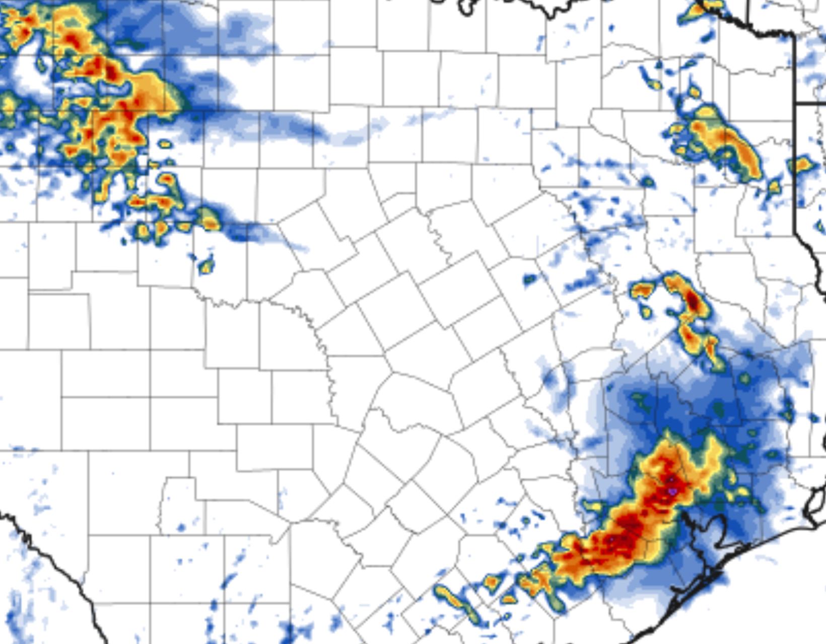
 HRRR Helicity Tracks
A swath of very large hail and damaging winds are shown on the helicity tracks today mostly in South Texas as a line of will develop later this evening and moving into South Texas.
Saturday’s Severe Weather Outlook
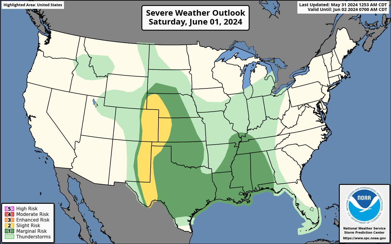
A slight chance of severe weather on Saturday for the Central and Southern High Plains.
Very large hail , severe wind gusts and brief tornadoes may develop this afternoon in the Central and Southern Plains then more into a cluster of severe storms this evening as they push East. These severe storms are possible in parts of TX, OK, CO, KS and NE. Please see SPC threat map.
Sunday’s Weather Severe Weather Outlook
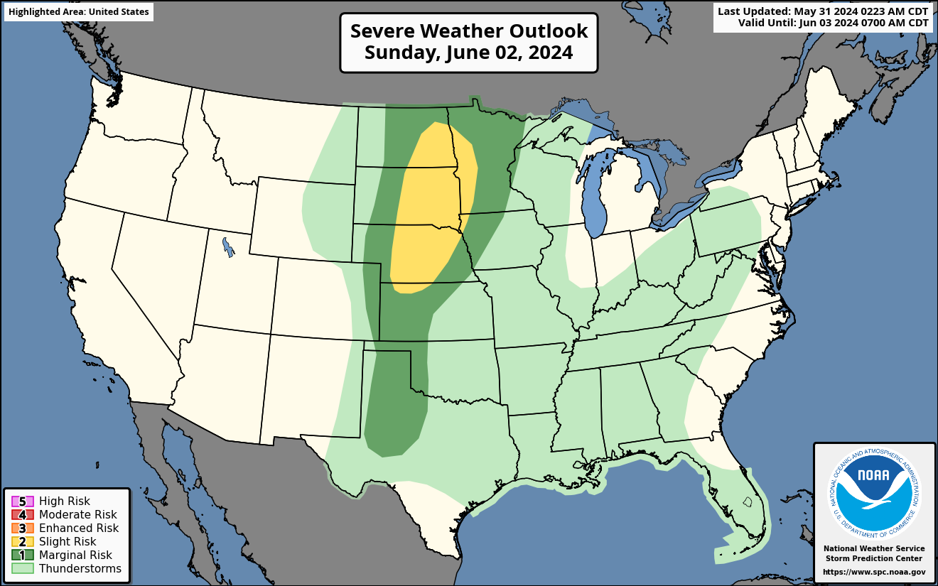
Strong to severe storms are expected in the Northern/Central Plains and the Upper Midwest on Sunday.
A slight chance of severe weather will be moving into the Northern/Central Plains and Upper Midwest on Sunday. A cold front will bring severe weather to parts of the Dakotas, NE,MN, IA,WI with large hail and damaging winds the main threat. Please see SPC threat map.
Please stay tuned for updates of anymore severe weather beyond this weekend.

You must be logged in to post a comment.